
MyTopo
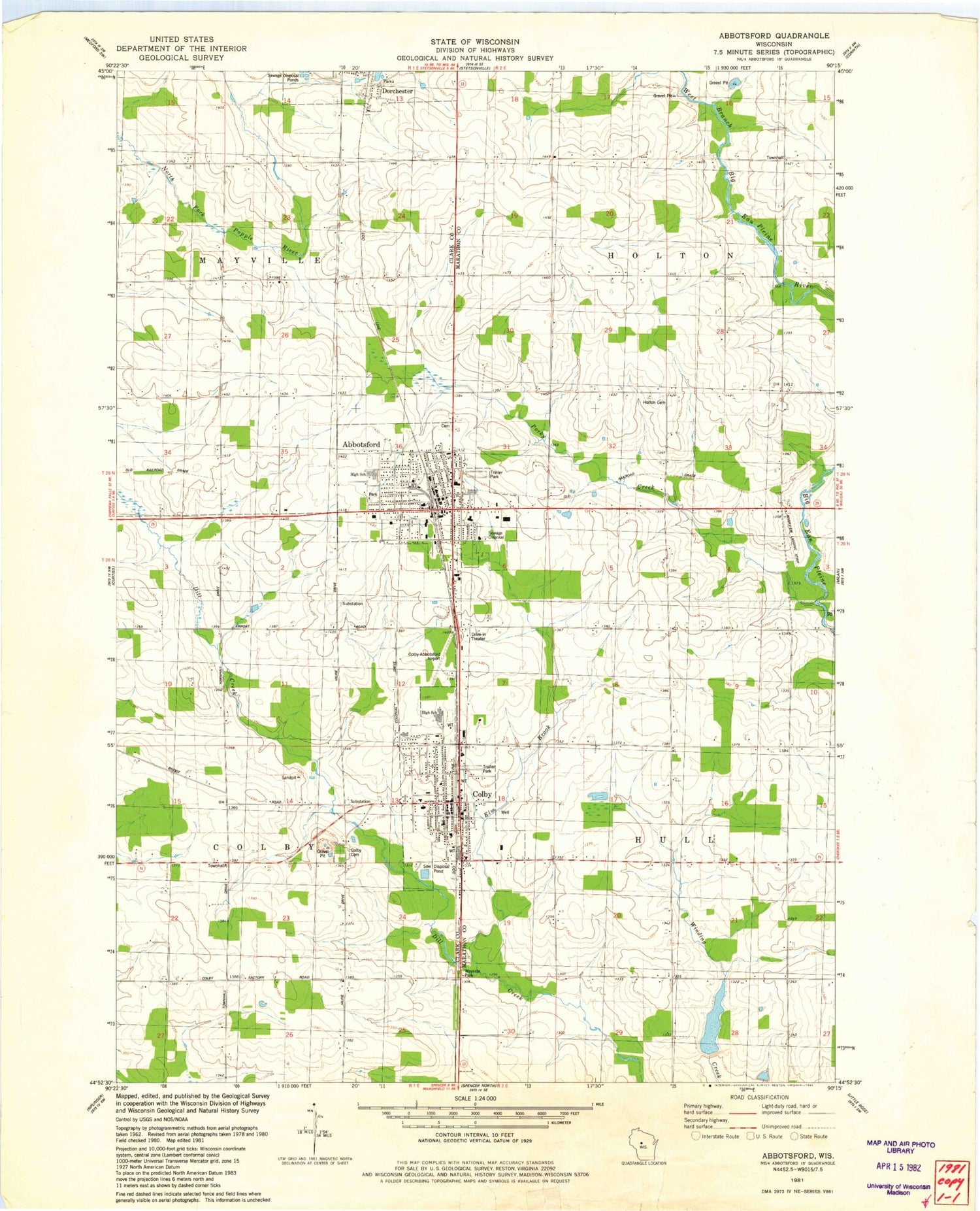
Classic USGS Abbotsford Wisconsin 7.5'x7.5' Topo Map
Couldn't load pickup availability
Historical USGS topographic quad map of Abbotsford in the state of Wisconsin. Map scale may vary for some years, but is generally around 1:24,000. Print size is approximately 24" x 27"
This quadrangle is in the following counties: Clark, Marathon.
The map contains contour lines, roads, rivers, towns, and lakes. Printed on high-quality waterproof paper with UV fade-resistant inks, and shipped rolled.
Contains the following named places: 13-29 Drive-In, 54405, 54421, Abbotsford, Abbotsford Cemetery, Abbotsford Christian Academy, Abbotsford Elementary School, Abbotsford Fire Department, Abbotsford Middle / High School, Abbotsford Police Department, Abbotsford Pond, Abbotsford Post Office, Abbotsford Wastewater Treatment Facility, Christ Lutheran Cemetery, City of Abbotsford, City of Colby, Colby, Colby Cemetery, Colby Elementary School, Colby High School, Colby Middle School, Colby Post Office, Colby Volunteer Fire Department, Colby Wastewater Treatment Plant, Colby-Abbotsford Airport, Elm Brook, First United Church of Christ, First United Presbyterian Church, Jones Airport, Pickard School, Pleasant Hill School, Porky Creek, Riverside School, Riverview Airport, Rosedale School, Saint Mary School, Saint Marys Catholic Church, Saint Pius X Monastery, Town of Holton, Town of Hull, Winding Creek Rearing Pond 1, Winding Creek Rearing Pond 3WR481 Dam


