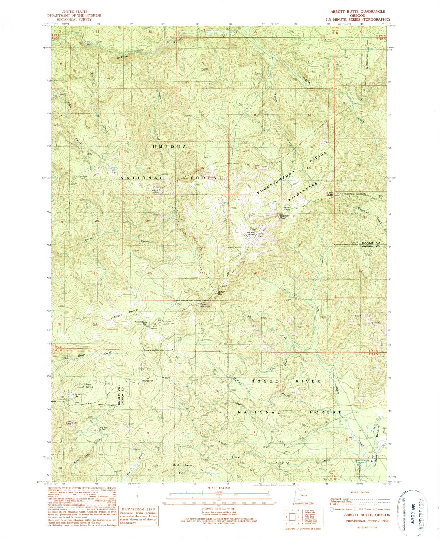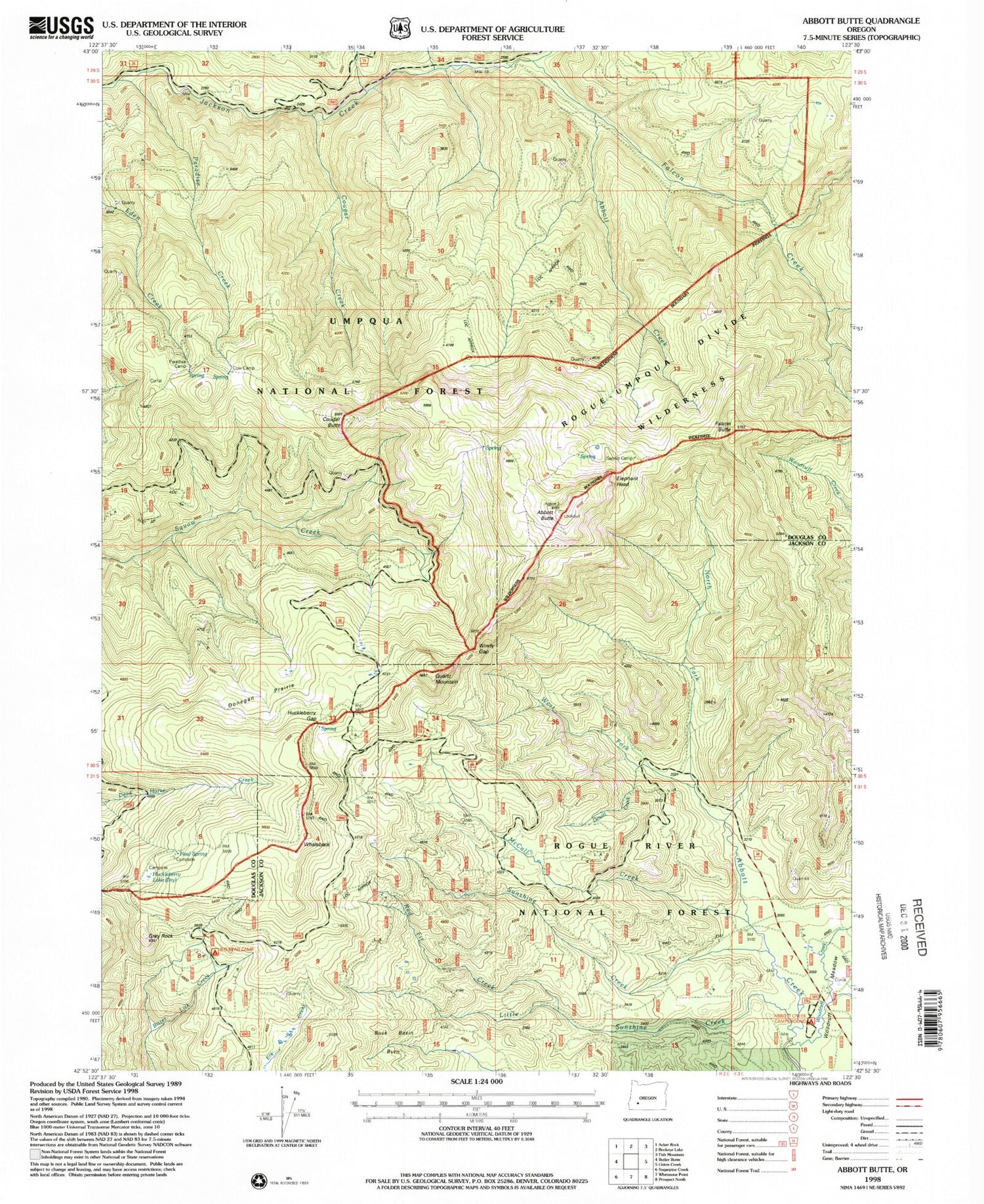
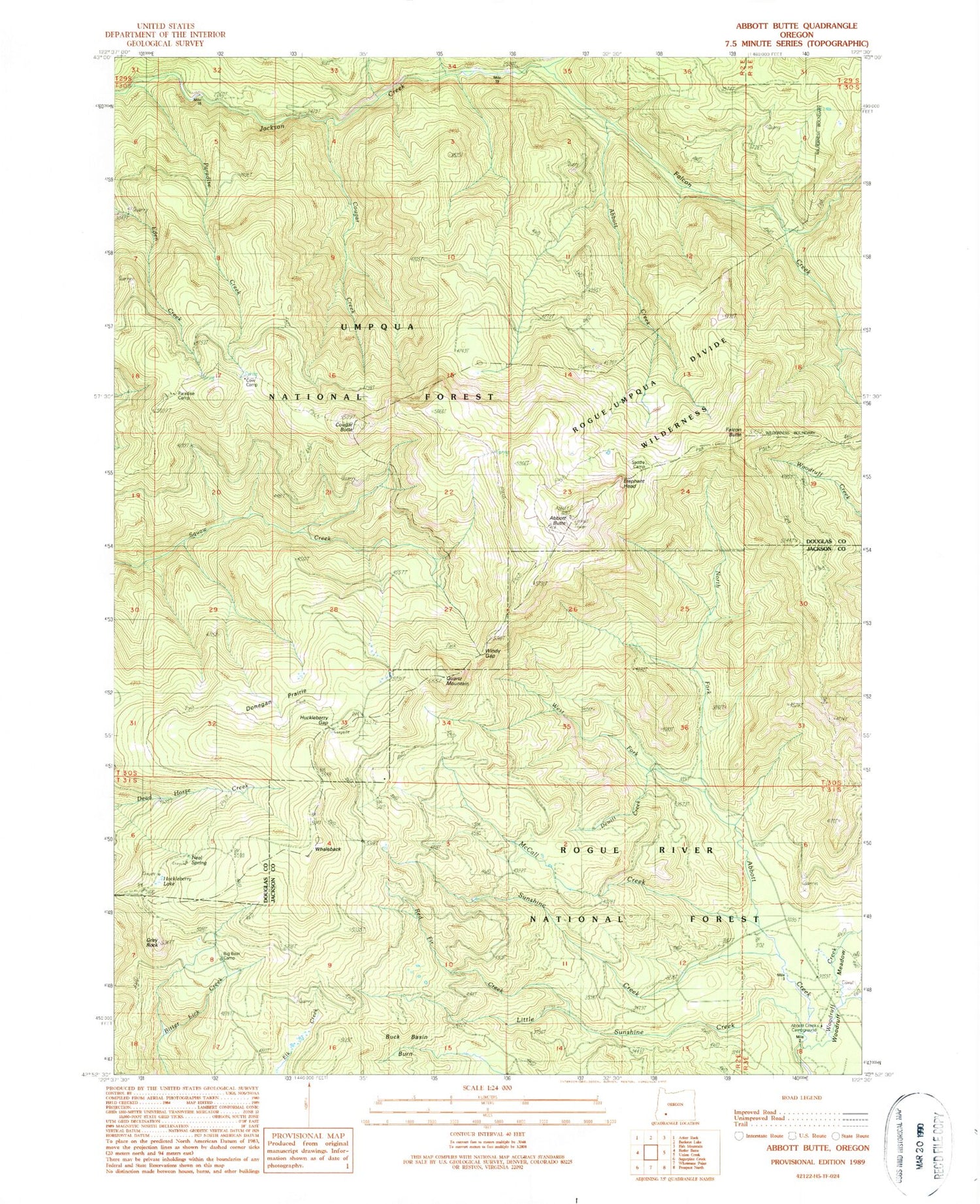
MyTopo
Classic USGS Abbott Butte Oregon 7.5'x7.5' Topo Map
Couldn't load pickup availability
Historical USGS topographic quad map of Abbott Butte in the state of Oregon. Map scale may vary for some years, but is generally around 1:24,000. Print size is approximately 24" x 27"
This quadrangle is in the following counties: Douglas, Jackson.
The map contains contour lines, roads, rivers, towns, and lakes. Printed on high-quality waterproof paper with UV fade-resistant inks, and shipped rolled.
Contains the following named places: Abbott Butte, Abbott Butte Lookout, Abbott Creek, Abbott Creek Recreation Site, Abbott Creek Research Natural Area, Big Bear Camp, Buck Basin Burn, Cougar Butte, Cougar Creek, Cow Camp, DeWitt Creek, Donegan Prairies, Elephant Head, Falcon Butte, Falcon Creek, Five Sticks Camp, Freddy Camp, Golden Stairs Trail, Grey Rock, Huckleberry Gap, Huckleberry Lake, Huckleberry Lake Campground, Little Bear Camp, Little Sunshine Creek, McCall Creek, Neal Spring, Neal Springs Campground, North Fork Abbott Creek, Paradise Camp, Paradise Creek, Quartz Mountain, Red Fir Creek, Saddle Camp, Sandstone Trail, Sunshine Creek, Tripod Camp, Umpqua Rogue Trail, West Fork Abbott Creek, Whaleback, Windy Gap, Woodruff Creek, Woodruff Meadow