MyTopo
Classic USGS Abbott New Mexico 7.5'x7.5' Topo Map
Regular price
$16.95
Regular price
Sale price
$16.95
Unit price
per
Couldn't load pickup availability
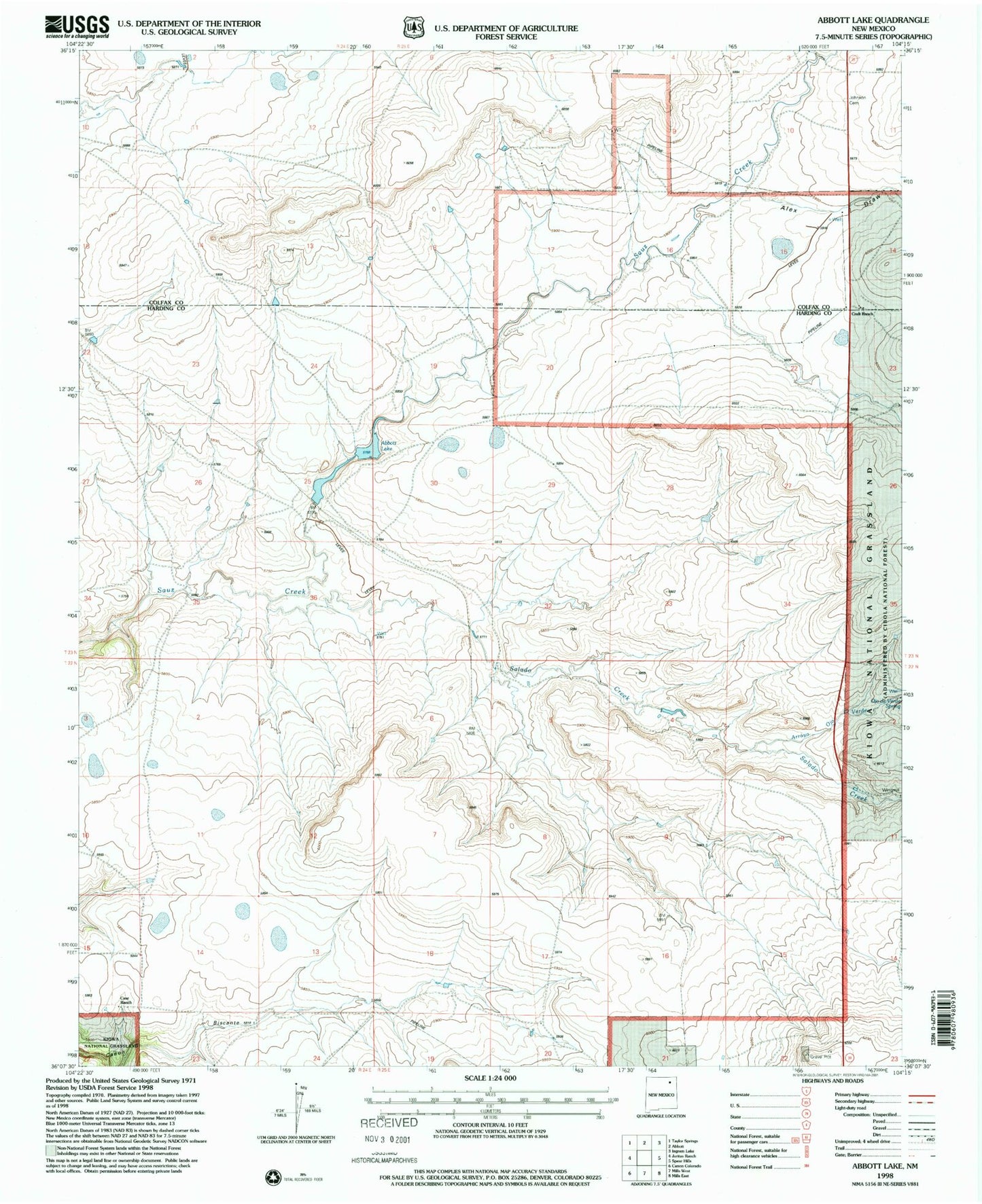
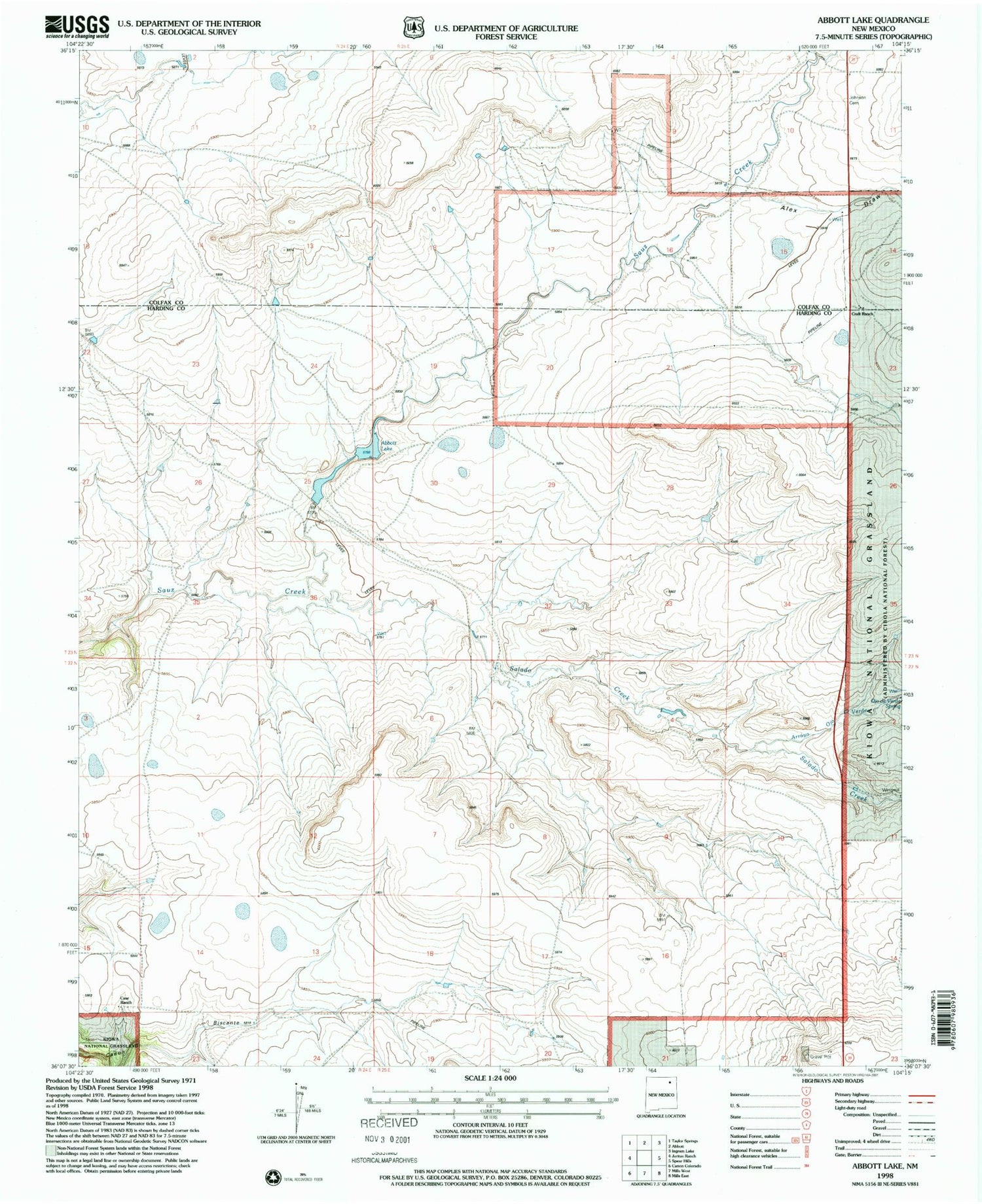
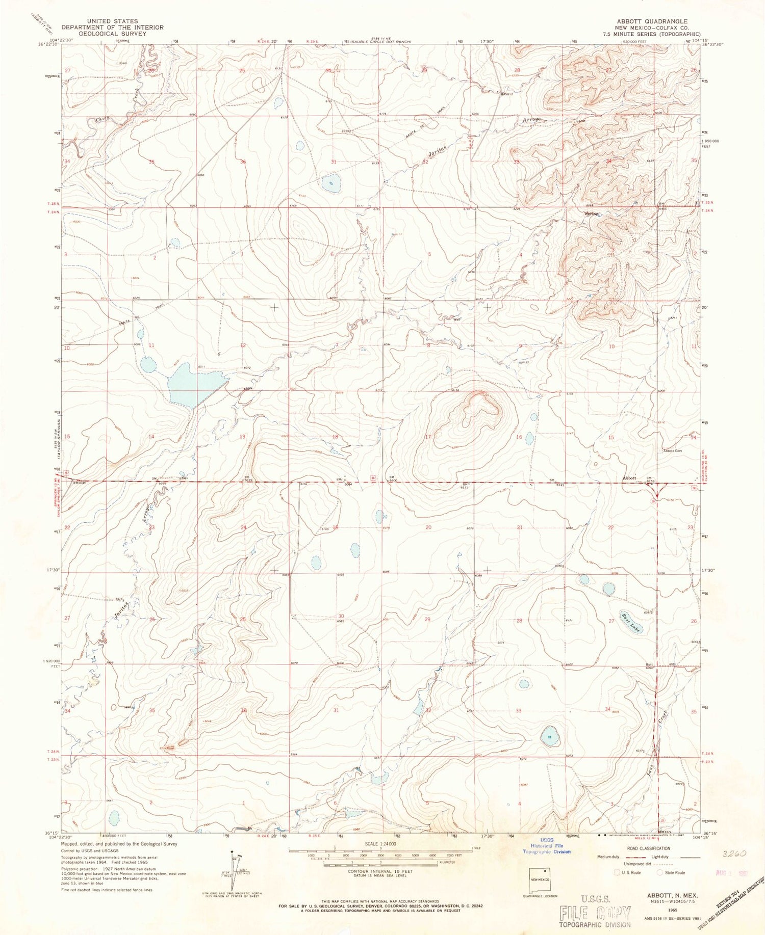
Historical USGS topographic quad map of Abbott in the state of New Mexico. Map scale may vary for some years, but is generally around 1:24,000. Print size is approximately 24" x 27"
This quadrangle is in the following counties: Colfax.
The map contains contour lines, roads, rivers, towns, and lakes. Printed on high-quality waterproof paper with UV fade-resistant inks, and shipped rolled.
Contains the following named places: Abbott, Abbott Weather Station, Big Lake, Colfax County Fire Department District 4 Farley Abbott Substation, East Lake, Jaritas Number Two Dam, Jones, Messick, Montoya, Santa fe Trail, Santa Fe Trail Historical Marker