MyTopo
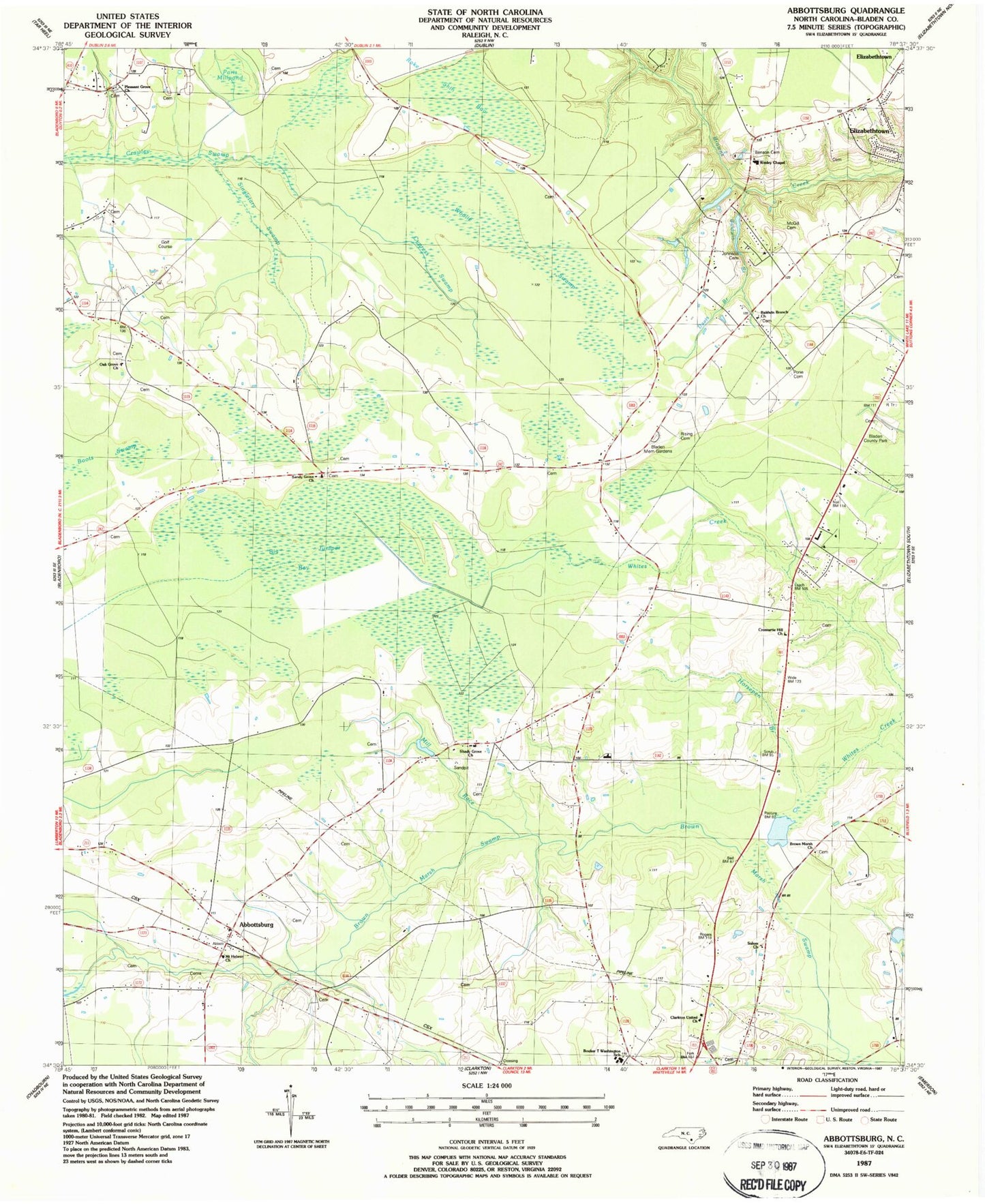
Classic USGS Abbottsburg North Carolina 7.5'x7.5' Topo Map
Couldn't load pickup availability
Historical USGS topographic quad map of Abbottsburg in the state of North Carolina. Map scale may vary for some years, but is generally around 1:24,000. Print size is approximately 24" x 27"
This quadrangle is in the following counties: Bladen.
The map contains contour lines, roads, rivers, towns, and lakes. Printed on high-quality waterproof paper with UV fade-resistant inks, and shipped rolled.
Contains the following named places: Abbottsburg, Baldwin Branch, Baldwin Branch Church, Benson Cemetery, Big Juniper Bay, Bladen County Hospital Airport, Bladen County Park, Bladen Memorial Gardens, Booker T Washington School, Brown Marsh Church, Calvary Church, Clarkton United Church, Cromartie Hill Church, Cypress Swamp, Davis Branch, Davis Millpond, Full Gospel Christian Church, Grays Bay, Horsepen Branch, Johnson Cemetery, McGill Cemetery, Mill Race, Mount Hebron Church, New Shiloh Church of Christ, North Carolina State Highway Patrol Troop B District 5 Substation, Oak Grove Church, Paris Millpond, Pleasant Grove Church, Pone Cemetery, Rake Shin Bay, Rising Cemetery, Salem Church, Sandy Grove Church, Shady Grove Church, Singletary Swamp, Township of Abbotts, Township of Brown Marsh, Wesley Chapel, Whites Creek, Woolie Swamp