MyTopo
Classic USGS Abbottsford Georgia 7.5'x7.5' Topo Map
Couldn't load pickup availability
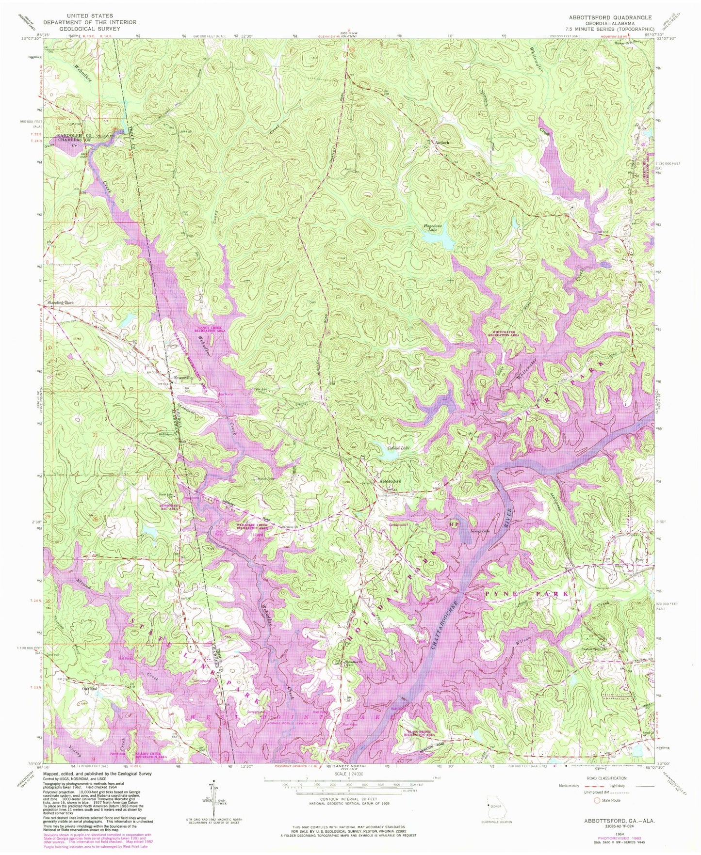
Historical USGS topographic quad map of Abbottsford in the states of Georgia, Alabama. Typical map scale is 1:24,000, but may vary for certain years, if available. Print size: 24" x 27"
This quadrangle is in the following counties: Chambers, Randolph, Troup.
The map contains contour lines, roads, rivers, towns, and lakes. Printed on high-quality waterproof paper with UV fade-resistant inks, and shipped rolled.
Contains the following named places: Veasey Creek, Antioch, Caney Creek, Cofield Lake, Fellowship Lake, Glass Bridge, Hagedons Lake, Lanier Lake (historical), Loyd Church, Midway Church, Pleasant Grove Church, Wehadkee Church, Whitewater Creek, Wilson Creek, Abbottsford, Evansville, Pyne, Vernon, Lewis Lake Dam, Lewis Lake, Darden Dam, Darden Lake, Cofield Dam, Hagedon Lake Dam, Birdsong Bridge, Harmony Church, Antioch Cemetery, Autry Day Use Park, Briarcreek Estates, Caney Creek Recreational Area, Colony Heights, Covered Bridge, Crowder (historical), Evansville Recreation Area, Freeman Cemetery, Glass Bridge Recreation Area, Harmony Church Cemetery, Heatherbrook, Heritage Hills, Holiday Park, Huntington, Lakeshore Estates, Loyd Chapel Cemetery, McGee Bridge (historical), North Lake, Pleasant Grove School (historical), Pyne Park, River Trace, Rivercrest, Riverridge, Riverside, Riverview, Rosamond, Shady Oaks, Smiths Pond, State Line Park, Timber Ridge, Turkey Point, Vernon (historical), Vernon Ferry Estates, Wehadkee Church Cemetery, Wehadkee Church, Wehadkee Creek Recreation Area, West Lake Village, Whatley Cemetery, Whitewater Estates, Whitewater Recreation Area, Whitewater Woods, Liberty Hill Recreation Area, Birdsongs Store (historical), Hawthorn Ferry (historical), Abbottsford Division, Chattahoochee Boy Scout Reservation, Troup County Fire Department Station 10, Rocky Mount Cemetery, Garrett Family Cemetery, Bethlehem Church, Cuss Creek, State Line Church, Stroud Creek, Cunningham Dam, Cunningham Lake, Hudson Dam, Hudson Lake, Dewberry Recreation Area, McCosh Mill, Oakland, Standing Rock Census Designated Place