
MyTopo
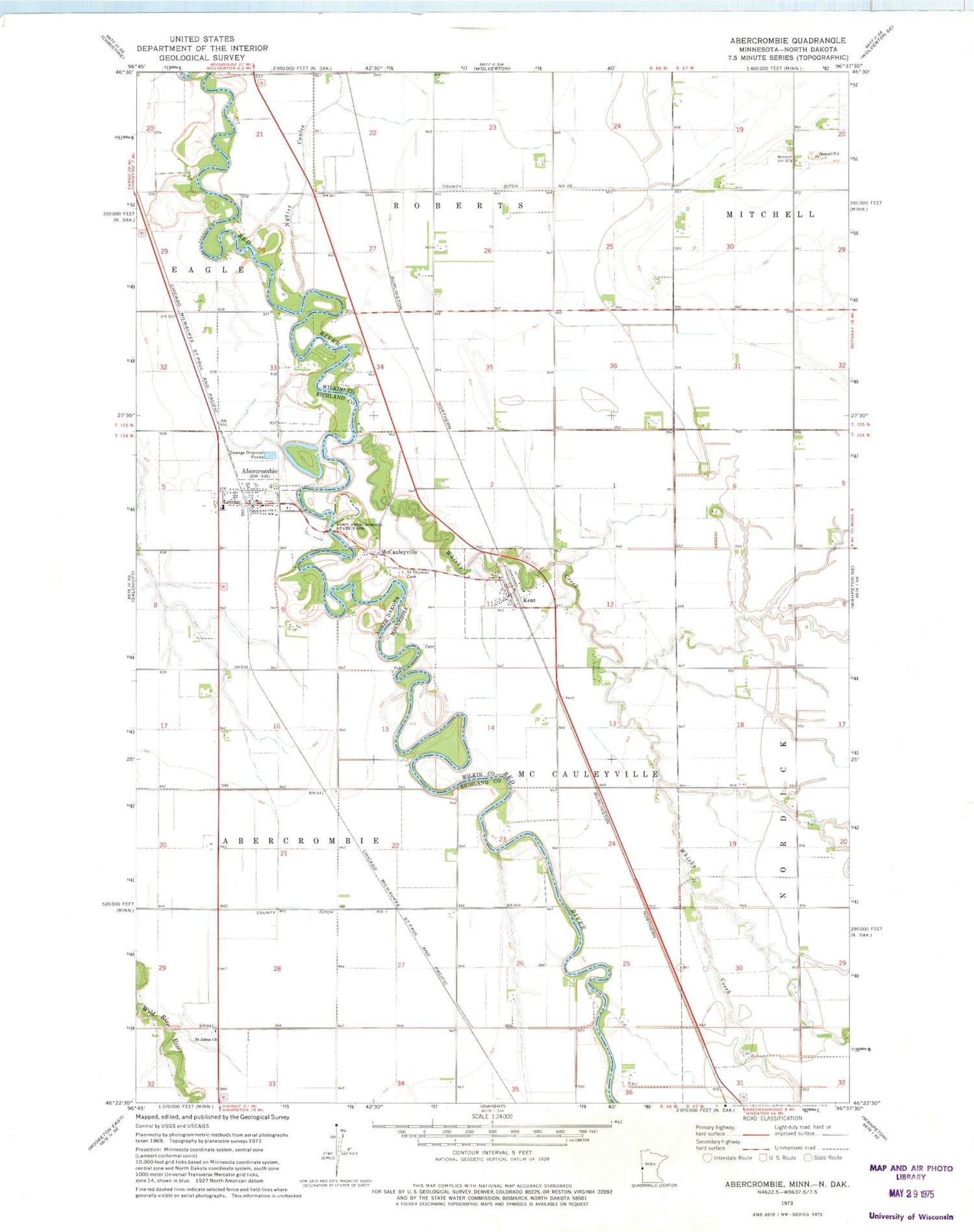
Classic USGS Abercrombie North Dakota 7.5'x7.5' Topo Map
Couldn't load pickup availability
Historical USGS topographic quad map of Abercrombie in the states of North Dakota, Minnesota. Map scale may vary for some years, but is generally around 1:24,000. Print size is approximately 24" x 27"
This quadrangle is in the following counties: Richland, Wilkin.
The map contains contour lines, roads, rivers, towns, and lakes. Printed on high-quality waterproof paper with UV fade-resistant inks, and shipped rolled.
Contains the following named places: Abercrombie, Abercrombie Fire Department, Abercrombie Post Office, City of Abercrombie, City of Kent, County Ditch Number 1, County Ditch Number Twentynine, Emmanuel Lutheran East Cemetery, Emmanuel Lutheran West Cemetery, Fort Abercrombie Historical Marker, Fort Abercrombie Post Cemetery, Fort Abercrombie State Park, Kent, Kent Post Office, McCauleysville Post Office, McCauleyville, McCauleyville Cemetery, Richland Elementary School, Saint Johns Church, Saint Johns Lutheran Church Cemetery, Saint Thomas Catholic Church, Saint Thomas Cemetery, Township of McCauleyville, Whisky Creek, ZIP Code: 58001


