MyTopo
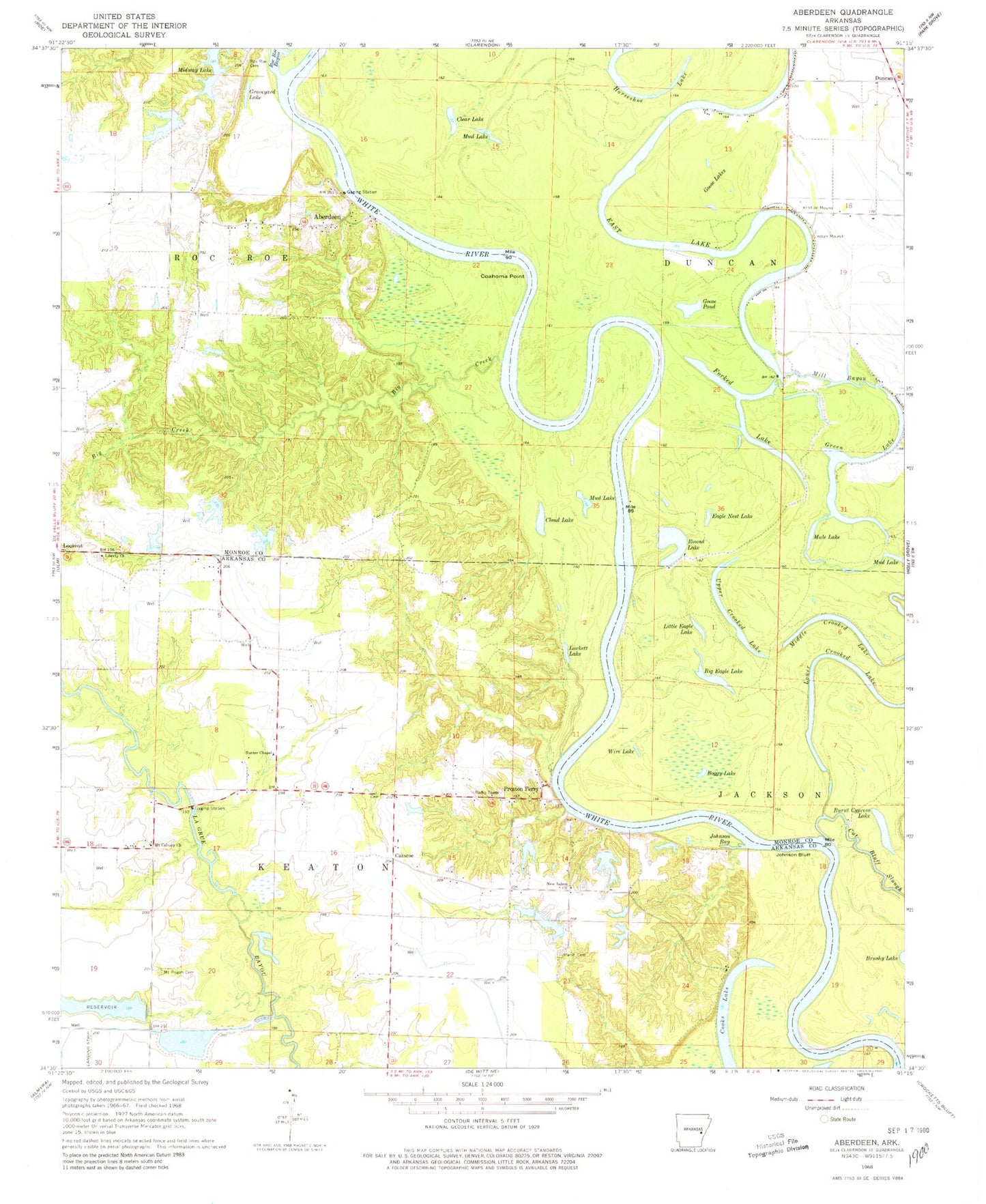
Classic USGS Aberdeen Arkansas 7.5'x7.5' Topo Map
Couldn't load pickup availability
Historical USGS topographic quad map of Aberdeen in the state of Arkansas. Typical map scale is 1:24,000, but may vary for certain years, if available. Print size: 24" x 27"
This quadrangle is in the following counties: Arkansas, Monroe.
The map contains contour lines, roads, rivers, towns, and lakes. Printed on high-quality waterproof paper with UV fade-resistant inks, and shipped rolled.
Contains the following named places: Aberdeen, Big Creek, Coahoma Point, Johnson Bay, Johnson Bluff, Liberty Church, Marsh Cemetery, Mill Bayou, Mount Calvary Church, Mount Pisgah Cemetery, Duncan, Preston Ferry, Round Turn, McGaughey Landing, Preston Bluff, Liberty Cemetery, Hunters Chapel Cemetery, Daugherty Reservoir, Cassco School (historical), Saint Luke Church, Ashford Landing, Hurricane Bend, Township of Roc Roe, Big Eagle Lake, Boggy Lake, Burnt Cypress Lake, Clear Lake, Cloud Lake, Eagle Nest Lake, East Lake, Forked Lake, Goose Lakes, Goose Pond, Graveyard Lake, Green Lake, Horseshoe Lake, Little Eagle Lake, Lower Crooked Lake, Luckett Lake, Middle Crooked Lake, Mud Lake, Mule Lake, Round Lake, Upper Crooked Lake, Wire Lake, Brushy Lake, Casscoe, Hunter Chapel, New Salem Church, Roc Roe Bayou, Roc Roe Cemetery, Cruthis Lake Dam, Cruthis Lake, Carnes Lake Dam, Carnes Lake, Trice Estate Lake Dam, Trice Lake, Daugherty Reservoir Dam, McFall Lake Dam, McFall Lake, Payer Lake Number One Dam, Payer Lake Number One, Payer Lake Number Two Dam, Payer Lake Number Two, Payer Lake Number Three Dam, Payer Lake Number Three, McGauhey Lake Dam, McGauhey Lake, Casscoe Fire Station, Casscoe Post Office