MyTopo
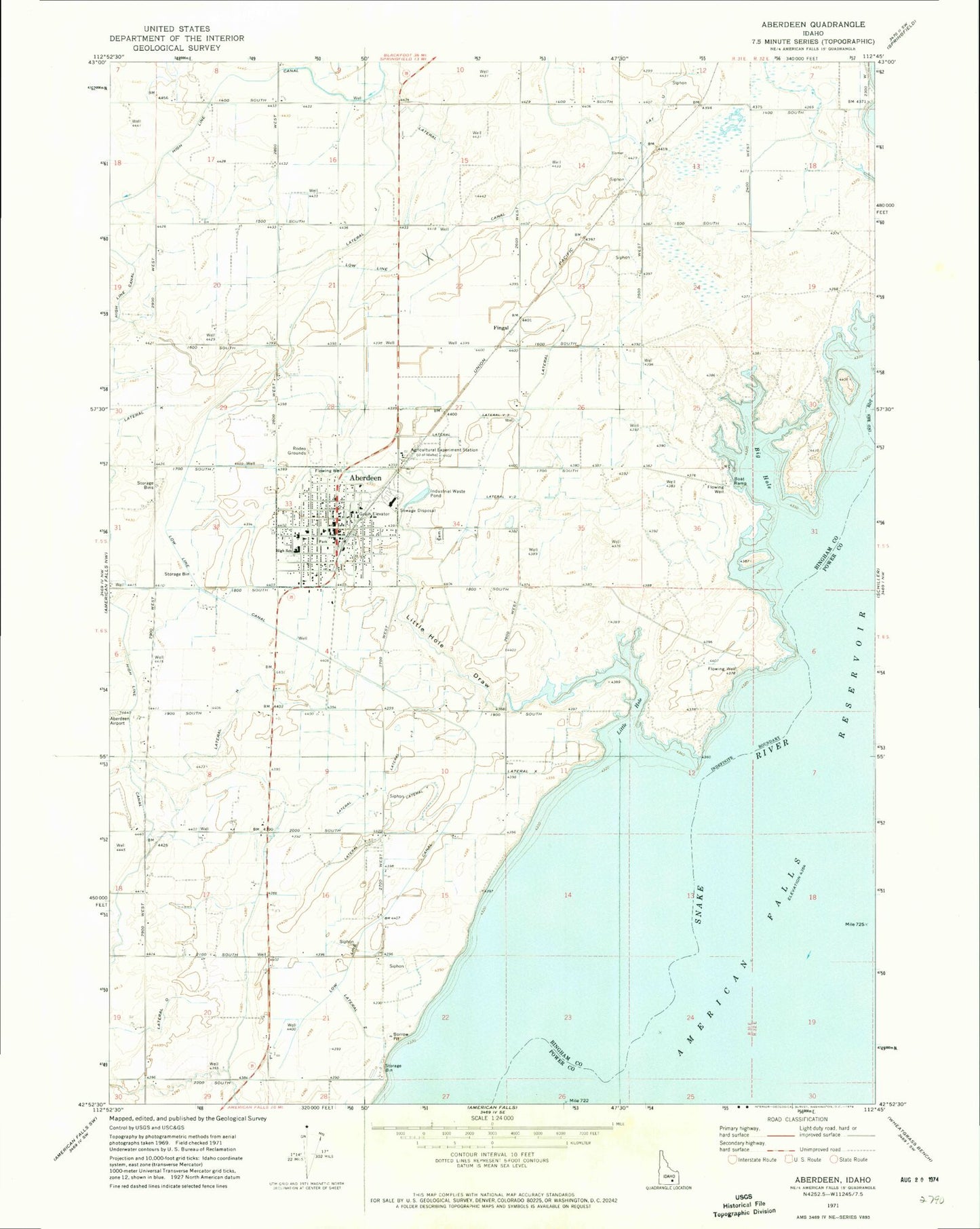
Classic USGS Aberdeen Idaho 7.5'x7.5' Topo Map
Couldn't load pickup availability
Historical USGS topographic quad map of Aberdeen in the state of Idaho. Map scale may vary for some years, but is generally around 1:24,000. Print size is approximately 24" x 27"
This quadrangle is in the following counties: Bannock, Bingham, Power.
The map contains contour lines, roads, rivers, towns, and lakes. Printed on high-quality waterproof paper with UV fade-resistant inks, and shipped rolled.
Contains the following named places: Aberdeen, Aberdeen - Springfield Fire Department, Aberdeen Cemetery, Aberdeen Division, Aberdeen Elementary School, Aberdeen High School, Aberdeen Police Department, Aberdeen Post Office, Aberdeen Wasteway Canal, Big Hole, City of Aberdeen, Fingal, Lateral I, Lateral J, Lateral K, Lateral N, Lateral O, Lateral U, Lateral U1, Lateral V, Lateral V 1, Lateral V-2, Lateral V-3, Lateral V4, Lateral W, Lateral X, Lateral Y, Lateral Y-1, Lateral Y-2, Lateral Y-3, Lateral Z, Little Hole, Little Hole Draw, Low Line Canal, Portneuf River, Sterling Wildlife Management Area