
MyTopo
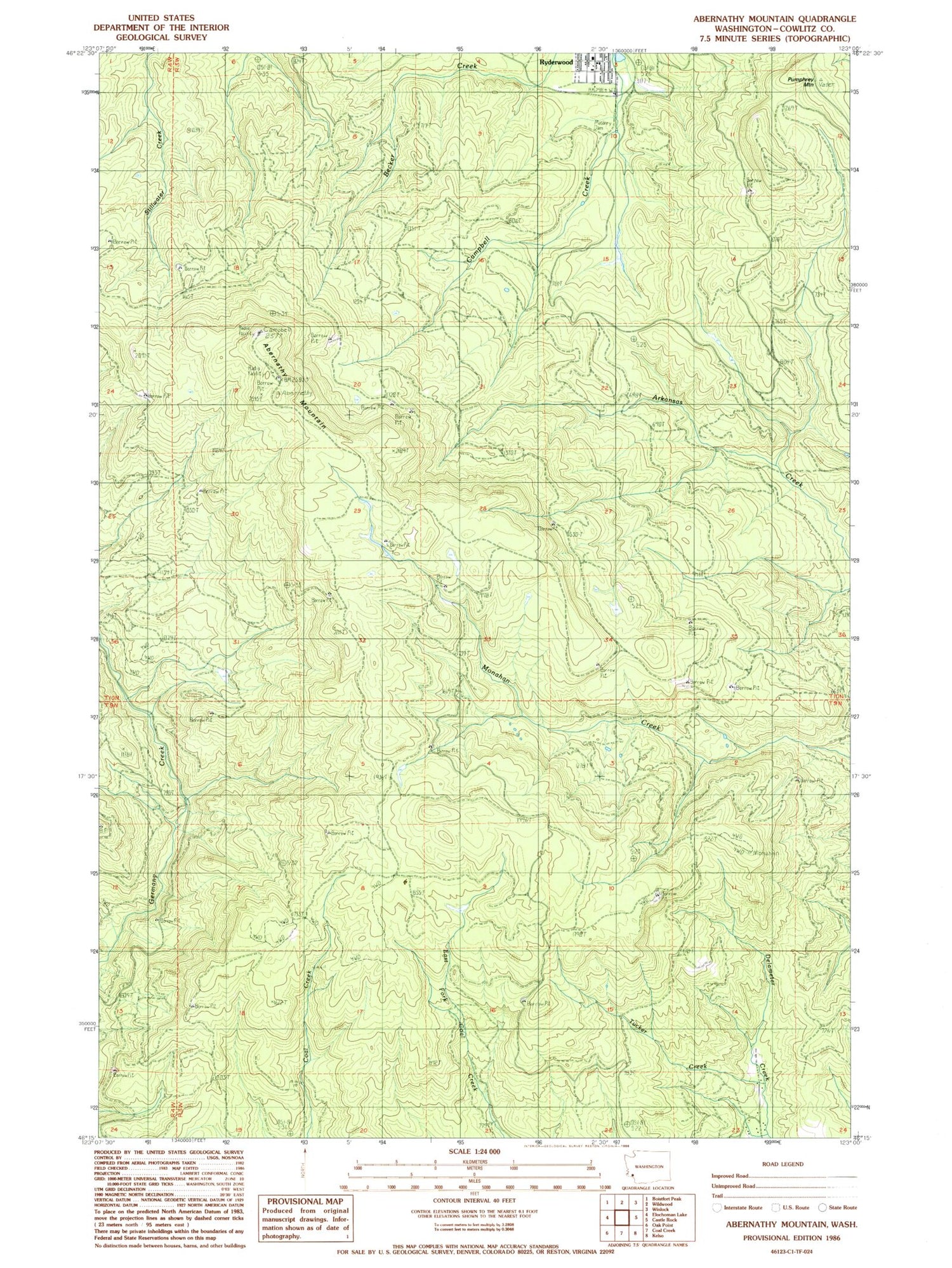
Classic USGS Abernathy Mountain Washington 7.5'x7.5' Topo Map
Couldn't load pickup availability
Historical USGS topographic quad map of Abernathy Mountain in the state of Washington. Map scale may vary for some years, but is generally around 1:24,000. Print size is approximately 24" x 27"
This quadrangle is in the following counties: Cowlitz.
The map contains contour lines, roads, rivers, towns, and lakes. Printed on high-quality waterproof paper with UV fade-resistant inks, and shipped rolled.
Contains the following named places: Abernathy Mountain, Abernathy Truck Trail, Castle Rock Division, Cowlitz County Fire District 4 Ryderwood, East and West Truck Trail, Pumphrey Mountain, Ryderwood Census Designated Place, Ryderwood Fish Pond Dam, Ryderwood Pond, Ryderwood Post Office, Stillwater Truck Trail, Tucker Creek, ZIP Code: 98581


