MyTopo
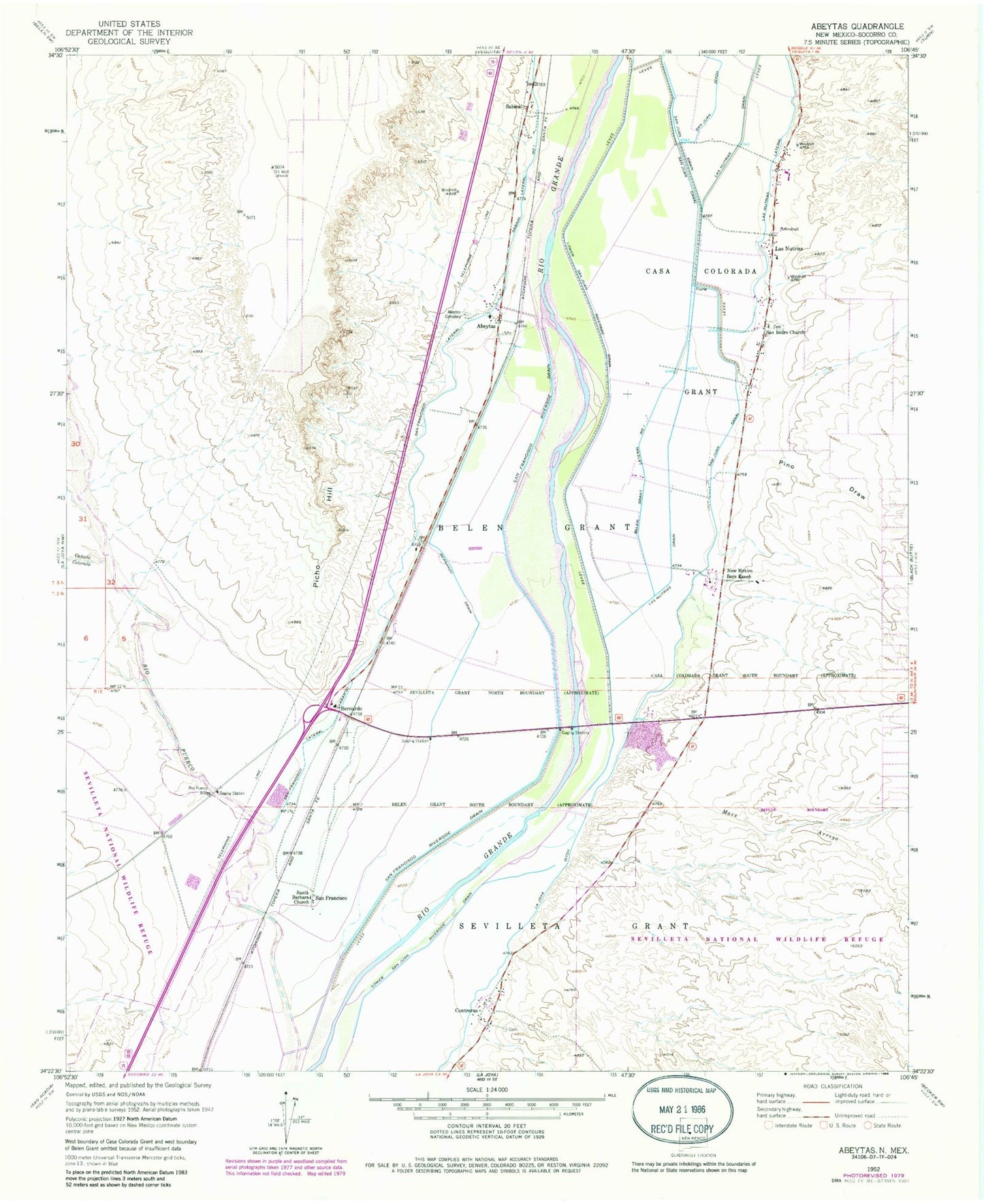
Classic USGS Abeytas New Mexico 7.5'x7.5' Topo Map
Couldn't load pickup availability
Historical USGS topographic quad map of Abeytas in the state of New Mexico. Map scale may vary for some years, but is generally around 1:24,000. Print size is approximately 24" x 27"
This quadrangle is in the following counties: Socorro.
The map contains contour lines, roads, rivers, towns, and lakes. Printed on high-quality waterproof paper with UV fade-resistant inks, and shipped rolled.
Contains the following named places: 10019 Water Well, 87006, 87028, Abeytas, Abeytas Cemetery, Abeytas Census Designated Place, Abeytas Fire Department, Abeytas Post Office, Belen Grant Lateral Number One, Bernado State Game Refuge, Bernardo, Bernardo Post Office, Canada Colorada, Contreras, Contreras Post Office, La Joya Ditch, Las Nutrias, Las Nutrias Census Designated Place, Las Nutrias Drain, Las Nutrias Lateral, Lower San Juan Riverside Drain, Maes Arroyo, New Mexico Boys Ranch, Picho Hill, Pino Draw, Rio Puerco Bridge, Sabinal, Sabinal Post Office, San Francisco, San Francisco Lateral, San Francisco Post Office, San Francisco Riverside Drain, San Isidro Church, San Juan Ditch, San Juan Drain, Santa Barbara Church, Torres Water Well, Yguado Dom Water Well, Yguado Irrigation Water Well