
MyTopo
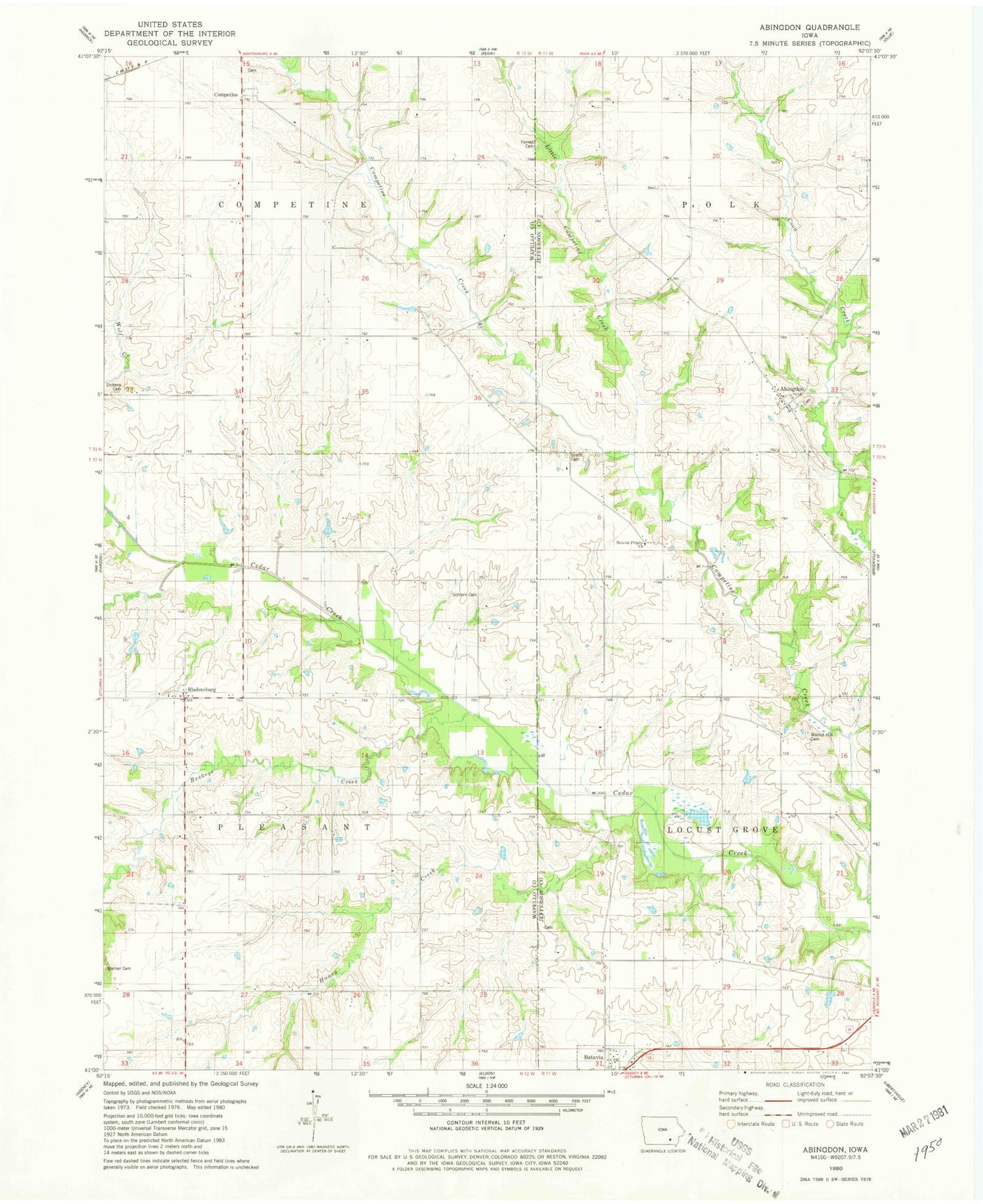
Classic USGS Abingdon Iowa 7.5'x7.5' Topo Map
Couldn't load pickup availability
Historical USGS topographic quad map of Abingdon in the state of Iowa. Map scale may vary for some years, but is generally around 1:24,000. Print size is approximately 24" x 27"
This quadrangle is in the following counties: Jefferson, Wapello.
The map contains contour lines, roads, rivers, towns, and lakes. Printed on high-quality waterproof paper with UV fade-resistant inks, and shipped rolled.
Contains the following named places: Abingdon, Abingdon Cemetery, Abingdon Post Office, Batavia Peoples Church, Bladensburg, Bladensburg Christian Church, Bladensburg Post Office, Buckeye Creek, Competine, Competine Cemetery, Competine Post Office, Coon Creek, Dickens Cemetery, Forrest Cemetery, Gobble Park, Gray Cemetery, Holmes Cemetery, Honey Creek, Johnson/Noel Buckeye Area, Jordan Creek, Little Competine Creek, Schrom Cemetery, Smith Cemetery, Township of Competine, Township of Pleasant, Walnut Hill Cemetery, Yampa, Yampa Post Office, ZIP Code: 52533


