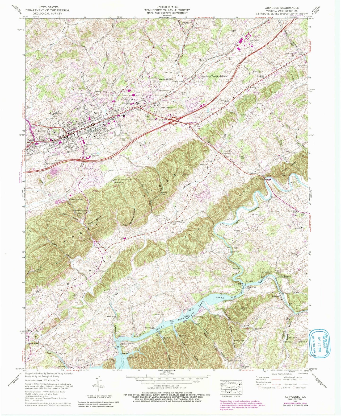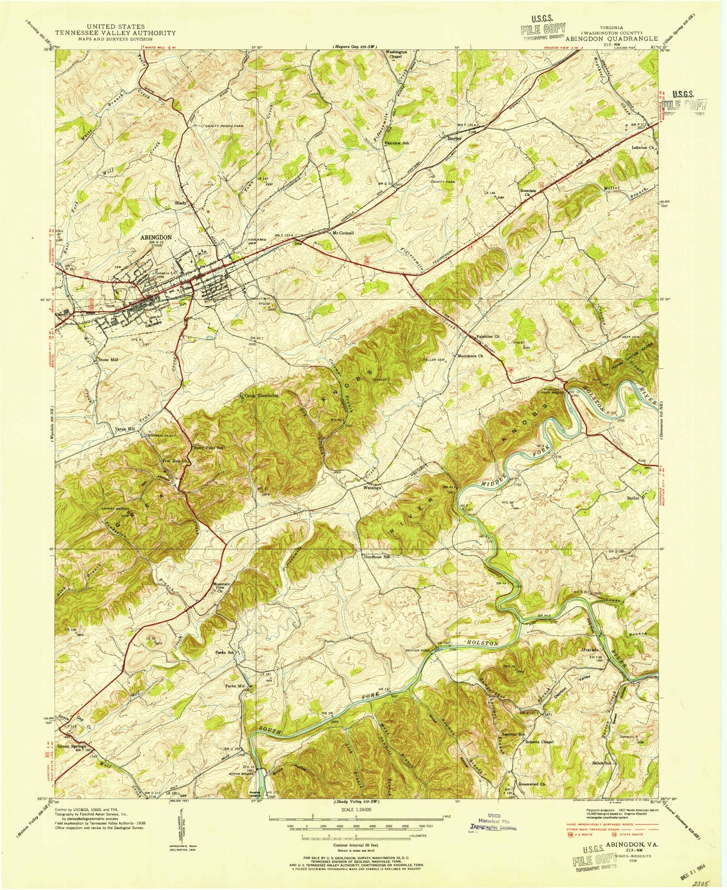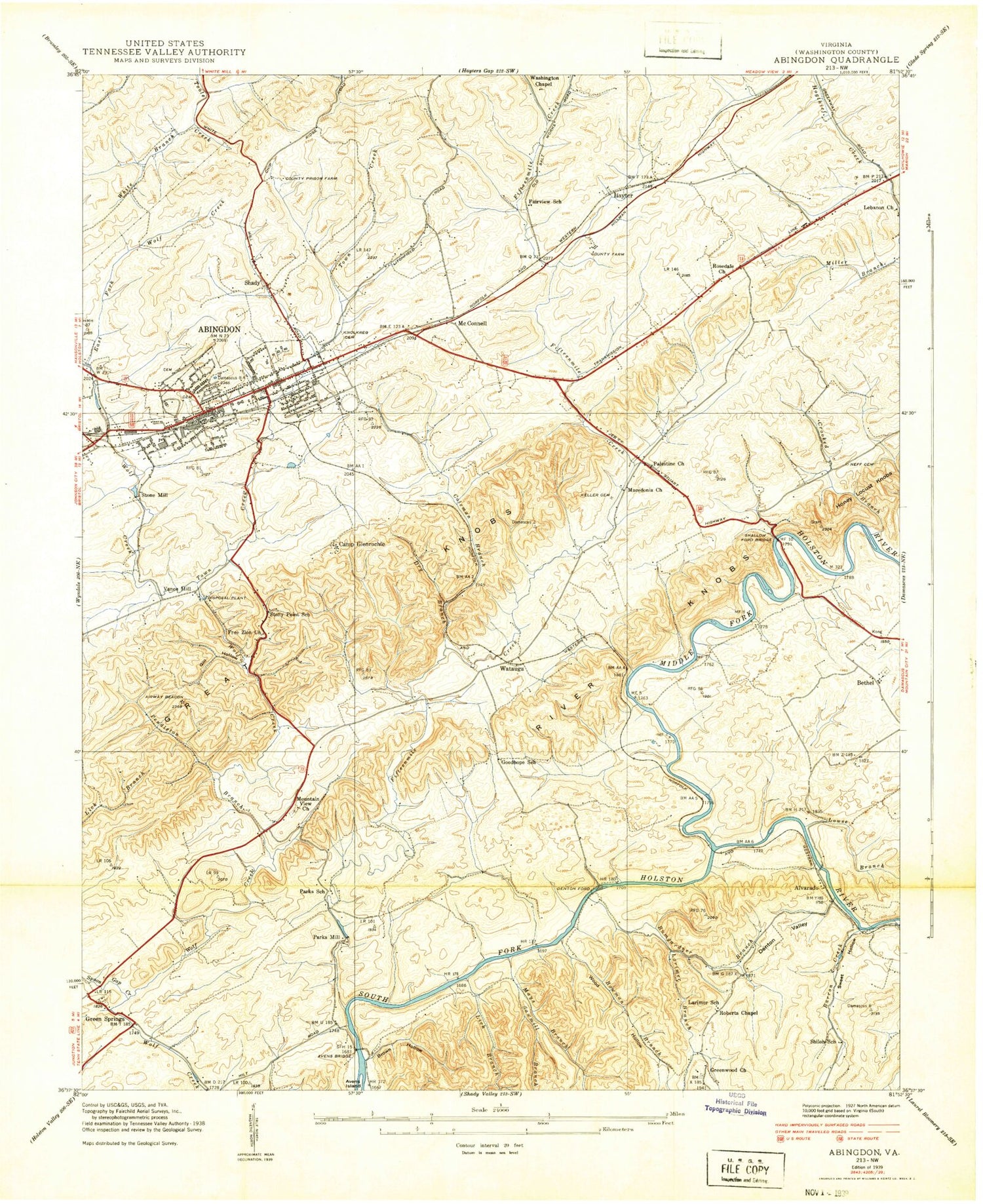
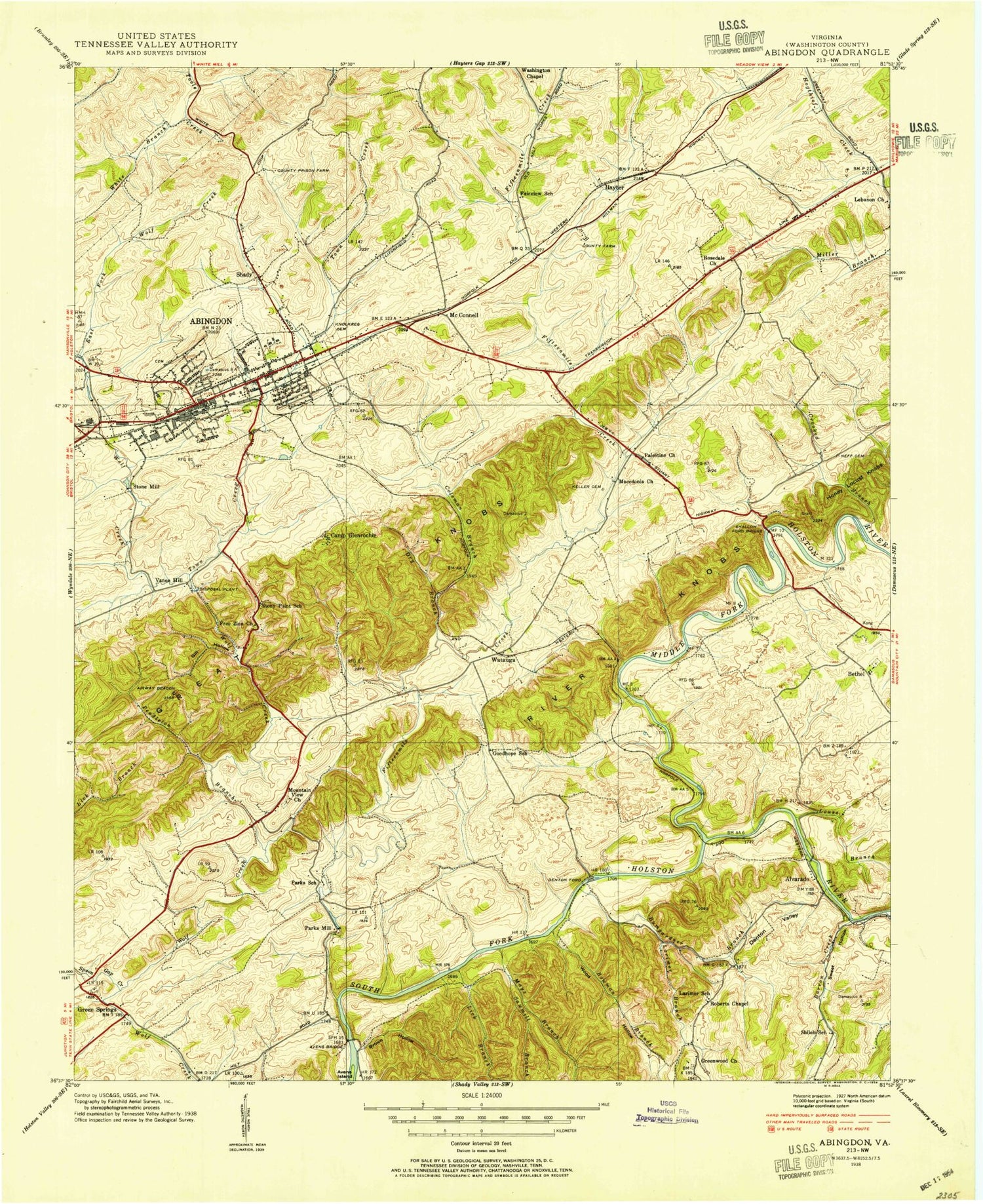
MyTopo
Classic USGS Abingdon Virginia 7.5'x7.5' Topo Map
Couldn't load pickup availability
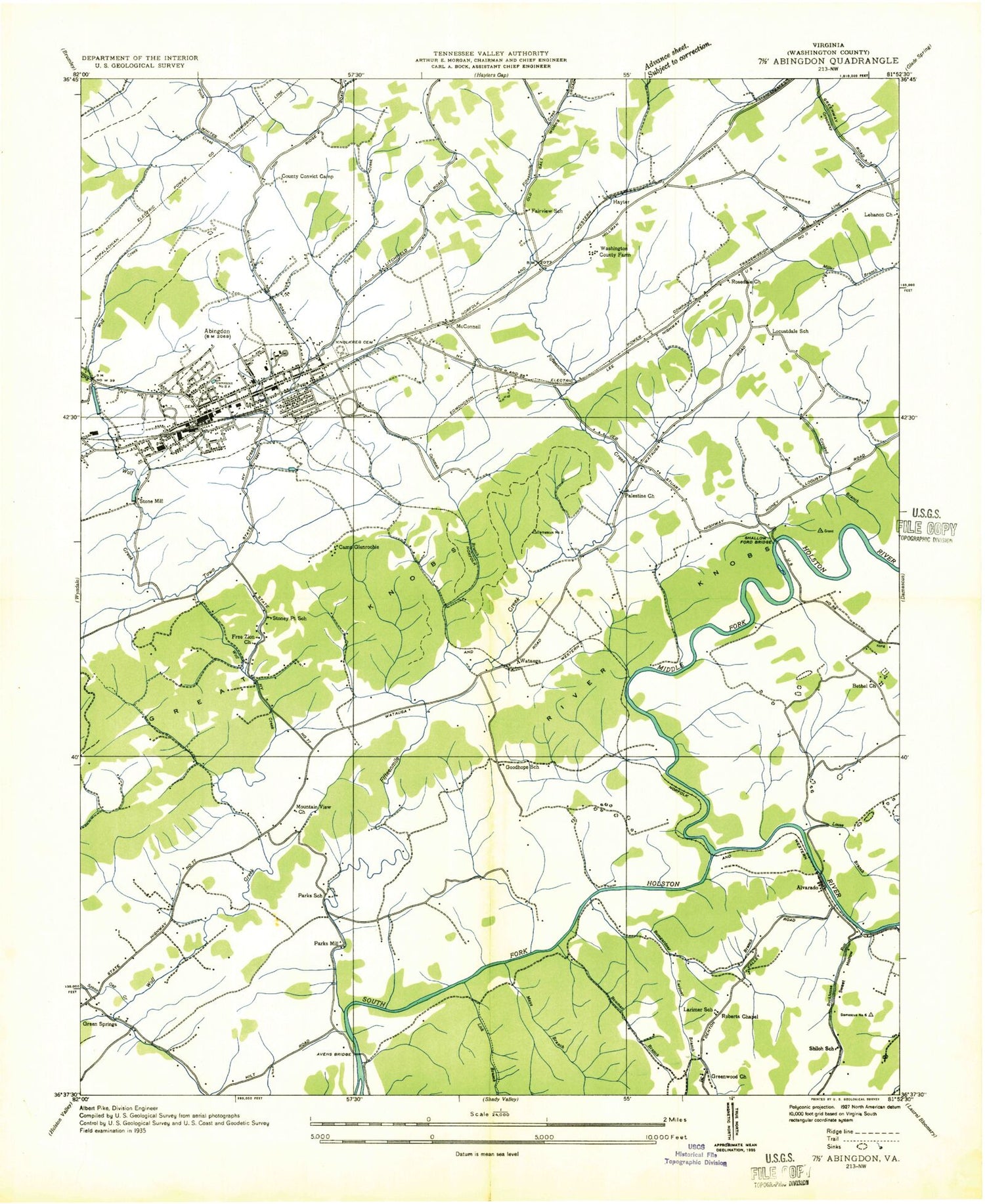
Historical USGS topographic quad map of Abingdon in the state of Virginia. Typical map scale is 1:24,000, but may vary for certain years, if available. Print size: 24" x 27"
This quadrangle is in the following counties: Washington.
The map contains contour lines, roads, rivers, towns, and lakes. Printed on high-quality waterproof paper with UV fade-resistant inks, and shipped rolled.
Contains the following named places: Holston Valley, Abingdon High School, Baugh Cemetery, Berrys Creek, Blind Hollow, Browning Cemetery, Bumgardner Branch, Campbell Cemetery, Campbell Hollow, Crooked Branch, Denton Cemetery, Dry Branch, Free Zion Church, General Morgan Bridge, Gill Hollow, Good Shepherd Chapel, Gray Cemetery, Great Knobs, Greenwood Church, Grubb Cemetery, Hagy Cemetery, Hayter Bridge, Hayter Cemetery, High Point Cemetery, Jordan Hollow, Keller Cemetery, Kings Mountain School, Knollkreg Cemetery, Larmer Cemetery, Latture Field, Lebanon Church, Macedonia Church, Middleton Cemetery, Miller Cemetery, Minton Cemetery, Mount View Church, Neff Cemetery, Palestine Church, Pendleton Branch, River Knobs, Roberts Church, Rosedale Church, Shallow Ford Bridge, Sinking Spring Cemetery, Southwest Virginia 4-H Center, Spoon Gap Creek, Town Creek, Washington Chapel, Watauga Valley, White Branch, Wilkinson Cemetery, William King High School, Wood Hollow, Alvarado, Watauga, Washington County Technical School, Bowman Branch, Fifteenmile Creek, Halfmile Creek, Honey Locust Knobs, Larimer Branch, Lick Branch, Louse Creek, Mays Branch, Middle Fork Holston River, Rockhouse Run, Sharp Branch, Sweet Hollow, Glenrochie Country Club, Bethel, Green Spring, Hayter, Morningside Hills, Parks Mill, Scott Addition, Shady Grove, Stone Mill, Abingdon City Hall, Abington Historic District, Abingdon Town Centre Shopping Center, Abington United Methodist Church, Ashleys, Bethel Church, Central Public School (historical), Charles Wesley United Methodist Church, Denton Ford (historical), E B Stanley Middle School, East Fork Wolf Creek, Fairview School (historical), First Baptist Church, Goodhope School (historical), Green Spring Cemetery, Green Spring Presbyterian Church, Johnston Memorial Hospital, Larimer School (historical), Locustdale School (historical), McConnell, Parks School (historical), Rosedale Cemetery, Saint Thomas Episcopal Church, Sawmill Branch, Shiloh School (historical), Sinking Spring Presbyterian Church, Stony Point School (historical), Valley Street Baptist Church, Vance Mill, Washington County Career and Technical Education Center, Washington Chapel Cemetery, Washington County, Washington County Courthouse, Washington County Farm (historical), Washington County Jail, Washington County Prison Farm (historical), Washington County Public Library, Watauga Chapel, Watauga Elementary School, Abingdon, WBBI-AM (Abingdon), WABN-FM (Abingdon), Abingdon Post Office, Sinking Springs Church (historical), Camp Glenrochie (historical), Harrison District, Madison District, Washington County Life Saving Crew, Abingdon Police Department, Overmountain Victory National History Trail, Town of Abingdon, Temple Christian School, Washington County Skill Center, Old South Aerodrome, Abingdon Fire Department, Green Springs Volunteer Fire Department & Rescue Squad, Abingdon Ambulance Service, Southwest Virginia Regional Jail Authority - Abingdon Facility, Greendwood Freewill Baptist Church Cemetery, Mountain View Church Cemetery, Bethel Cemetery, Holston Valley, Abingdon High School, Baugh Cemetery, Berrys Creek, Blind Hollow, Browning Cemetery, Bumgardner Branch, Campbell Cemetery, Campbell Hollow, Crooked Branch, Denton Cemetery, Dry Branch, Free Zion Church, General Morgan Bridge, Gill Hollow, Good Shepherd Chapel, Gray Cemetery, Great Knobs, Greenwood Church, Grubb Cemetery, Hagy Cemetery, Hayter Bridge, Hayter Cemetery, High Point Cemetery, Jordan Hollow, Keller Cemetery, Kings Mountain School, Knollkreg Cemetery, Larmer Cemetery, Latture Field, Lebanon Church, Macedonia Church, Middleton Cemetery, Miller Cemetery, Minton Cemetery, Mount View Church, Neff Cemetery, Palestine Church, Pendleton Branch, River Knobs, Roberts Church, Rosedale Church, Shallow Ford Bridge, Sinking Spring Cemetery, Southwest Virginia 4-H Center, Spoon Gap Creek, Town Creek, Washington Chapel, Watauga Valley, White Branch, Wilkinson Cemetery, William King High School, Wood Hollow, Alvarado, Watauga, Washington County Technical School, Bowman Branch, Fifteenmile Creek, Halfmile Creek, Honey Locust Knobs, Larimer Branch, Lick Branch, Louse Creek, Mays Branch, Middle Fork Holston River, Rockhouse Run, Sharp Branch, Sweet Hollow, Glenrochie Country Club, Bethel, Green Spring, Hayter, Morningside Hills, Parks Mill, Scott Addition, Shady Grove, Stone Mill, Abingdon City Hall, Abington Historic District, Abingdon Town Centre Shopping Center, Abington United Methodist Church, Ashleys, Bethel Church, Central Public School (historical), Charles Wesley United Methodist Church, Denton Ford (historical), E B Stanley Middle School, East Fork Wolf Creek, Fairview School (historical), First Baptist Church, Goodhope School (historical), Green Spring Cemetery, Green Spring Presbyterian Church, Johnston Memorial Hospital, Larimer School (historical), Locustdale School (historical), McConnell, Parks School (historical)