
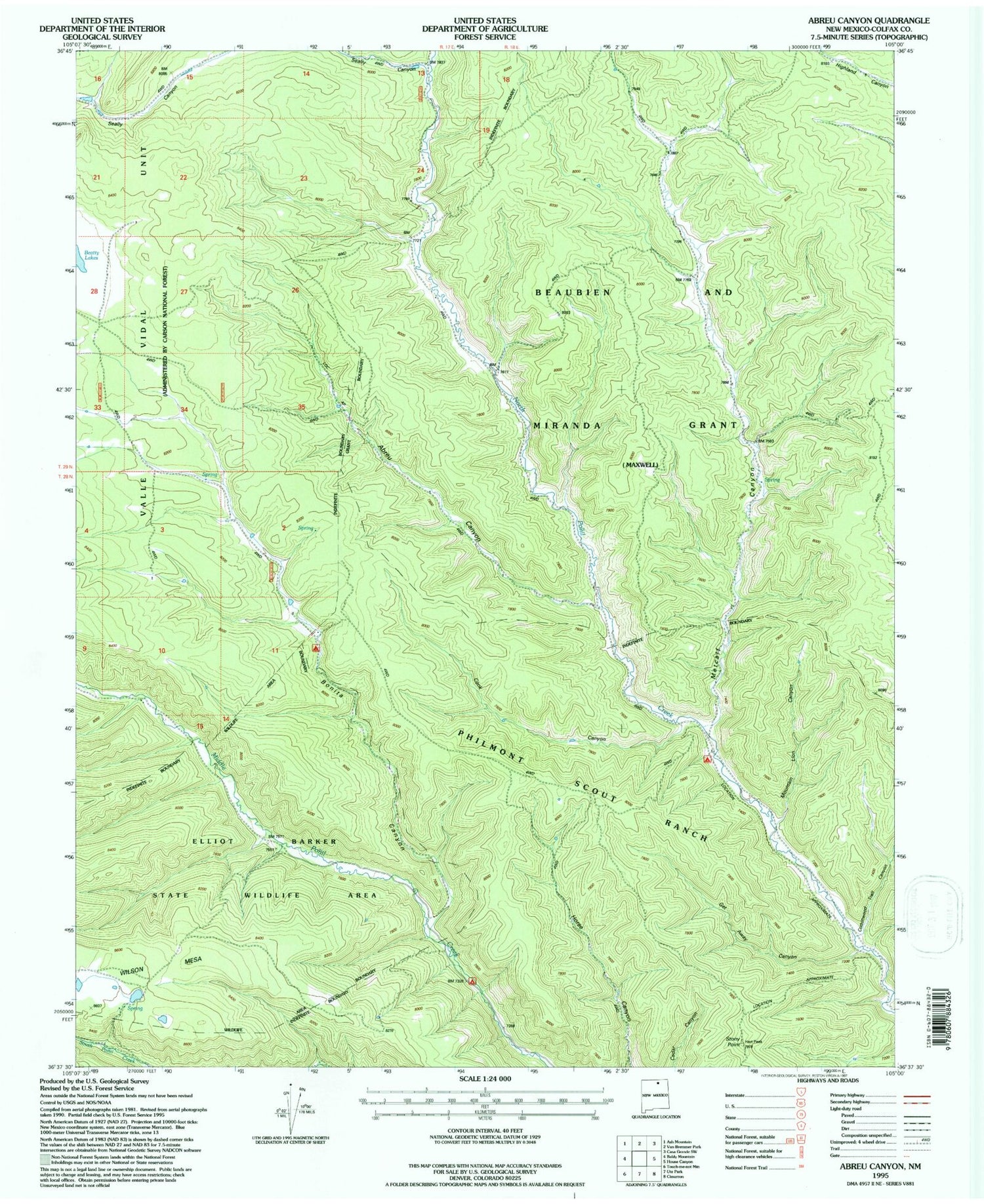
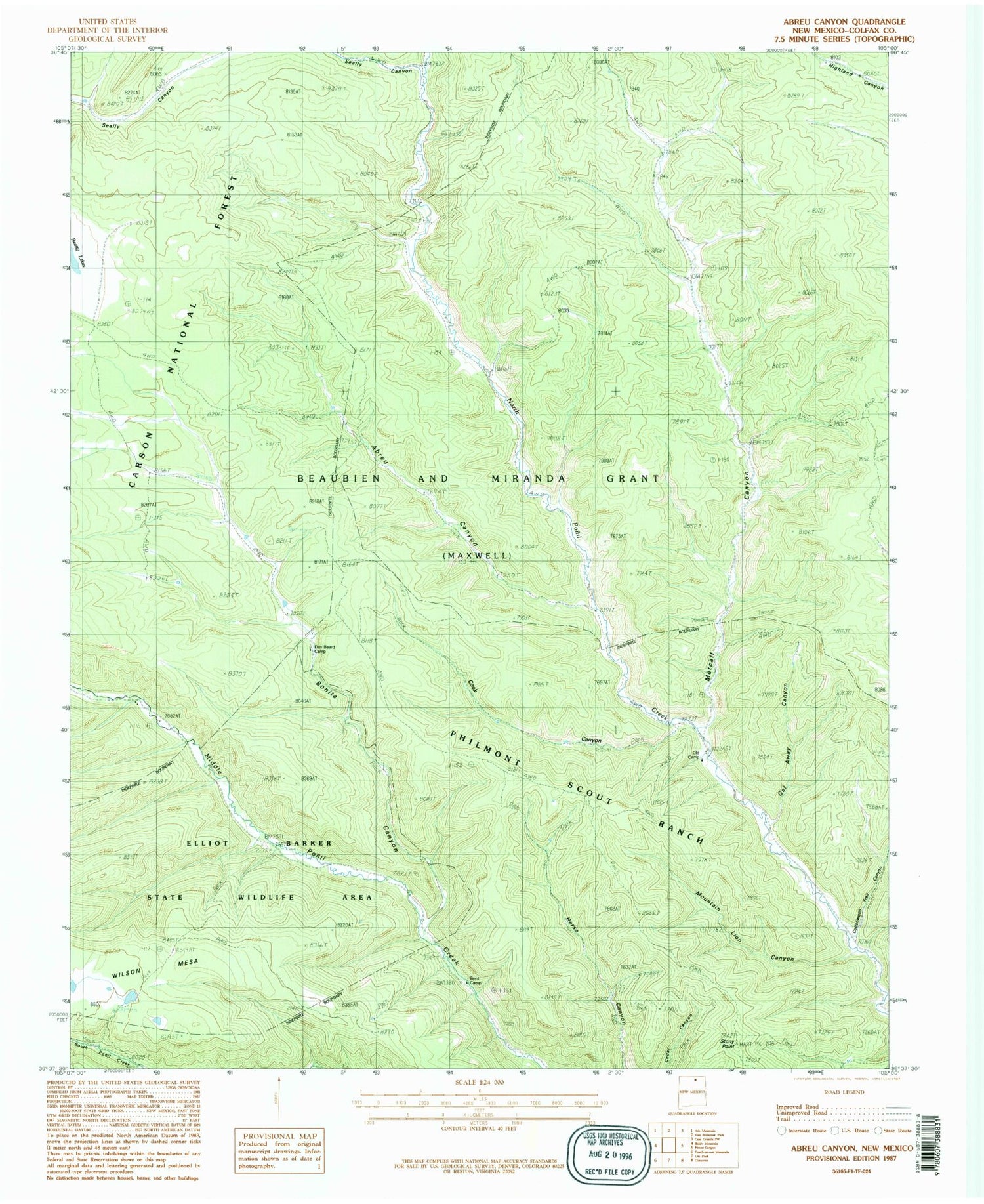
MyTopo
Classic USGS Abreu Canyon New Mexico 7.5'x7.5' Topo Map
Couldn't load pickup availability
Historical USGS topographic quad map of Abreu Canyon in the state of New Mexico. Typical map scale is 1:24,000, but may vary for certain years, if available. Print size: 24" x 27"
This quadrangle is in the following counties: Colfax.
The map contains contour lines, roads, rivers, towns, and lakes. Printed on high-quality waterproof paper with UV fade-resistant inks, and shipped rolled.
Contains the following named places: A Camp, Abreu Canyon, Bonita Canyon, Cook Canyon, Cottonwood Trail Canyon, Dan Beard Trail Camp, Get Away Canyon, Metcalf Canyon, Mountain Lion Canyon, Old Camp, Seally Canyon, Stern Ranch (historical), Stony Point, Wilson Mesa, Stern Post Office, Elliot Barker State Wildlife Area, Bent Camp, Valle Vidal Unit


