MyTopo
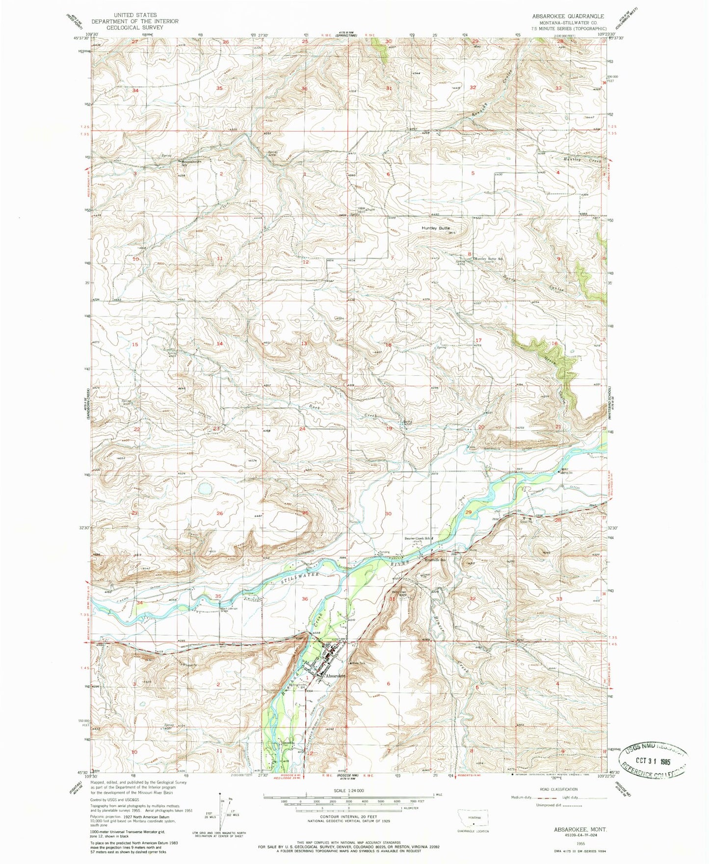
Classic USGS Absarokee Montana 7.5'x7.5' Topo Map
Couldn't load pickup availability
Historical USGS topographic quad map of Absarokee in the state of Montana. Map scale may vary for some years, but is generally around 1:24,000. Print size is approximately 24" x 27"
This quadrangle is in the following counties: Stillwater.
The map contains contour lines, roads, rivers, towns, and lakes. Printed on high-quality waterproof paper with UV fade-resistant inks, and shipped rolled.
Contains the following named places: 03S18E36DCDD01 Well, 03S19E05BBBB01 Well, 03S19E29CCCB01 Well, 03S19E31CADB01 Well, 04S18E01ACCD01 Well, 04S18E03BBAB01 Well, Absaroka Fishing Access Site, Absarokee, Absarokee Census Designated Place, Absarokee Evangelical Church, Absarokee Fire Department, Absarokee Medical Clinic, Absarokee Post Office, Absarokee School, Albert Johnson Bridge, Beaver Creek, Beaver Creek School, Buck Creek, Christ Covenant Church, Community Congregational Church, Garrigus Ditch, Grove Creek, Huntley Butte, Huntley Butte School, Immanual Lutheran Church, J Kern Ditch, Mendenhall Ditch, Mountainview School, Nichols Ditch, Riverside Inn, Roadhouse Ditch, Rosebud, Rosebud Creek, Saint Michaels Catholic Church, The Church of Jesus Christ of Latter Day Saints, Town Ditch