MyTopo
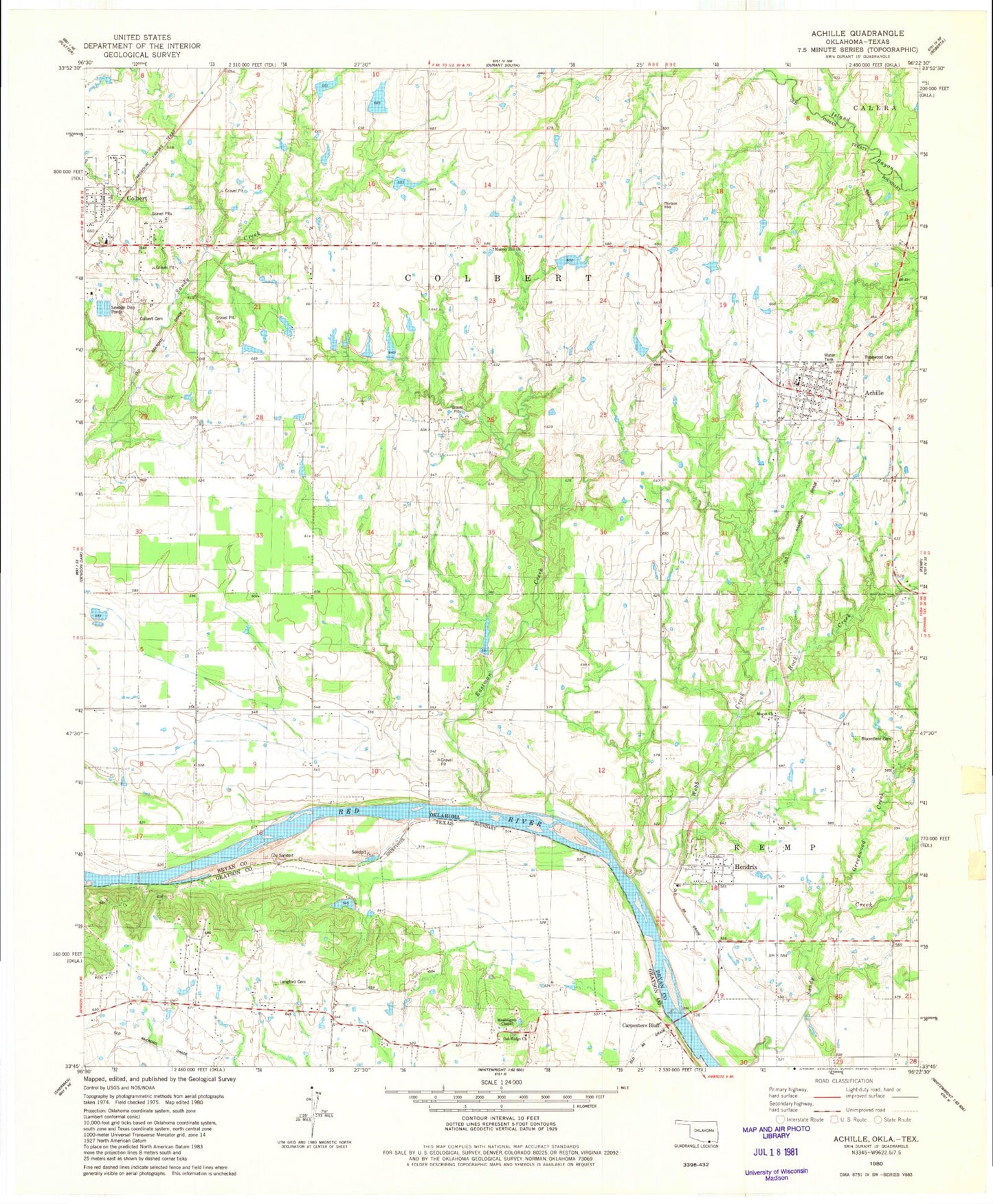
Classic USGS Achille Oklahoma 7.5'x7.5' Topo Map
Couldn't load pickup availability
Historical USGS topographic quad map of Achille in the states of Oklahoma, Texas. Map scale may vary for some years, but is generally around 1:24,000. Print size is approximately 24" x 27"
This quadrangle is in the following counties: Bryan, Grayson.
The map contains contour lines, roads, rivers, towns, and lakes. Printed on high-quality waterproof paper with UV fade-resistant inks, and shipped rolled.
Contains the following named places: Achille, Achille Elementary School, Achille Fire Department, Achille High School, Achille Police Department, Achille Post Office, Bloomfield Cemetery, Booker T Washington School, Carpenters Bluff, Colbert Cemetery, Colbert Eastward Elementary School, Eastman Creek, Greenwood Creek, Ham Lake, Ham Lake Dam, Hendrix, Hendrix Post Office, Kemp Lake, Kemp Lake Dam, Lankford Cemetery, McCarley Lake, Mccarley Lake Dam, McCarley Lake Dam, Mognt Church, Murray Hill Church, Oak Ridge School, Oakridge Cemetery, Oknoname 013002 Dam, Oknoname 013002 Reservoir, Pearson Church, Rock Creek, Rosewood Cemetery, Sims Number 1 Dam, Sims Number 1 Reservoir, Sims Number 2 Dam, Sims Number 2 Reservoir, Town of Achille, Town of Hendrix, Township of Colbert, Webb Creek, ZIP Code: 74733