MyTopo
Classic USGS Ackley NE Iowa 7.5'x7.5' Topo Map
Regular price
$16.95
Regular price
Sale price
$16.95
Unit price
per
Couldn't load pickup availability
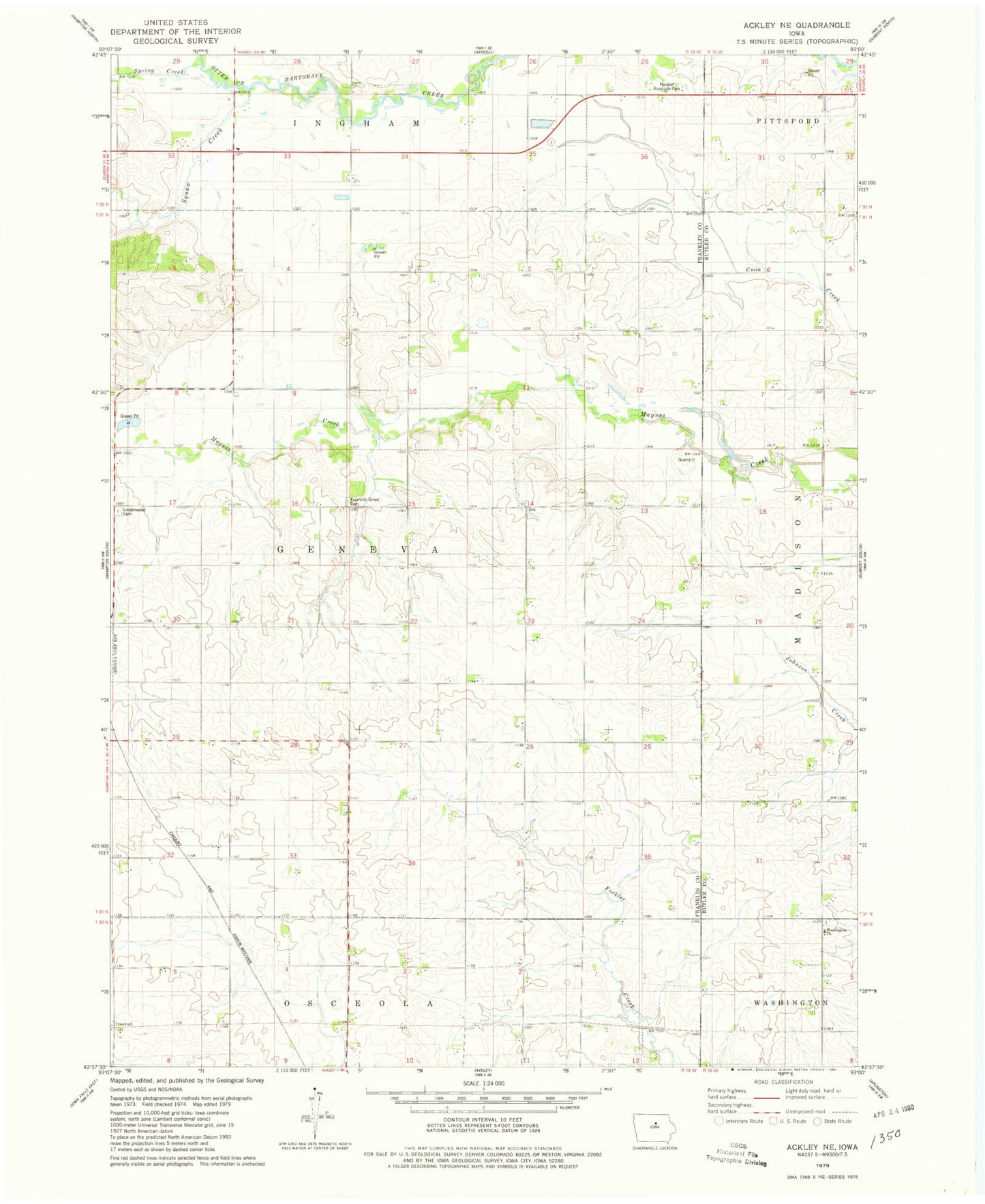
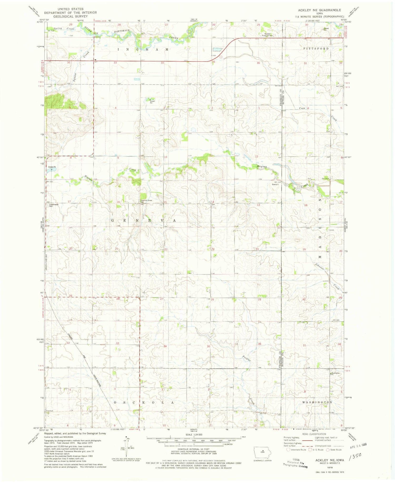
Historical USGS topographic quad map of Ackley NE in the state of Iowa. Map scale may vary for some years, but is generally around 1:24,000. Print size is approximately 24" x 27"
This quadrangle is in the following counties: Butler, Franklin.
The map contains contour lines, roads, rivers, towns, and lakes. Printed on high-quality waterproof paper with UV fade-resistant inks, and shipped rolled.
Contains the following named places: Four Mile Grove Cemetery, Handorf Roadside Park, Lindenwood Cemetery, Otter Creek, Spring Creek, Squaw Creek, Township of Geneva, Washington Reformed Cemetery, Washington Reformed Church