MyTopo
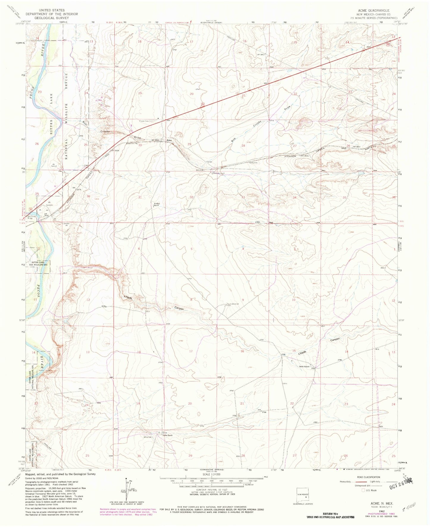
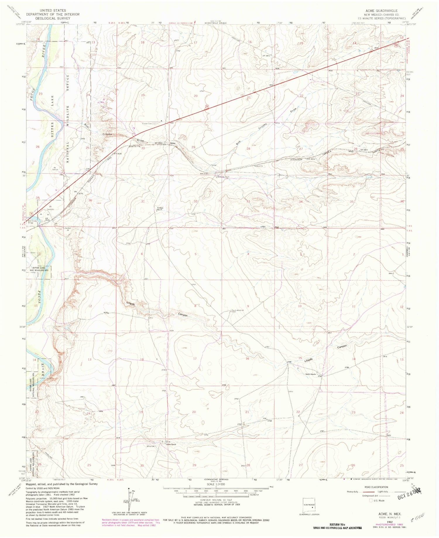
Classic USGS Acme New Mexico 7.5'x7.5' Topo Map
Couldn't load pickup availability
Historical USGS topographic quad map of Acme in the state of New Mexico. Map scale may vary for some years, but is generally around 1:24,000. Print size is approximately 24" x 27"
This quadrangle is in the following counties: Chaves.
The map contains contour lines, roads, rivers, towns, and lakes. Printed on high-quality waterproof paper with UV fade-resistant inks, and shipped rolled.
Contains the following named places: 06222 Water Well, 06234 Water Well, 06235 Water Well, 06236 Water Well, 06237 Water Well, 06238 Water Well, 10798 Water Well, 10799 Water Well, 10822 Water Well, 10827 Water Well, Acme, Acme Post Office, Bob Crosby Bridge, Bob Crosby Draw, Dallas Ranch, Frazier, Frazier Cemetery, Frazier Post Office, Hurford Pit, Jesse E Hite Pit, Kitchen Ranch, Lloyds Canyon, North Windmill, Plaster Plant, Smith Ranch, South Windmill