
MyTopo
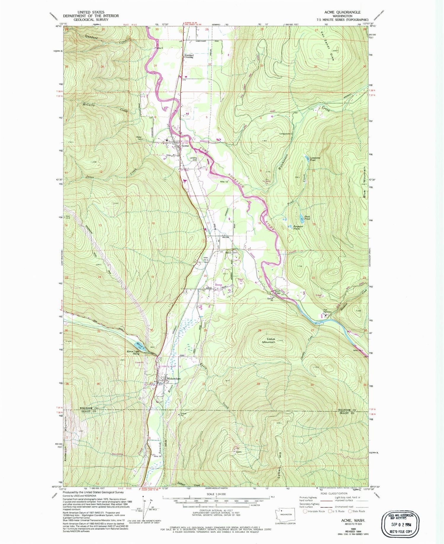
Classic USGS Acme Washington 7.5'x7.5' Topo Map
Couldn't load pickup availability
Historical USGS topographic quad map of Acme in the state of Washington. Typical map scale is 1:24,000, but may vary for certain years, if available. Print size: 24" x 27"
This quadrangle is in the following counties: Skagit, Whatcom.
The map contains contour lines, roads, rivers, towns, and lakes. Printed on high-quality waterproof paper with UV fade-resistant inks, and shipped rolled.
Contains the following named places: Acme, Blue Mountain, Comar, Doran, Edfro Creek, Ennis Creek, Jones Creek, McCarty Creek, Mirror Lake, Mirror Lake, Saxon, Saxon Bridge, Skookum Creek, Wickersham, Doolittle Creek, Mirror Lake Siding, Christie Creek, Pond Creek, Standard Creek, Lonesome Pond, Duck Pond, Ferguson Ponds, Eddys Mountain, Acme Elementary School, Marona Mill Pond Dam, Marona Mill Pond, Hutchinson Creek, Acme Field, Acme Census Designated Place, Saxon Cemetery, Lummi Indian Business Council Skookum Creek Fish Hatchery, Saxon Quarry, Acme Post Office, Acme Presbyterian Church, Whatcom County Fire District 16, Kalsbeek Dairy, Shetler Dairy, Anderson Dairy, Coldstream Farm


