MyTopo
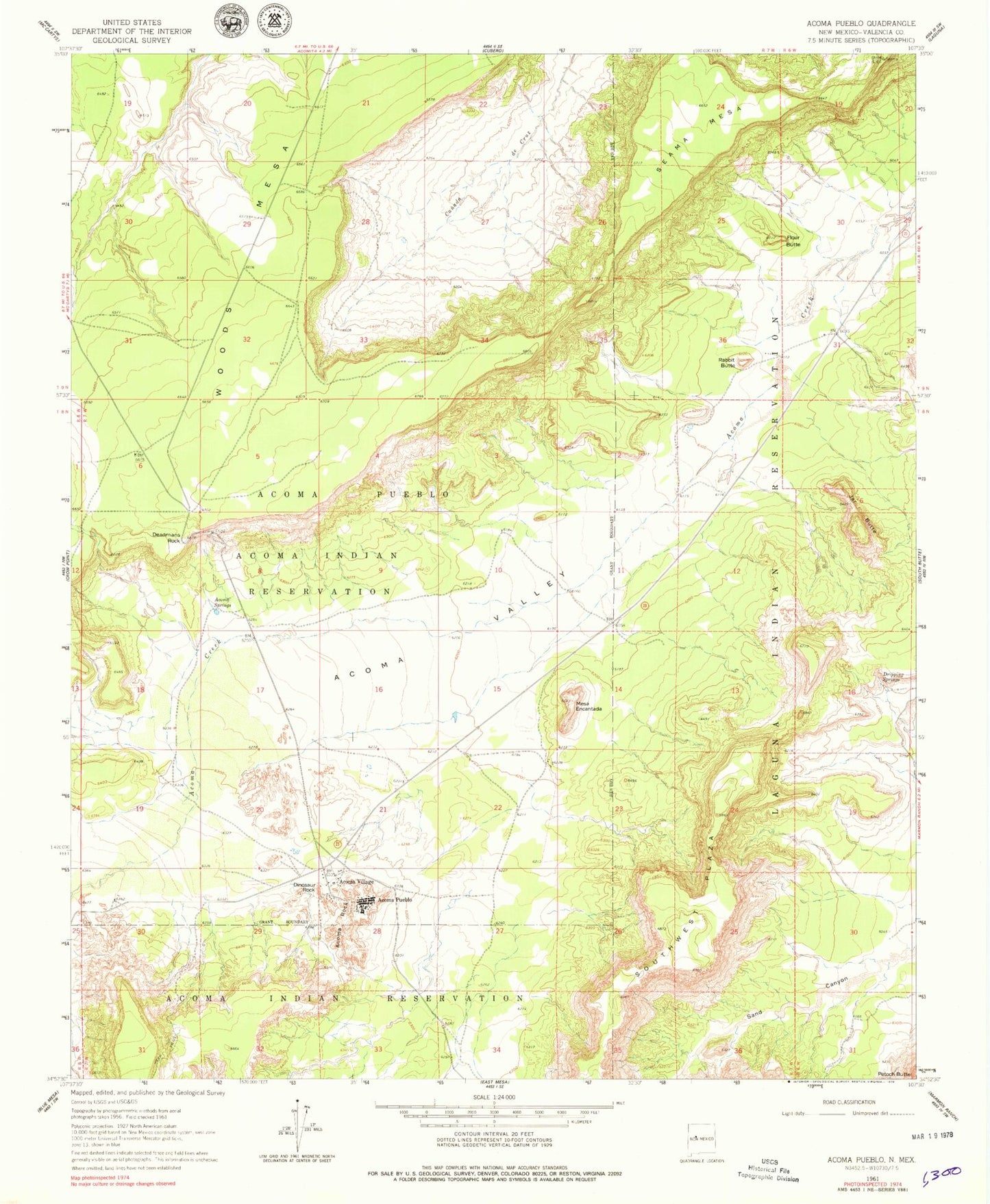
Classic USGS Acoma Pueblo New Mexico 7.5'x7.5' Topo Map
Couldn't load pickup availability
Historical USGS topographic quad map of Acoma Pueblo in the state of New Mexico. Map scale may vary for some years, but is generally around 1:24,000. Print size is approximately 24" x 27"
This quadrangle is in the following counties: Cibola.
The map contains contour lines, roads, rivers, towns, and lakes. Printed on high-quality waterproof paper with UV fade-resistant inks, and shipped rolled.
Contains the following named places: Acoma Community Library Resource Center, Acoma Museum, Acoma Pueblo, Acoma Rock, Acoma Springs, Acoma Valley, Acoma Village, Acomita Pit, Balo Deposit, Canada de Cruz, Cebolleta Historical Marker, Deadmans Rock, Dinosaur Rock, Dripping Springs, Eye of the Moon, Flour Butte, Jar Butte, Laguna 6 Water Well, Limestone Quarry, Mesa Encantada, Pueblo of Acoma Historical Marker, Rabbit Butte, San Esteban Del Rey Mission Cemetery, San Estevan de Acoma Mission Church Historic Site, Sand Canyon, Seama Mesa, Sky City Community, Woods Mesa