MyTopo
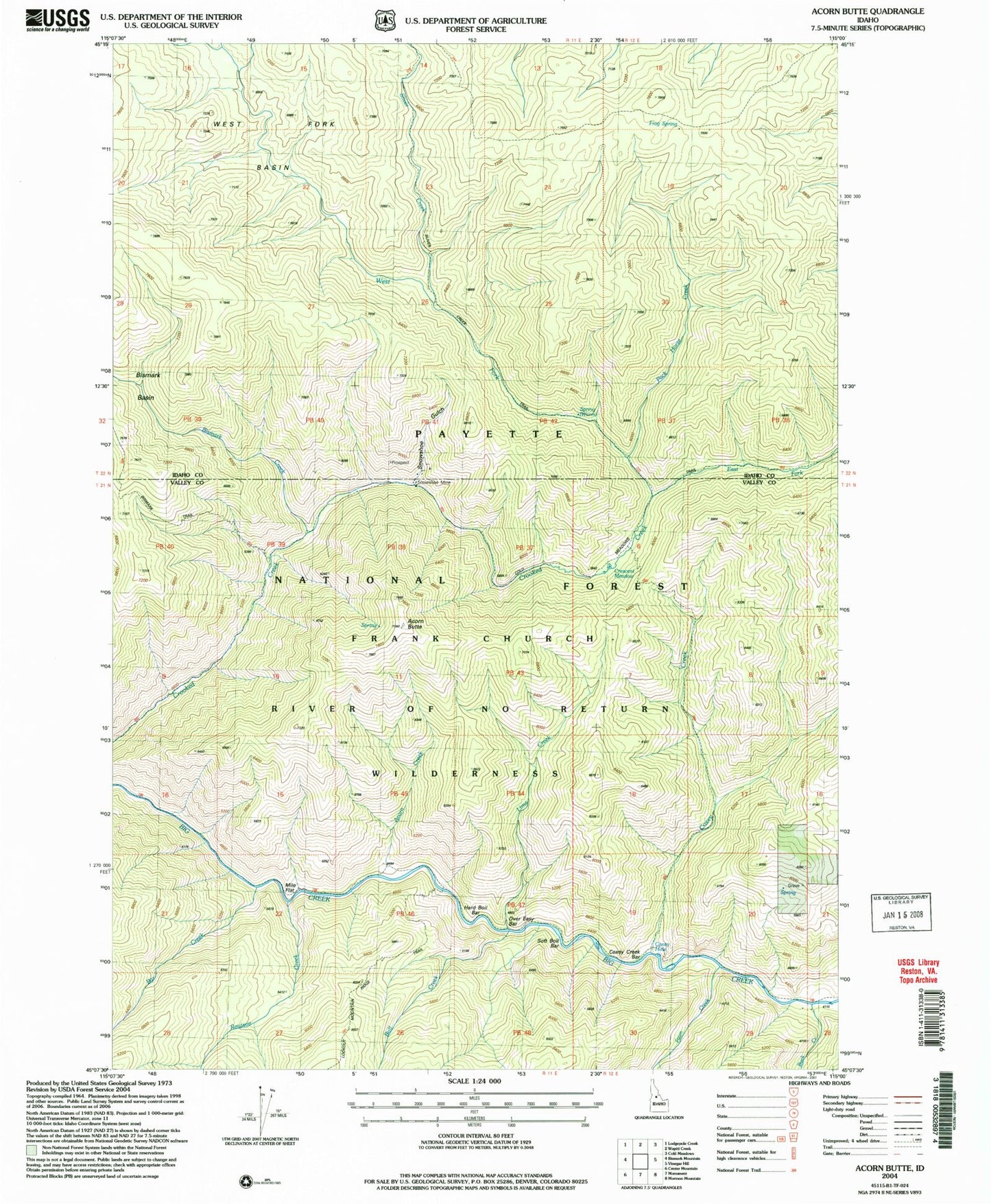
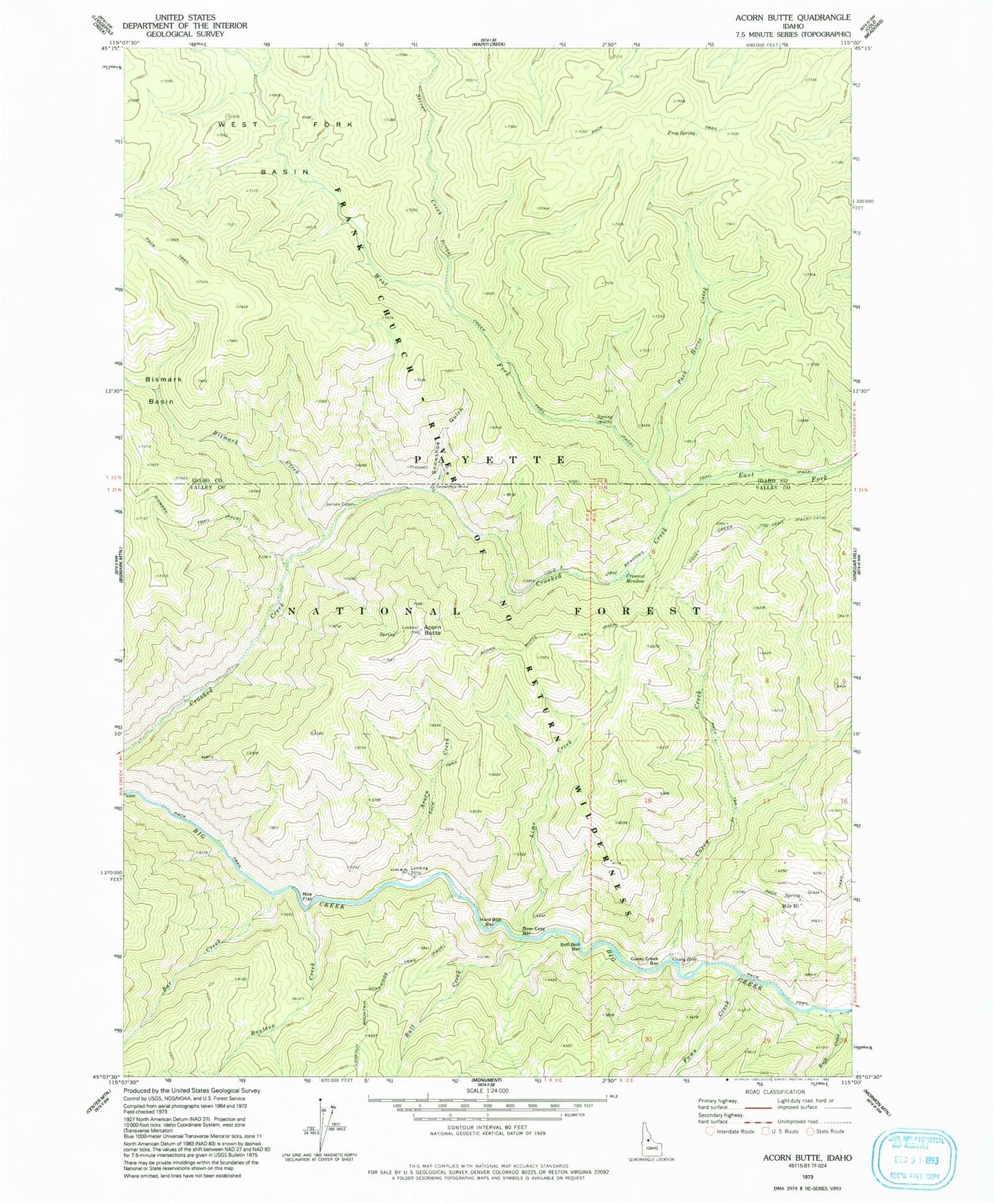
Classic USGS Acorn Butte Idaho 7.5'x7.5' Topo Map
Couldn't load pickup availability
Historical USGS topographic quad map of Acorn Butte in the state of Idaho. Typical map scale is 1:24,000, but may vary for certain years, if available. Print size: 24" x 27"
This quadrangle is in the following counties: Idaho, Valley.
The map contains contour lines, roads, rivers, towns, and lakes. Printed on high-quality waterproof paper with UV fade-resistant inks, and shipped rolled.
Contains the following named places: Acorn Butte, Acorn Creek, Bar Creek, Bismark Basin, Bismark Creek, Buck Creek, Bull Creek, Cold Meadow Trail, Coxey Creek, Coxey Creek Bar, Coxey Creek Trail, Coxey Hole, Crescent Meadow, East Fork Crooked Creek, Fawn Creek, Frog Spring, Hard Boil Bar, Jensen Cabin, Lime Creek, Mile Flat, Mile Hi, Over Easy Bar, Pack Horse Creek, Routson Creek, Sliver Creek, Sliver Creek Trail, Snowshoe Gulch, Snowshoe Mine, Soft Boil Bar, West Fork Basin, West Fork Crooked Creek, Mile High Ranch