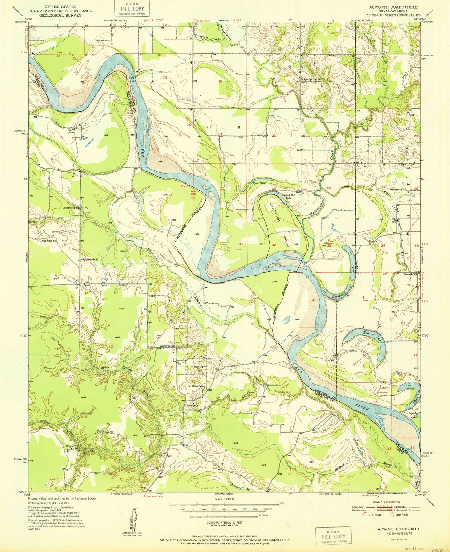
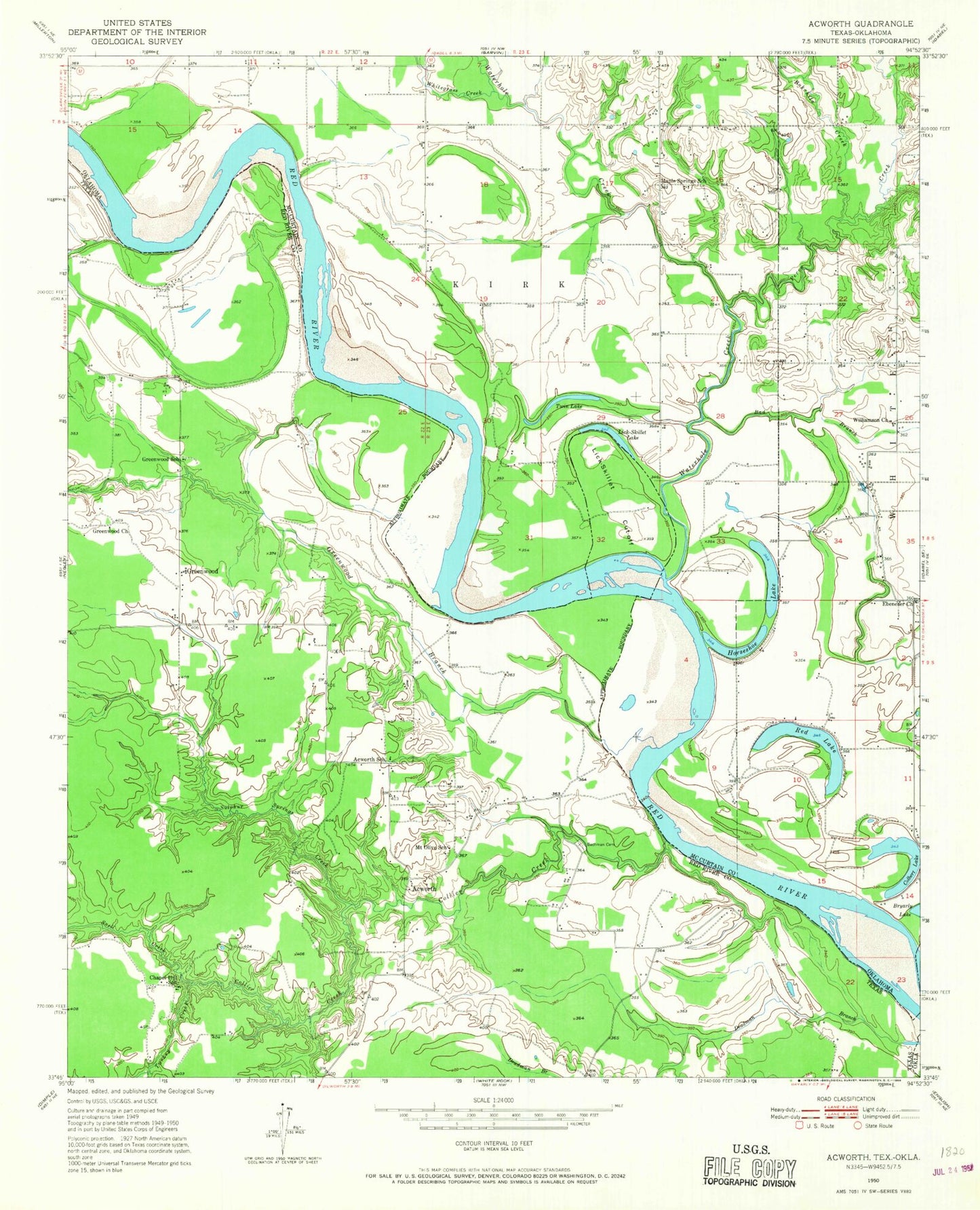
MyTopo
Classic USGS Acworth Texas 7.5'x7.5' Topo Map
Couldn't load pickup availability
Historical USGS topographic quad map of Acworth in the states of Texas, Oklahoma. Map scale may vary for some years, but is generally around 1:24,000. Print size is approximately 24" x 27"
This quadrangle is in the following counties: McCurtain, Red River.
The map contains contour lines, roads, rivers, towns, and lakes. Printed on high-quality waterproof paper with UV fade-resistant inks, and shipped rolled.
Contains the following named places: Acworth, Acworth School, Bachman Cemetery, Bad Branch, Bokchito Creek, Bryarly Springs, Chapel Hill School, Colbert Lake, Collier Creek, Ebenezer Church, Greenwood, Greenwood Branch, Greenwood Church, Greenwood School, Horseshoe Lake, Lick-Skillet Cut-Off, Lick-Skillet Lake, Maple Springs School, McKinsey Slough, Mount Olive School, Oknoname 089004 Dam, Oknoname 089004 Reservoir, Perry Creek, Red Lake, Snell Creek, Sulpher Springs Creek, Turkey Branch, Twin Lake, Waterfall-Gilford Creeks Site 1 Dam, Waterfall-Gilford Creeks Site 1 Reservoir, Waterhole Creek, Whitegrass Creek, Williamson Church