
MyTopo
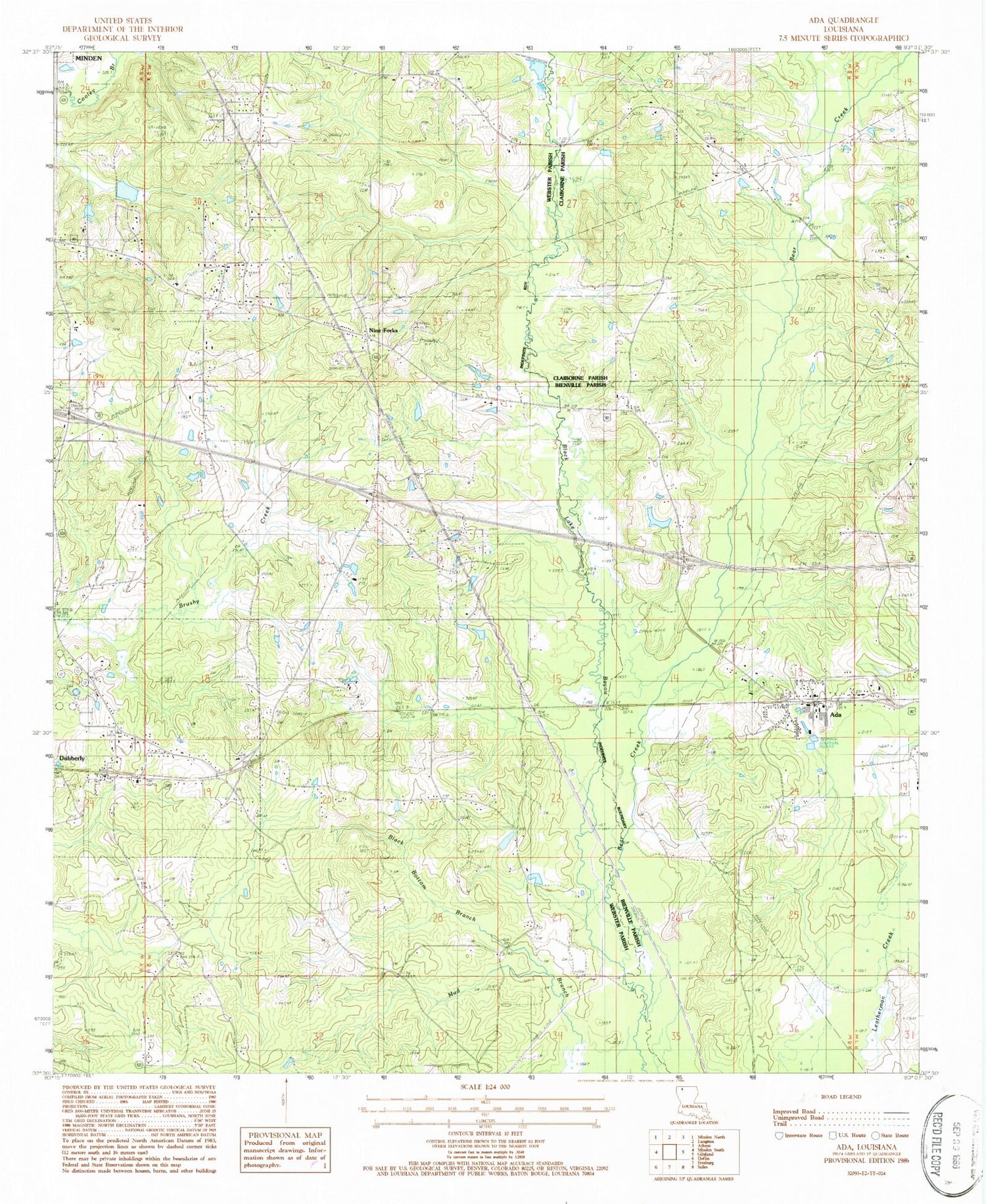
Classic USGS Ada Louisiana 7.5'x7.5' Topo Map
Couldn't load pickup availability
Historical USGS topographic quad map of Ada in the state of Louisiana. Map scale may vary for some years, but is generally around 1:24,000. Print size is approximately 24" x 27"
This quadrangle is in the following counties: Bienville, Claiborne, Webster.
The map contains contour lines, roads, rivers, towns, and lakes. Printed on high-quality waterproof paper with UV fade-resistant inks, and shipped rolled.
Contains the following named places: Ada, Bear Creek, Beck Cemetery, Beech Springs Baptist Church, Black Bottom Branch, Brushwood School, Brushwood United Methodist Church, Burns Cemetery, Colbert Cemetery, Dubberly, Dubberly Post Office, Fellowship Baptist Church, Fellowship Cemetery, Fuller Cemetery, Gilgal Cemetery, Gilgal Church, Holoman - Jones Cemetery, Hopewell School, Nine Forks, North Bienville Fire Protection District Station 7, Pine Grove Cemetery, Piney Grove Church, Pleasant Grove School, Smith Pond Number Three Dam, Talton School, Taylor Baptist Church, Turners School, Turners Store, Village of Dubberly, Webster Parish Fire Protection District 4, Woodard Cemetery


