
MyTopo
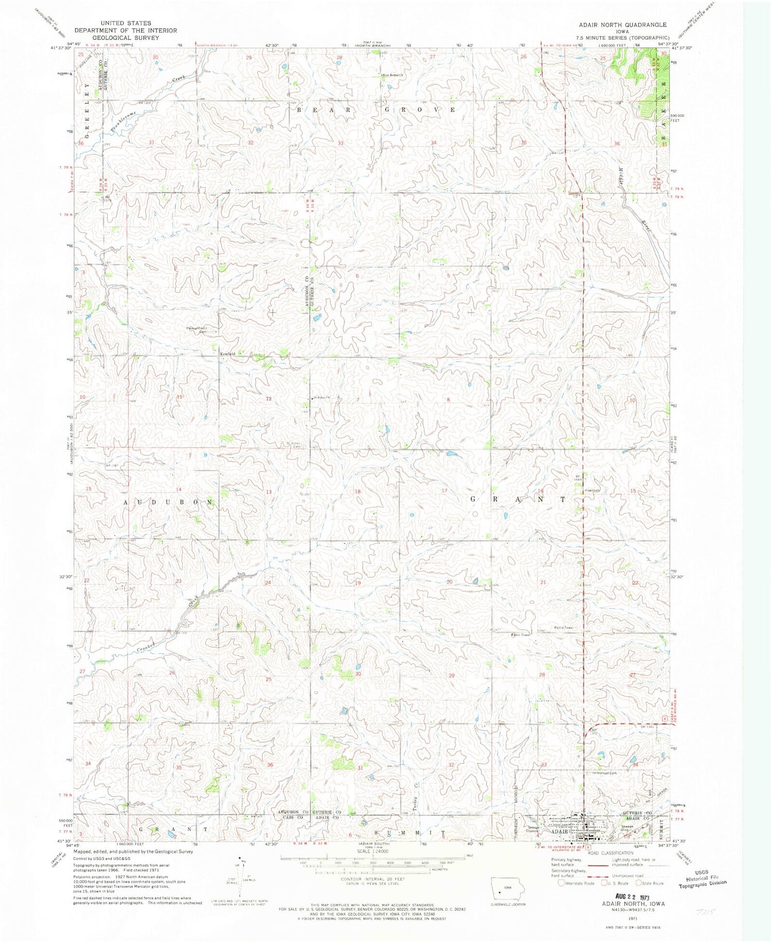
Classic USGS Adair North Iowa 7.5'x7.5' Topo Map
Couldn't load pickup availability
Historical USGS topographic quad map of Adair North in the state of Iowa. Map scale may vary for some years, but is generally around 1:24,000. Print size is approximately 24" x 27"
This quadrangle is in the following counties: Adair, Audubon, Cass, Guthrie.
The map contains contour lines, roads, rivers, towns, and lakes. Printed on high-quality waterproof paper with UV fade-resistant inks, and shipped rolled.
Contains the following named places: Adair, Adair City Hall, Adair Community Health Center, Adair Fire Department, Adair Library, Adair Medical Center, Adair Police Department, Adair Post Office, City of Adair, First Presbyterian Church, Good Shepherd Lutheran Church, Immanual Evangelical Lutheran Cemetery, Immanuel Lutheran Cemetery, Immanuel Lutheran Church, Jobes Post Office, Kenfield, New Bethel Church, New Bethel United Methodist Church, Pleasant Hill Cemetery, Saint Johns Catholic Church, Saint Johns Cemetery, Saint Johns Church, Saint Johns Lutheran Church, School House Prairie, Township of Grant, United Methodist Church, ZIP Code: 50002


