MyTopo
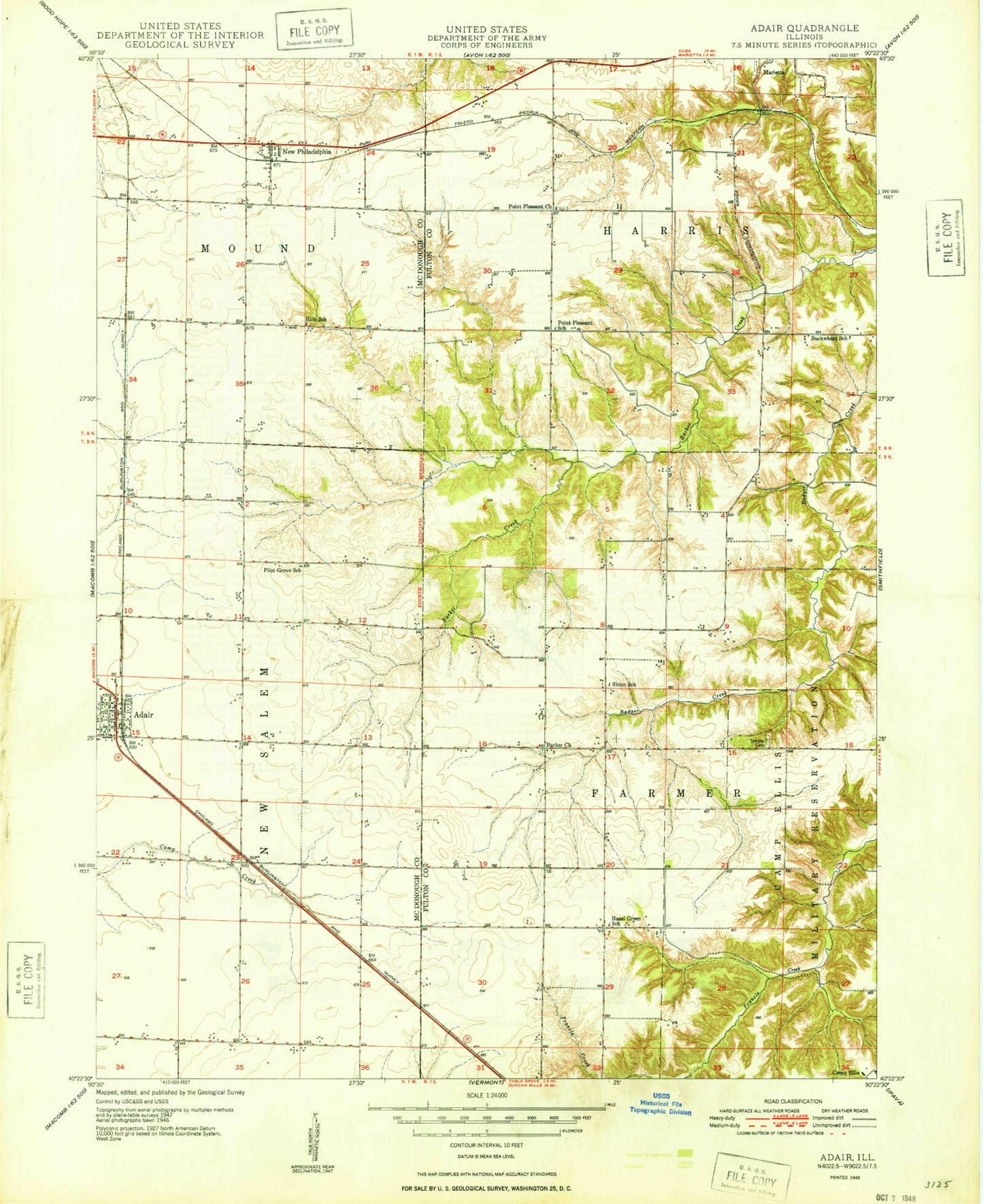
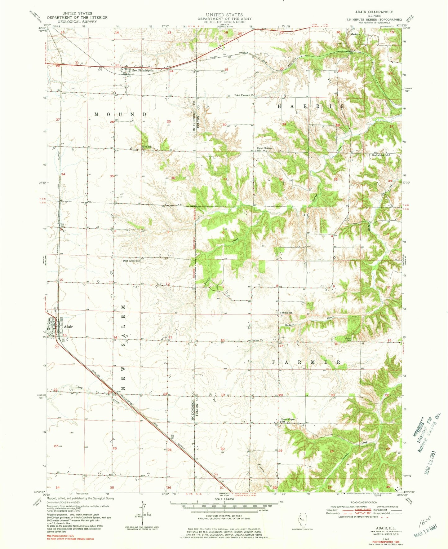
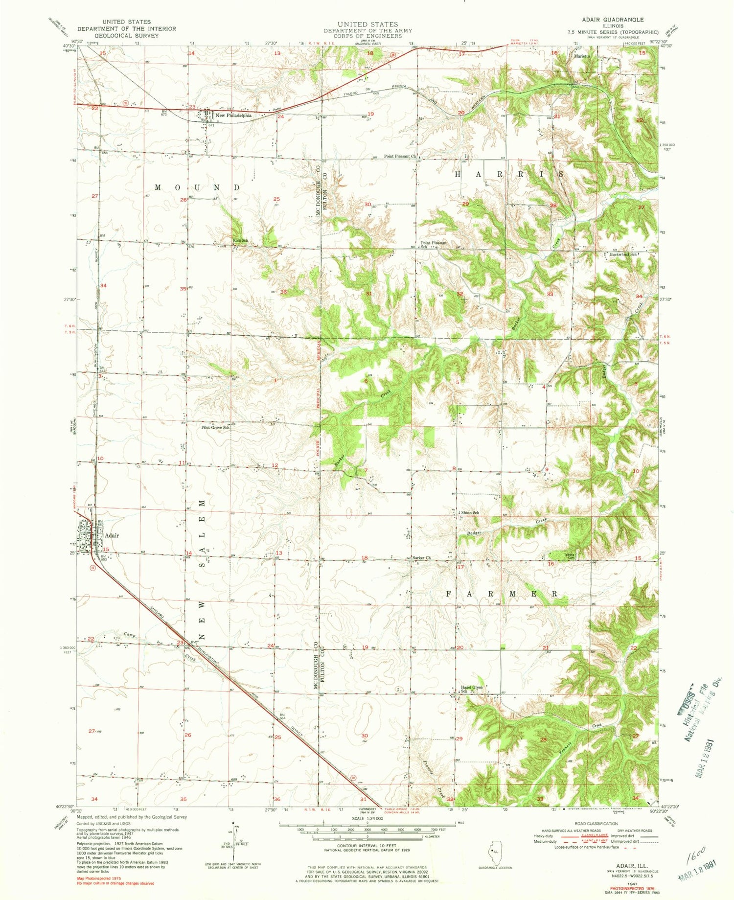
Classic USGS Adair Illinois 7.5'x7.5' Topo Map
Couldn't load pickup availability
Historical USGS topographic quad map of Adair in the state of Illinois. Map scale may vary for some years, but is generally around 1:24,000. Print size is approximately 24" x 27"
This quadrangle is in the following counties: Fulton, McDonough.
The map contains contour lines, roads, rivers, towns, and lakes. Printed on high-quality waterproof paper with UV fade-resistant inks, and shipped rolled.
Contains the following named places: Adair, Adair Census Designated Place, Adair Community High School, Adair Post Office, Adair United Brethren Church, Adair United Methodist Church, Barker Cemetery, Barker Church, Buckwheat School, Hazel Green School, Hughes Centennial Farm, Ipava Dam, Ipava Settling Basin, Leaman Station, Marietta Cemetery, New Philadelphia, New Philadelphia School, New Philadelphia United Methodist Church, New Salem Fire Protection District, Pilot Grove School, Pilot Grove United Brethren Church, Point Pleasant Cemetery, Point Pleasant School, Point Pleasant United Methodist Church, Rich School, Shinn School, Shoo Fly, Temple Cemetery, Township of Farmers, Township of Harris, Village of Marietta, ZIP Code: 61482