MyTopo
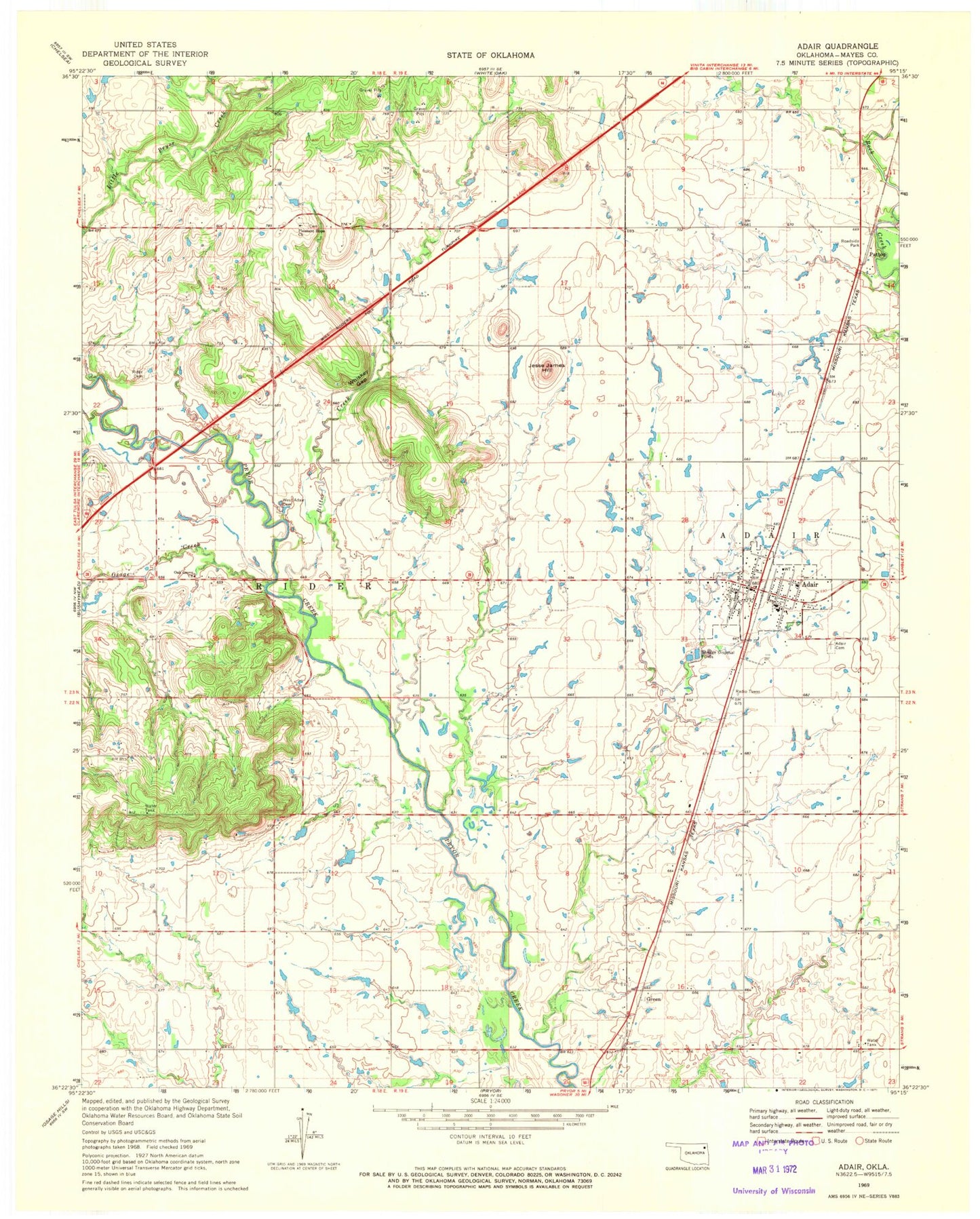
Classic USGS Adair Oklahoma 7.5'x7.5' Topo Map
Couldn't load pickup availability
Historical USGS topographic quad map of Adair in the state of Oklahoma. Map scale may vary for some years, but is generally around 1:24,000. Print size is approximately 24" x 27"
This quadrangle is in the following counties: Mayes.
The map contains contour lines, roads, rivers, towns, and lakes. Printed on high-quality waterproof paper with UV fade-resistant inks, and shipped rolled.
Contains the following named places: Adair, Adair Cemetery, Adair Division, Adair Fire Department, Adair High School, Adair Middle School, Adair Police Department, Adair Post Office, Bernita Hughes Elementary School, Bitter Creek, Green, Jesse James Hill, Mayes Emergency Services Trust Authority Station 4, Oak Grove Church, Osage Creek, Patton, Pleasant Hope Cemetery, Pleasant Hope Church, Rider Cemetery, Town of Adair, Township of Rider, West Adair Cemetery, Whiskey Gap, ZIP Code: 74330