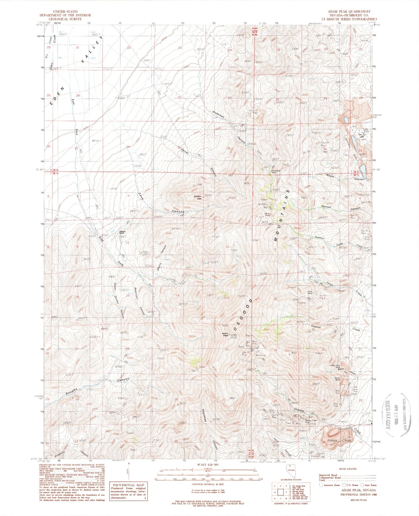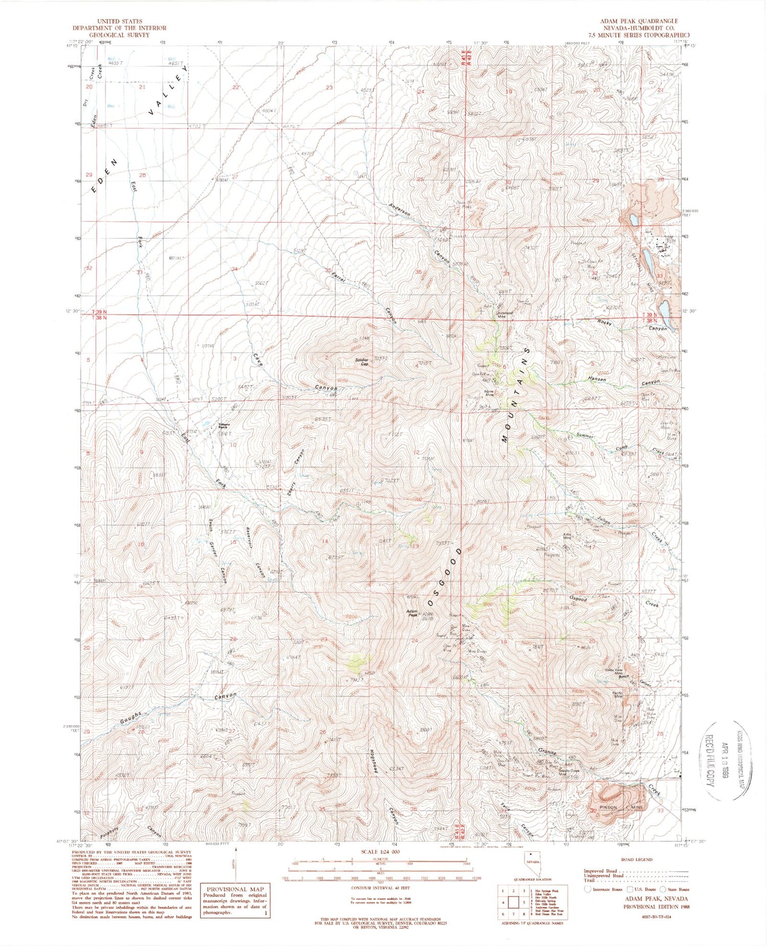
MyTopo
Classic USGS Adam Peak Nevada 7.5'x7.5' Topo Map
Couldn't load pickup availability
Historical USGS topographic quad map of Adam Peak in the state of Nevada. Map scale may vary for some years, but is generally around 1:24,000. Print size is approximately 24" x 27"
This quadrangle is in the following counties: Humboldt.
The map contains contour lines, roads, rivers, towns, and lakes. Printed on high-quality waterproof paper with UV fade-resistant inks, and shipped rolled.
Contains the following named places: Adam Peak, Alpine Mine, Anderson Canyon, Bunch Canyon, Cave Canyon, Cherry Canyon, Clover Valley School, Dry Creek, Dry Hills, East Fork Eden Creek, Farrel Canyon, Getchell, Getchell Mine, Getchell Section Five Pit, Granite Creek Mine, Kirby Mine, Marcus Mine, Mountain King Mine, Pacific Mine, Penson Ranch, Pinson Mine, Pinson Mining Company Landing Strip, Potosi-Getchell Mining District, Reilly Mine, Reservoir Canyon, Richmond Mine, Soldier Cap, Soldier Cap Creek, Soldiers Cap Spring, South Garden Canyon, Stone House, T N T Mine, Tip Top Mine, Tonopah Mine, Top Row Mine, Valley View Mine, Yribarne Ranch