
MyTopo
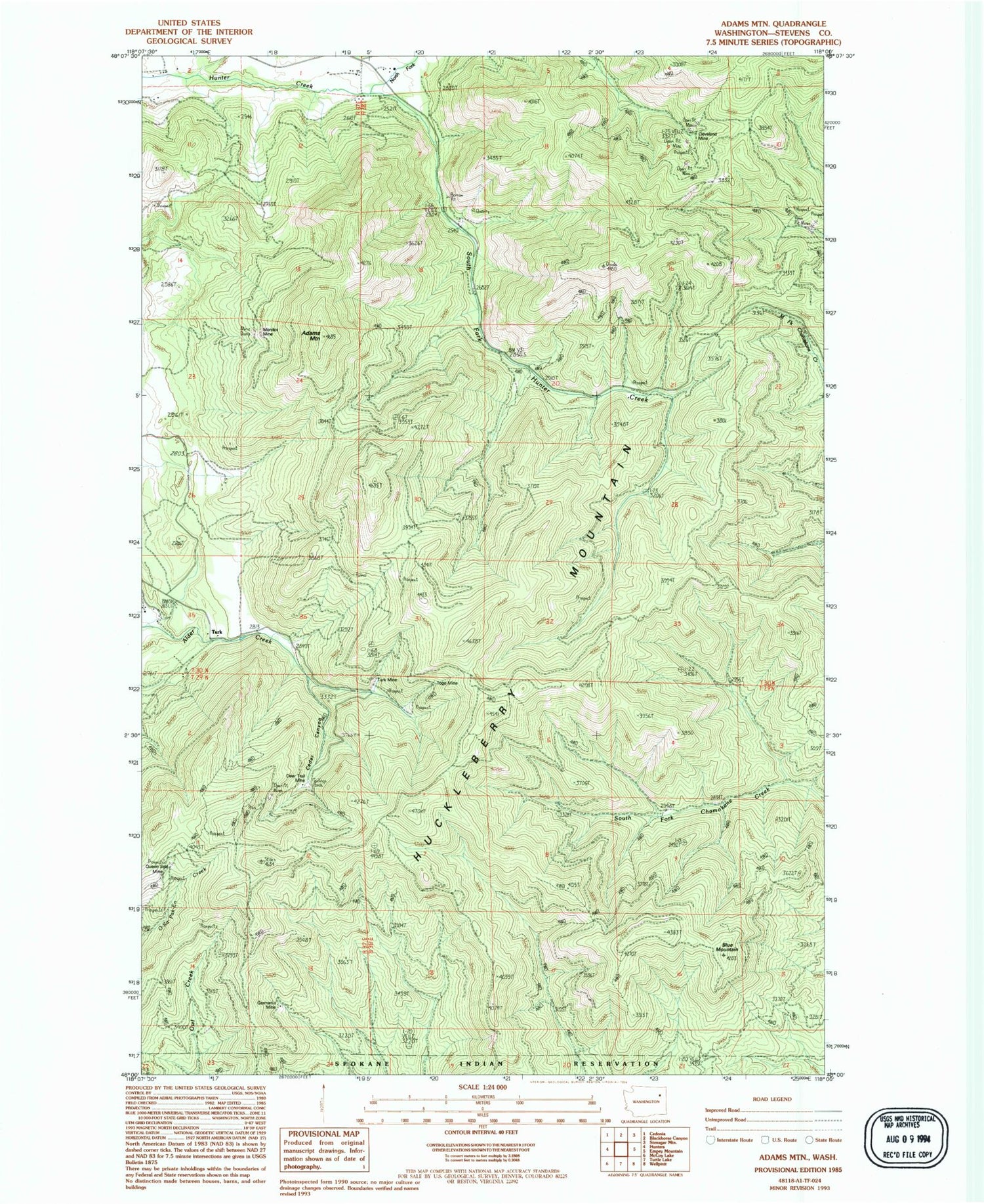
Classic USGS Adams Mountain Washington 7.5'x7.5' Topo Map
Regular price
$16.95
Regular price
Sale price
$16.95
Unit price
per
Couldn't load pickup availability
Historical USGS topographic quad map of Adams Mountain in the state of Washington. Typical map scale is 1:24,000, but may vary for certain years, if available. Print size: 24" x 27"
This quadrangle is in the following counties: Stevens.
The map contains contour lines, roads, rivers, towns, and lakes. Printed on high-quality waterproof paper with UV fade-resistant inks, and shipped rolled.
Contains the following named places: Adams Mountain, Blue Mountain, Cedar Canyon, Cleveland Mine, Deer Trail Mine, Germania Mine, Monitor Mine, Queen Seal Mine, South Fork Hunter Creek, Togo Mine, Turk Mine, North Fork Hunter Creek, Turk, Deer Trail


