MyTopo
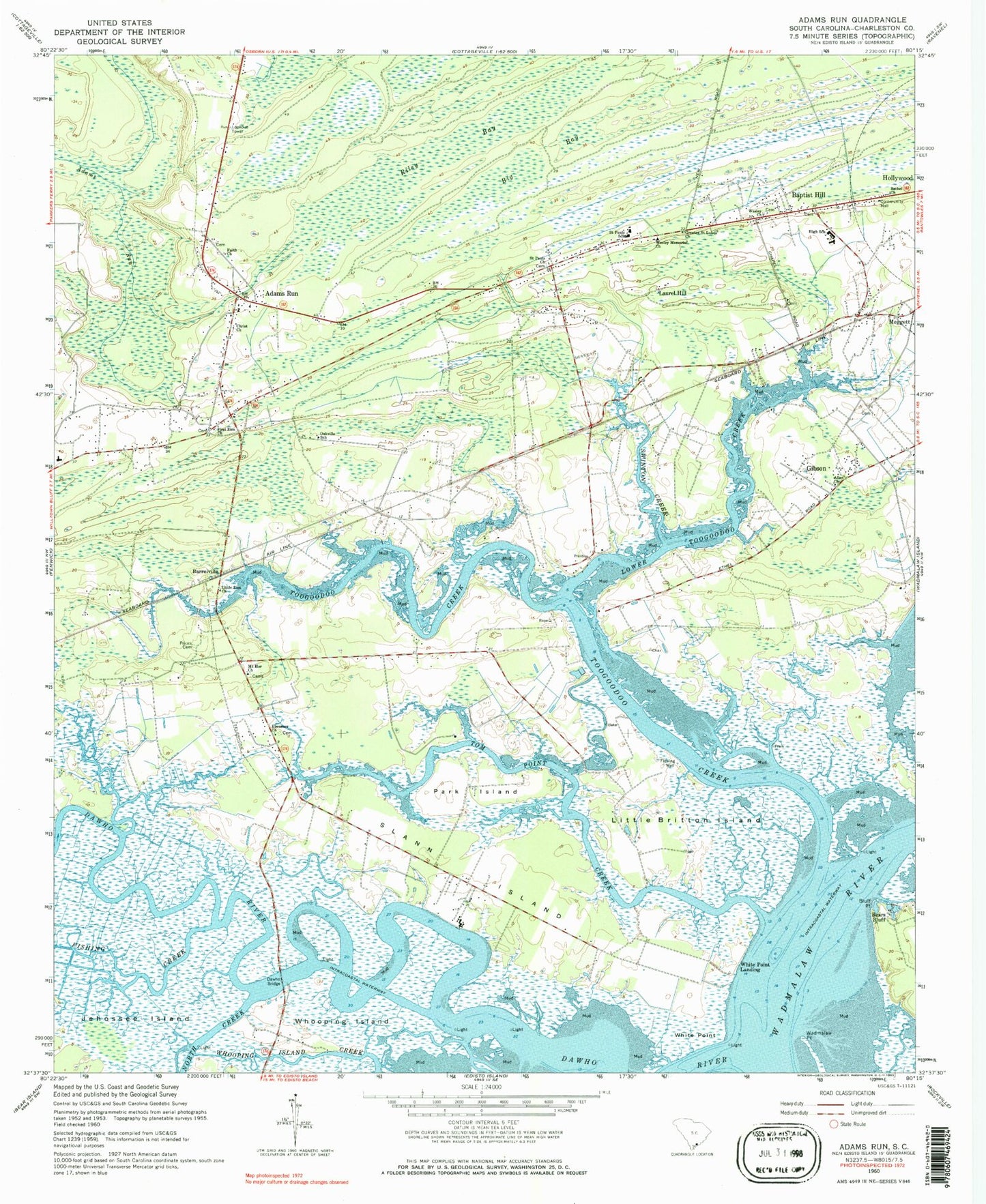
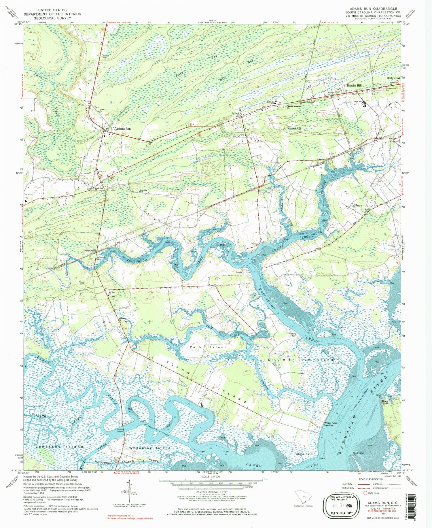
Classic USGS Adams Run South Carolina 7.5'x7.5' Topo Map
Couldn't load pickup availability
Historical USGS topographic quad map of Adams Run in the state of South Carolina. Map scale may vary for some years, but is generally around 1:24,000. Print size is approximately 24" x 27"
This quadrangle is in the following counties: Charleston.
The map contains contour lines, roads, rivers, towns, and lakes. Printed on high-quality waterproof paper with UV fade-resistant inks, and shipped rolled.
Contains the following named places: Adams Run, Adams Run Census Designated Place, Adams Run Post Office, Adams Run School, Allen Church, Baptist Hill, Baptist Hill Elementary School, Baptist Hill High School, Barrelville, Bears Bluff, Bears Bluff National Fish Hatchery, Bethel Church, Big Bay, Bluff Point, C C Blaney Elementary School, Christ Church, Dawho Bridge, Dawho River, Ebenezer Church, Ernest F Hollings Ace Basin National Wildlife Refuge, Faith Church, First Zion Church, Fishing Creek, Gannon, Gibson, Greater Saint Lukes Church, Jehossee Island, Laroche, Laurel Hill, Little Britton Island, Little Zion Church, Lower Toogoodoo Creek, Minnie Hughes Elementary School, Mount Hor Church, Newton Berry Farms, North Creek, Oakville School, Park Island, Prices Cemetery, R D Schroder Middle School, Riley Bay, Saint Paul Episcopal Church, Saint Pauls Church, Saint Paul's Fire Department Station 1, Saint Paul's Fire Department Station 5, Saint Pauls School, Slann Island, South Carolina Noname 10063 D-3044 Dam, Swinton Creek, Tom Point Creek, Too Goo Doo Farms Airport, Toogoodoo Creek, Town of Meggett, Wadmalaw Point, Wadmalaw River, Wesley Church, Wesley Memorial Church, White Point, White Point Landing, Whooping Island, WMGL-FM (Ravenel), ZIP Code: 29449