MyTopo
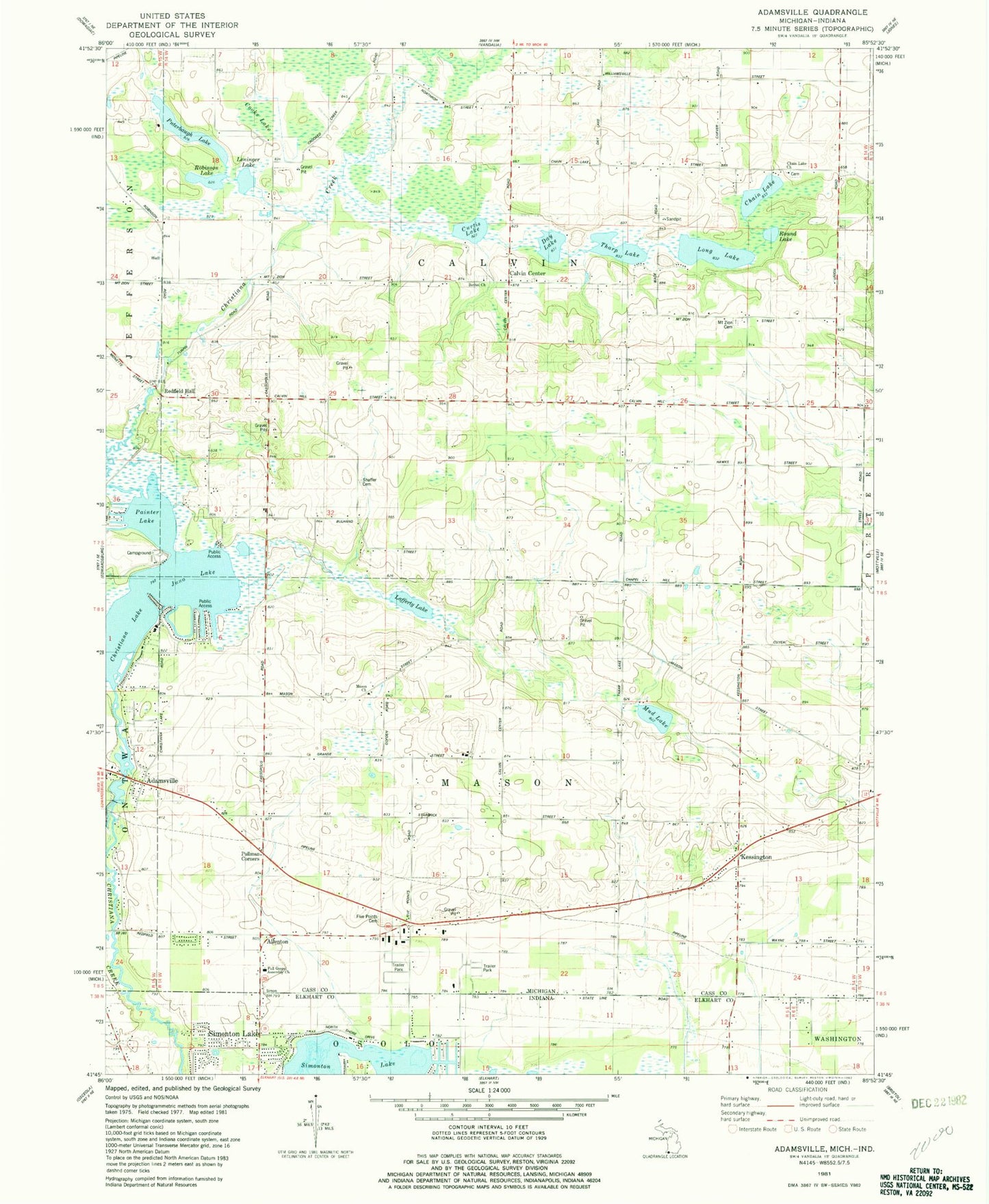
Classic USGS Adamsville Michigan 7.5'x7.5' Topo Map
Couldn't load pickup availability
Historical USGS topographic quad map of Adamsville in the states of Michigan, Indiana. Map scale may vary for some years, but is generally around 1:24,000. Print size is approximately 24" x 27"
This quadrangle is in the following counties: Cass, Elkhart.
The map contains contour lines, roads, rivers, towns, and lakes. Printed on high-quality waterproof paper with UV fade-resistant inks, and shipped rolled.
Contains the following named places: Adamsville, Adamsville Post Office, Allenton, Bethel Cemetery, Bethel Church, Bulhand School, Calvin Center, Calvin Center Cemetery, Calvin Hill School, Calvin Post Office, Calvin Township Hall, Cass District Library-Kessington, Chain Lake, Chain Lake Baptist Church and Cemetery Historical Marker, Chain Lake Cemetery, Chain Lake Church, Christ Tabernacle Church, Christiana Lake, Cooks Lake, Curtis Lake, Day Lake, Day Post Office, District Schoolhouse Historical Marker, Five Points Cemetery, Five Points School, Full Gospel Assembly Church, Gline School, Juno Lake, Kessington, Kessington Cemetery, Lafferty Lake, Leninger Lake, Linden Mobile Home Park, Long Lake, Mason Church, Mount Zion Cemetery, Mount Zion Church, Mud Lake, Painter Lake, Paradise Cemetery, Pullman Corners, Puterbaugh Lake, Red Brick School, Redfield Hall, Robinson Lake, Round Lake, Rustic Acres Mobile Home Park, Sailor Post Office, Shaffer Cemetery, Simmons Mobile Home Park, Simonton Lake, Swamp School, Taylors Flight Park, Tharp Lake, Township of Calvin, Township of Mason, Willow Pond School