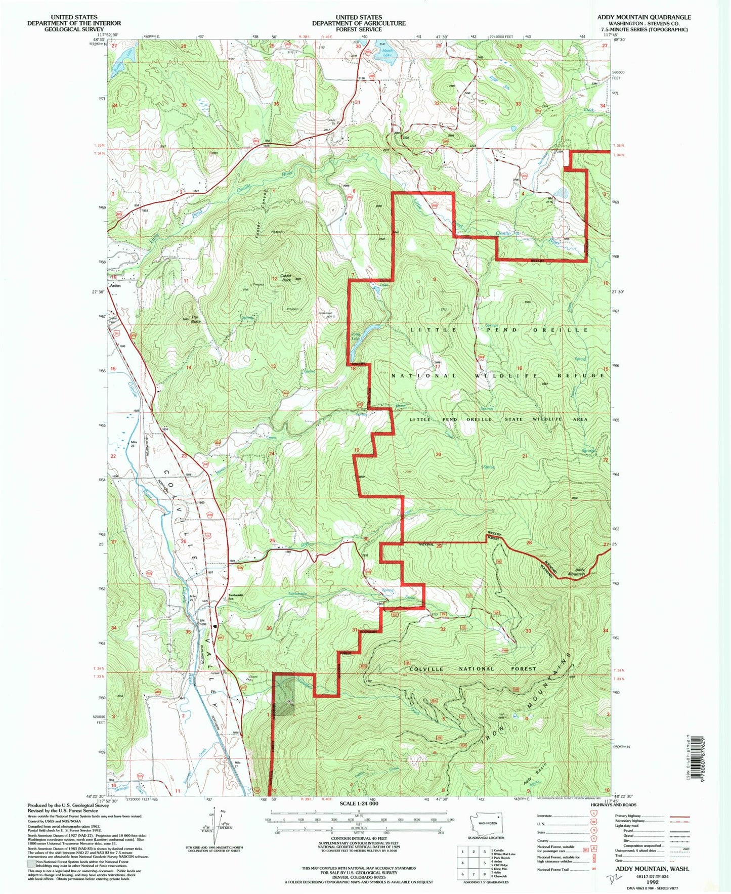
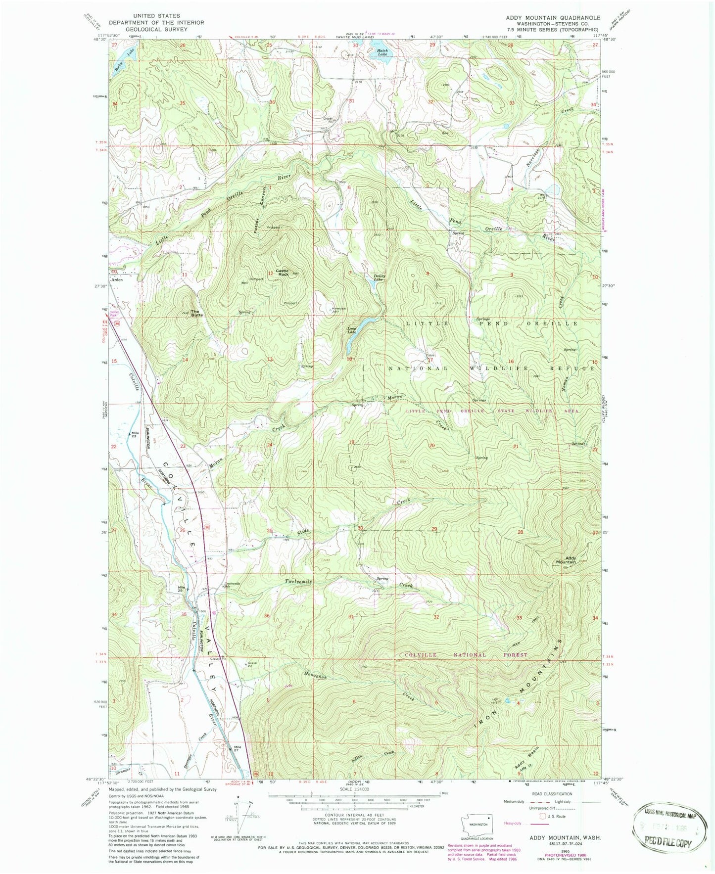
MyTopo
Classic USGS Addy Mountain Washington 7.5'x7.5' Topo Map
Couldn't load pickup availability
Historical USGS topographic quad map of Addy Mountain in the state of Washington. Map scale may vary for some years, but is generally around 1:24,000. Print size is approximately 24" x 27"
This quadrangle is in the following counties: Stevens.
The map contains contour lines, roads, rivers, towns, and lakes. Printed on high-quality waterproof paper with UV fade-resistant inks, and shipped rolled.
Contains the following named places: Addy Basin, Addy Mountain, Castle Rock, Country Villa Mobile Estates, Dailey Lake, Foster Canyon, Hatch Lake, Iron Mountains, Long Lake, Monaghan Creek, Moran Creek, Narcisse, Narcisse Creek, Noman Creek, Rocky Lake, Rocky Lake Recreation Site, Sherwood, Slide Creek, Stevens County, Stevens County Fire District 7 Station 72, Stevens County Fire District 7 Station 73, Stranger Creek, The Butte, Twelvemile Creek, Twelvemile School