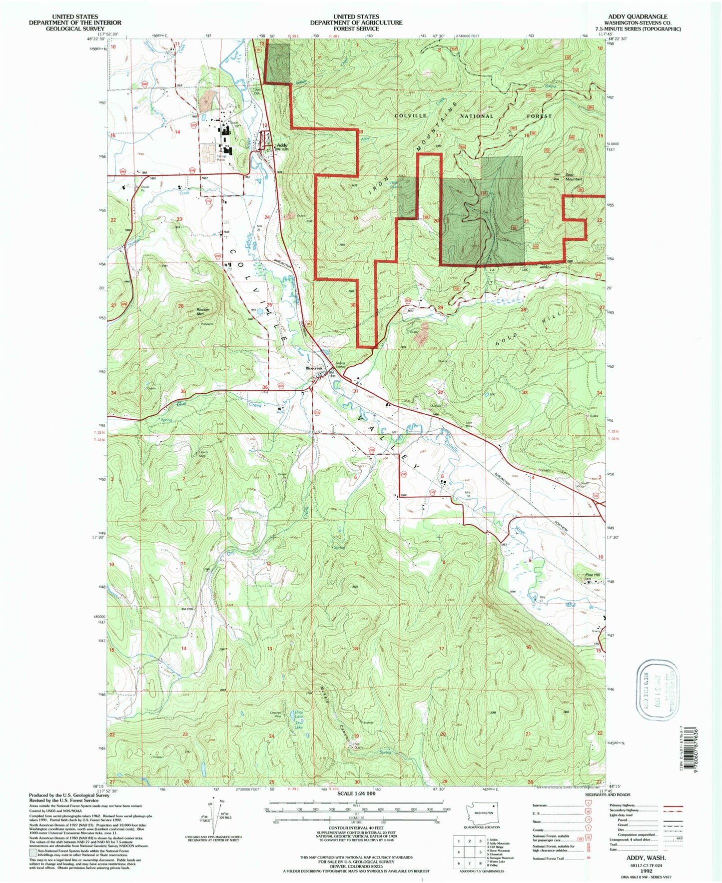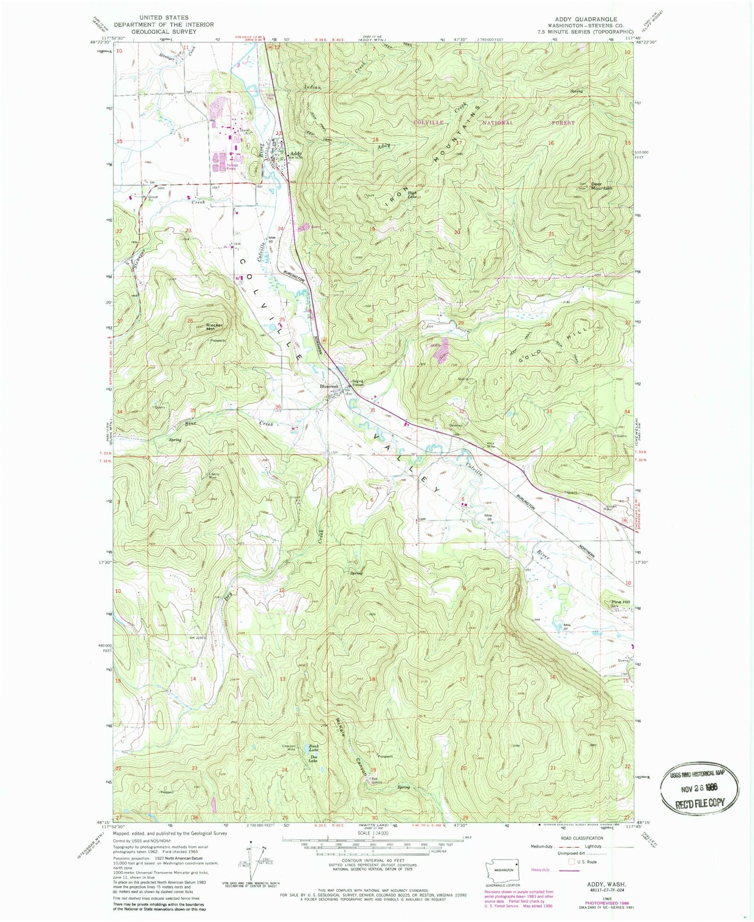
MyTopo
Classic USGS Addy Washington 7.5'x7.5' Topo Map
Couldn't load pickup availability
Historical USGS topographic quad map of Addy in the state of Washington. Map scale may vary for some years, but is generally around 1:24,000. Print size is approximately 24" x 27"
This quadrangle is in the following counties: Stevens.
The map contains contour lines, roads, rivers, towns, and lakes. Printed on high-quality waterproof paper with UV fade-resistant inks, and shipped rolled.
Contains the following named places: Addy, Addy Census Designated Place, Addy Creek, Addy Dolomite Quarry, Addy New Life Christian Center, Addy Pit, Addy Post Office, Addy Sewage Lagoon, Alice Mine, Black Rock Quarry, Blue Creek, Blue Creek Station, Bluecreek, Bluecreek Airport, Buck Lake, Checops Mine, Chewelah Golf and Country Club, Country Hills Mobile Home Park, Deer Mountain, Doe Lake, Dry Creek, Gold Hill, High Lake, Indian Creek, Liberty Mine, McKale Canyon, Pine Hill, Red Quarry, Riecker Mountain, Stensgar Creek, Stevens County Fire District 5 Station 51 Addy, The Church of Jesus Christ of Latter Day Saints