MyTopo
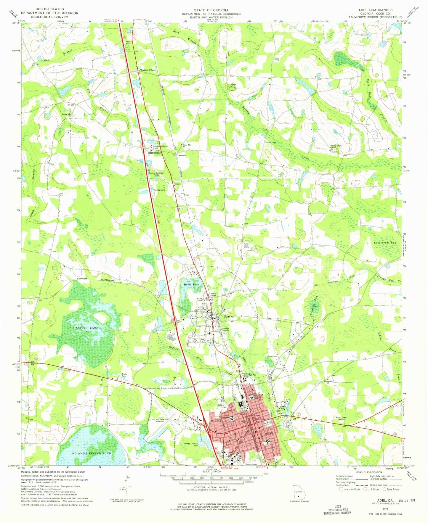
Classic USGS Adel Georgia 7.5'x7.5' Topo Map
Couldn't load pickup availability
Historical USGS topographic quad map of Adel in the state of Georgia. Map scale may vary for some years, but is generally around 1:24,000. Print size is approximately 24" x 27"
This quadrangle is in the following counties: Cook.
The map contains contour lines, roads, rivers, towns, and lakes. Printed on high-quality waterproof paper with UV fade-resistant inks, and shipped rolled.
Contains the following named places: Adel, Adel Assembly of God Church, Adel Church of God, Adel City Hall, Adel Elementary School, Adel Fire Department Station 1, Adel Fire Department Station 2, Adel Methodist Church, Adel Police Department, Adel Presbyterian Church, Adel Primitive Baptist Church, Baker Cemetery, Barneyville, Berrien, Bethel Missionary Baptist Church, Brushy Creek Church, Brushy Creek School, City of Adel, Concord Primitive Baptist Church, Cook County, Cook County Airport, Cook County Courthouse, Cook County Jail, Cook County Library, Cook County Sheriff's Office, Cook High School, Cook Medical Center, Cook Middle School, Crossroads Bay, First Baptist Church, First Church of the Nazarene, Giddens Mill Creek, Giddens Pond, Halls Pond, Laconte, Macedonia Church, New Hope Church, Rock Branch, Rose Hill Church, Salem Primitive Baptist Church, Sparks, Sparks Baptist Church, Sparks Collegiate Institute, Sparks Elementary School, Sparks Police Department, Sparks Post Office, Sparks Volunteer Fire Department, Spring Hill Church, Spring Hill School, Sumner Lake, Sumner Lake Dam, Thornhill Bay, Town of Sparks, Wagon Wheel, WBIT-AM (Adel), WDDQ-FM (Adel), West Side Baptist Church, Woodlawn Cemetery, ZIP Code: 31647