MyTopo
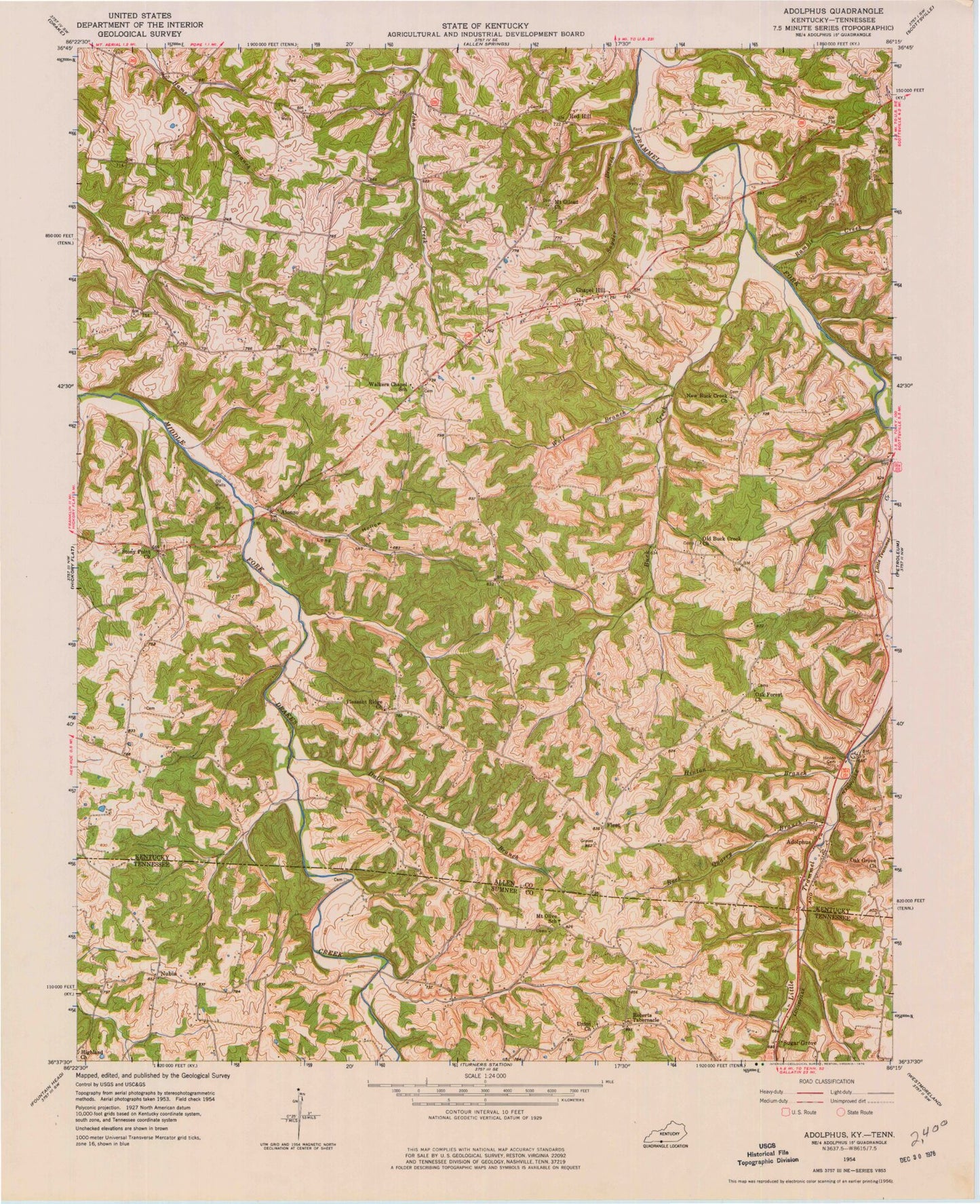
Classic USGS Adolphus Kentucky 7.5'x7.5' Topo Map
Couldn't load pickup availability
Historical USGS topographic quad map of Adolphus in the states of Kentucky, Tennessee. Map scale may vary for some years, but is generally around 1:24,000. Print size is approximately 24" x 27"
This quadrangle is in the following counties: Allen, Sumner.
The map contains contour lines, roads, rivers, towns, and lakes. Printed on high-quality waterproof paper with UV fade-resistant inks, and shipped rolled.
Contains the following named places: Adolphus, Adolphus Division, Adolphus Post Office, Alonzo, Buck Creek, Chapel Hill, Dutch Branch, Fleet, Highland Church, Hinton Branch, Hinton Cemetery, Long Hollow, Mount Gilead Church, Mount Olive Cemetery, Mount Olive School, Mount Olive United Methodist Church, New Buck Creek Methodist Church, Nubia, Oak Forest Cemetery Number 1, Oak Forest Number 1 Missionary Baptist Church, Oak Grove Baptist Church, Old Buck Creek Church, Pleasant Ridge Church, Ramble Creek, Red Hill, Roberts Tabernacle, Roberts Tabernacle Cemetery, Rock Quarry Branch, Snyder Branch, South Allen Fire Department Station 2, Stoney Point United Methodist Church, Stony Point Volunteer Fire Department, Sugar Grove, Sugar Grove Airport, Union Chapel Cemetery, Union Church, Walkers Chapel School, Wolf Branch, ZIP Code: 42120