MyTopo
Classic USGS Adrian Georgia 7.5'x7.5' Topo Map
Couldn't load pickup availability
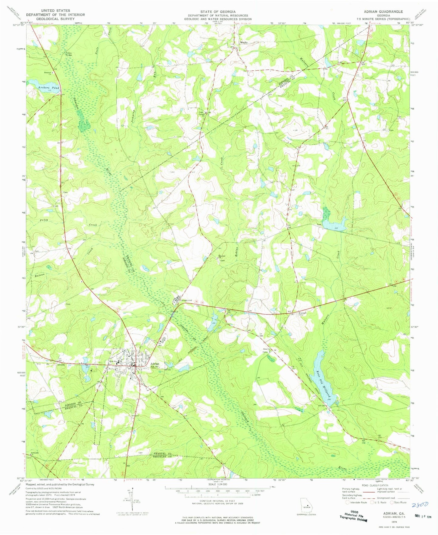
Historical USGS topographic quad map of Adrian in the state of Georgia. Map scale may vary for some years, but is generally around 1:24,000. Print size is approximately 24" x 27"
This quadrangle is in the following counties: Emanuel, Johnson, Treutlen.
The map contains contour lines, roads, rivers, towns, and lakes. Printed on high-quality waterproof paper with UV fade-resistant inks, and shipped rolled.
Contains the following named places: Adrian, Adrian Division, Adrian Elementary School, Adrian Housing Pond, Adrian Housing Pond Dam, Adrian Police Department, Adrian Post Office, Adrian Rural Fire Department, Archers Pond, Archers Pond Dam, Aurin Memorial Cemetery, Batson Creek, Bethsaida Church, Braswell Cemetery, Brazwell Pond, Brazwell Pond Dam, City of Adrian, Corinth Church, Drake Cemetery, Emanuel Cemetery, Emanuel Church, Emanuel County Volunteer Fire Department Adrian Station, Faith Tabernacle Church, Foskey Cemetery, Foskey Turf Farm, General Land Corporation Lake, General Land Corporation Lake Dam, Jumping Run, Keas Church, Keas Old Millpond, Keas Old Millpond Dam, Meeks, Meeks Volunteer Fire Department, Mulepen Creek, Neels Creek, Poley Creek, Pullen Bridge, Robins Creek, Trinity Church, ZIP Code: 31002