MyTopo
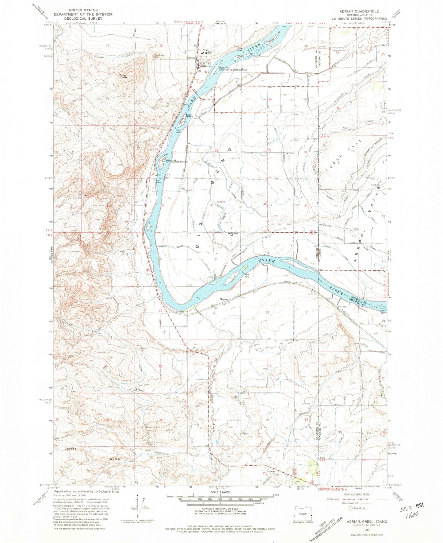
Classic USGS Adrian Oregon 7.5'x7.5' Topo Map
Couldn't load pickup availability
Historical USGS topographic quad map of Adrian in the states of Oregon, Idaho. Map scale may vary for some years, but is generally around 1:24,000. Print size is approximately 24" x 27"
This quadrangle is in the following counties: Canyon, Malheur, Owyhee.
The map contains contour lines, roads, rivers, towns, and lakes. Printed on high-quality waterproof paper with UV fade-resistant inks, and shipped rolled.
Contains the following named places: Adrian, Adrian Boat Launch, Adrian Division, Adrian Elementary School, Adrian Fire Department, Adrian High School, Adrian Post Office, Alkali Creek, Allen Drain, Arena Case Drain, Arena Valley, Big Bend, Big Bend Park, Big Bend School, Brown Butte, Bullock Drain, Central Alkali Drain, Chance Lateral, City of Adrian, Coyote Gulch, Coyote Gulch Siphon, Deer Flat, Five and Seventenths Canal, Gibson Drain, Golden Gate Canal, Graham Lateral, Hettinger Island, Holly Drain, Imbler Drain, Johanson Drain, Magoffin, Napton, North Alkali Creek, North Oakander Drain, Oakander Drain, Red Drain, Riverside Canal, Rowell Marsh Wildlife Habitat Area, Singer Drain, South Alkali Drain, South Canal, Stradley Drain, Suzy Island, Tunnel Number 6, Walker Drain, Welch Drain