MyTopo
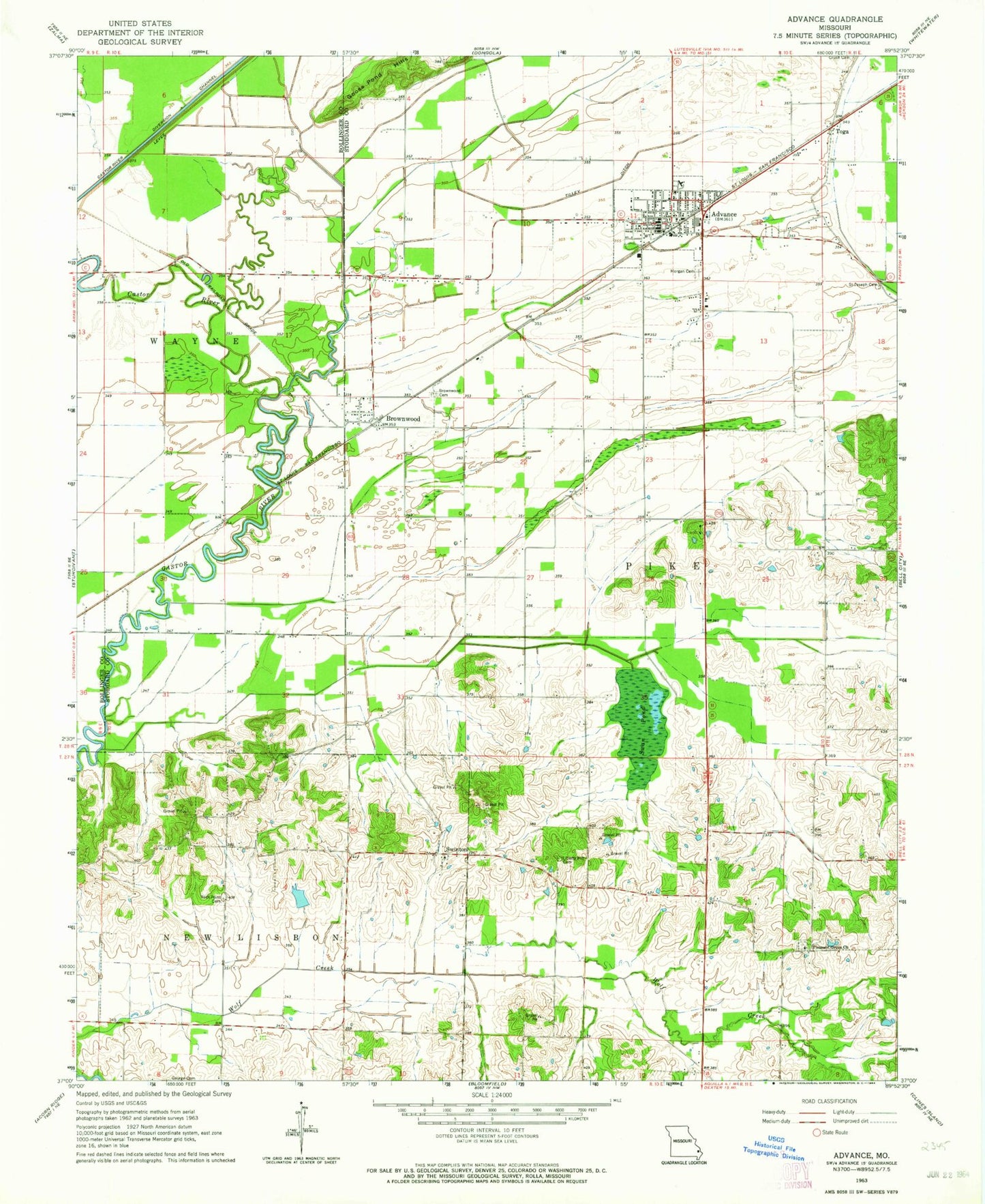
Classic USGS Advance Missouri 7.5'x7.5' Topo Map
Couldn't load pickup availability
Historical USGS topographic quad map of Advance in the state of Missouri. Map scale may vary for some years, but is generally around 1:24,000. Print size is approximately 24" x 27"
This quadrangle is in the following counties: Bollinger, Stoddard.
The map contains contour lines, roads, rivers, towns, and lakes. Printed on high-quality waterproof paper with UV fade-resistant inks, and shipped rolled.
Contains the following named places: Advance, Advance Fire Department, Advance Police Department, Advance Post Office, Bluff, Brownwood, Brownwood Cemetery, Brownwood Post Office, Castor, City of Advance, Horseshoe Lake, Johnsons Lake, Johnsons Lake Dam, Liberty Hill Cemetery, Liberty Hill School, Little Rock School, Little Vine School, Morgan Memorial Park Cemetery, Pleasant Grove Church, Rendleman Lake Dam, Rock Point Cemetery, Rock Point School, Saint Joseph Cemetery, Swan Pond, Swan Pond School, Swinton, Tilley Ditch, Toga, Wolf Creek, Woodlawn School, ZIP Codes: 63730, 63738