MyTopo
Classic USGS Advent Gulch Idaho 7.5'x7.5' Topo Map
Regular price
$16.95
Regular price
Sale price
$16.95
Unit price
per
Couldn't load pickup availability
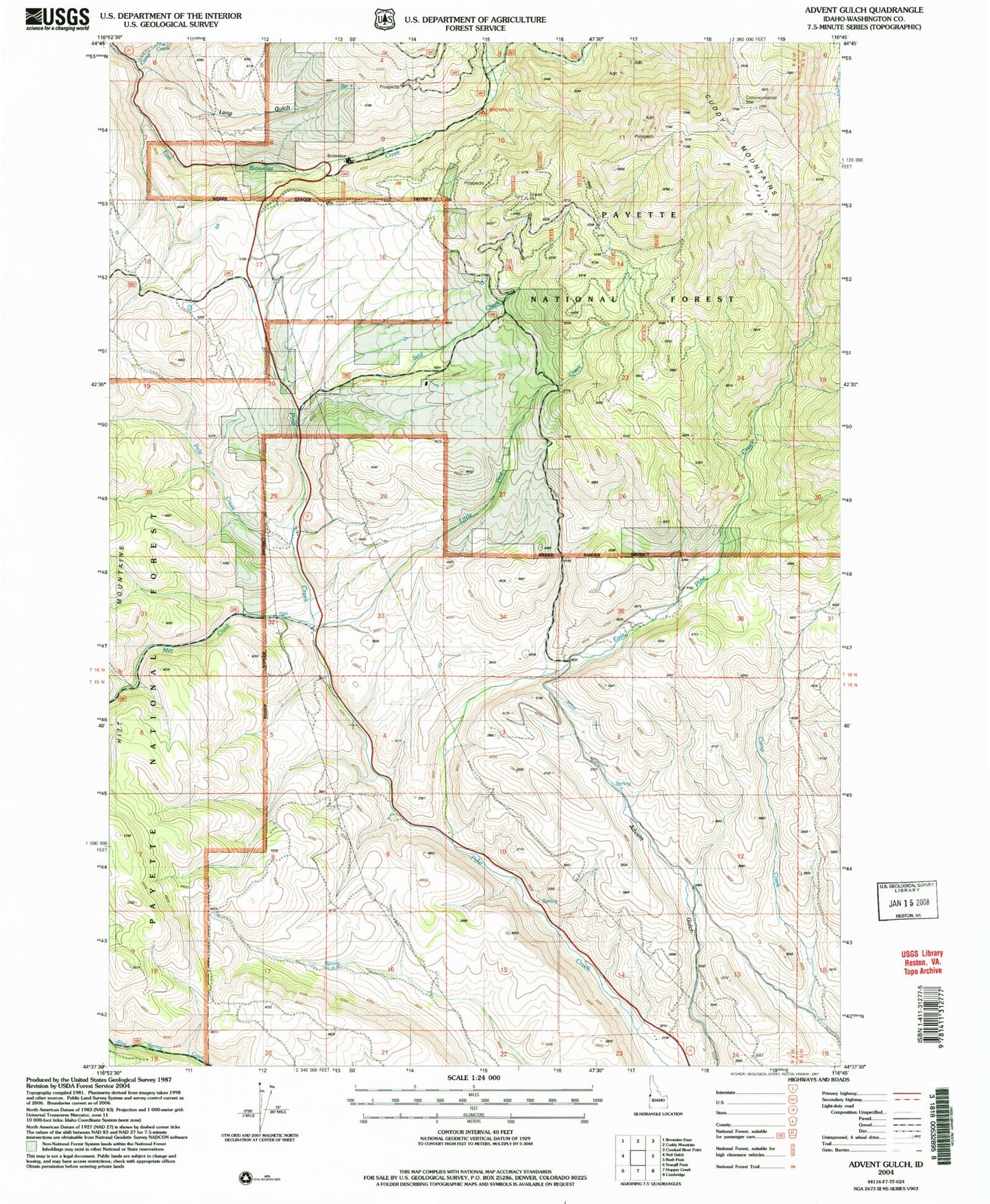
Historical USGS topographic quad map of Advent Gulch in the state of Idaho. Map scale may vary for some years, but is generally around 1:24,000. Print size is approximately 24" x 27"
This quadrangle is in the following counties: Washington.
The map contains contour lines, roads, rivers, towns, and lakes. Printed on high-quality waterproof paper with UV fade-resistant inks, and shipped rolled.
Contains the following named places: Brownlee Ranger Station, Cambridge Division, Camp Creek, Cuddy Meadows Airport, East Pine Creek, Mill Creek, Repeater Station, ZIP Code: 83610