

MyTopo
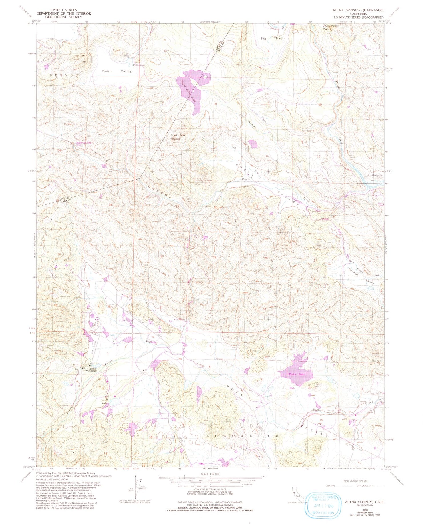
Classic USGS Aetna Springs California 7.5'x7.5' Topo Map
Couldn't load pickup availability
Historical USGS topographic quad map of Aetna Springs in the state of California. Map scale may vary for some years, but is generally around 1:24,000. Print size is approximately 24" x 27"
This quadrangle is in the following counties: Lake, Napa.
The map contains contour lines, roads, rivers, towns, and lakes. Printed on high-quality waterproof paper with UV fade-resistant inks, and shipped rolled.
Contains the following named places: Aetna Mine, Aetna Springs, Aetna Springs Golf Course, Aetna Springs Post Office, Big Basin, Black Oak Villa, Blanchard-Offner 2416 Dam, Bohn Valley, Burns 1419 Dam, Butts Canyon, Butts Creek, Davis 1416 Dam, Deer Creek 3414 Dam, Devils Head Peak, Dick Week 418 Dam, Duvall 414 Dam, Duvall Lake, Goat Hill, James Creek, Lower Bohn Lake, Routan Creek, Snell Creek, Snell Peak, Snell Valley, Spanish Valley, Swartz Canyon, Swartz Creek, Upper Bohn 3410 Dam, Upper Bohn Lake, Weeks Lake, White Rock Mine, ZIP Code: 94567


