MyTopo
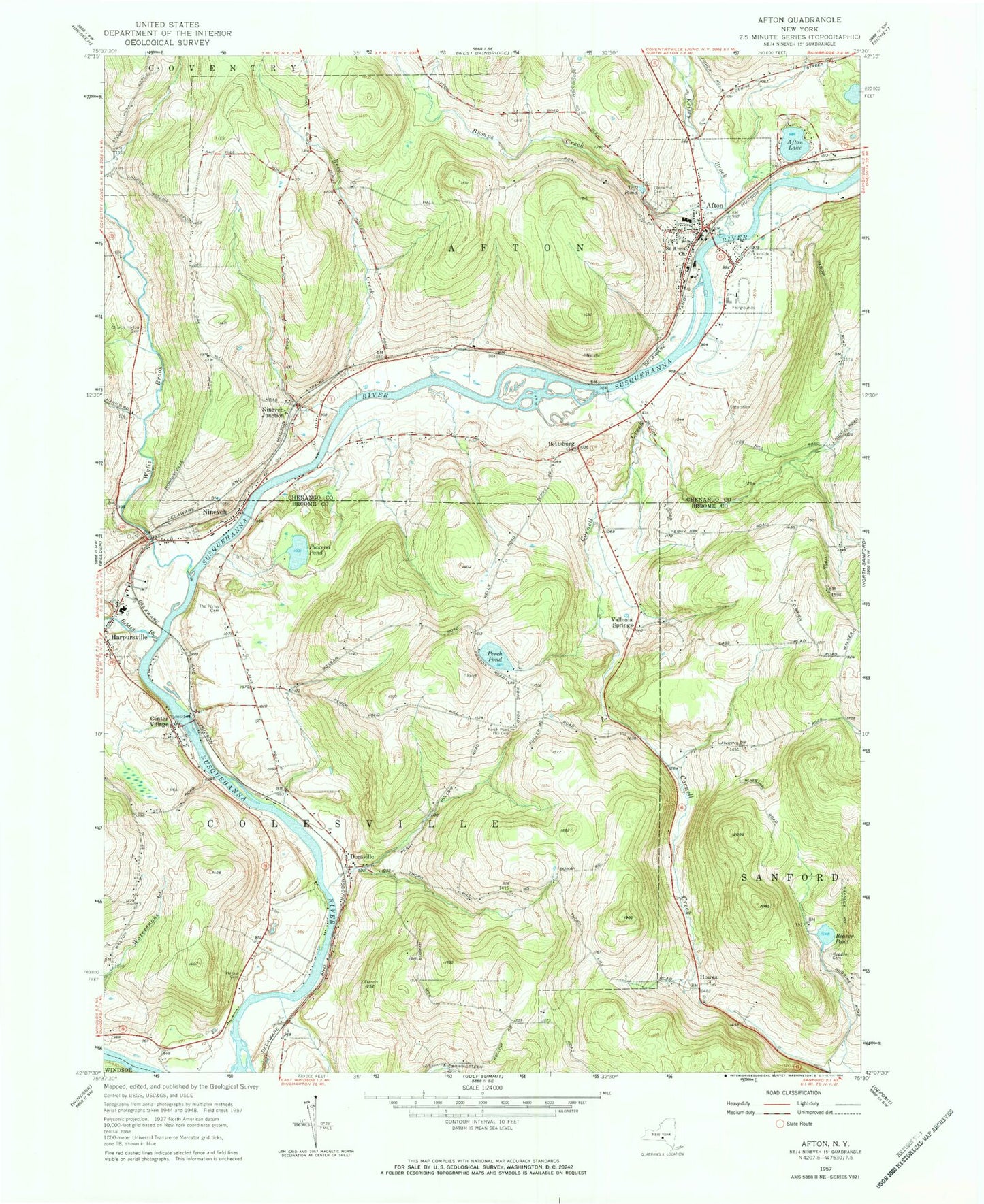
Classic USGS Afton New York 7.5'x7.5' Topo Map
Couldn't load pickup availability
Historical USGS topographic quad map of Afton in the state of New York. Map scale may vary for some years, but is generally around 1:24,000. Print size is approximately 24" x 27"
This quadrangle is in the following counties: Broome, Chenango.
The map contains contour lines, roads, rivers, towns, and lakes. Printed on high-quality waterproof paper with UV fade-resistant inks, and shipped rolled.
Contains the following named places: Afton, Afton Elementary School, Afton Fire Department, Afton Free Library, Afton Golf Club, Afton Lake, Afton Middle - High School, Afton Post Office, Afton Presbyterian Church, Afton United Methodist Church, Beaver Pond, Belden Brook, Bettsburg, Bumps Creek, Center Village, Cornell Creek, Doraville, Eastside Cemetery, First Baptist Church, First Baptist Church Cemetery, Glenwood Cemetery, Harpur Cemetery, Harpursville, Harpursville Fire Department Station 1, Harpursville Junior - Senior High School, Higher Ground Christian Church, Hope Congregational Church, Howes, Huggins Cemetery, Kellystone Park, Kelsey Creek, Nineveh, Nineveh Junction, Nineveh Plains Cemetery, Nineveh Post Office, Nineveh Presbyterian Cemetery, Nineveh Presbyterian Church, Nineveh Public Library of Colesville Township, Perch Pond, Perch Pond Cemetery, Pickerel Pond, Reed Creek, Reed Guy Cemetery, Riverview Cemetery, Saint Agnes Catholic Church, Saint Anns Episcopal Church, Stevens Cemetery, Taft Pond, Three Pines Community Church, Town of Afton, Vallonia Springs, Village of Afton, W A Olmsted Elementary School, Wylie Brook, ZIP Codes: 13730, 13813