MyTopo
Classic USGS Agat Guam 7.5'x7.5' Topo Map
Couldn't load pickup availability
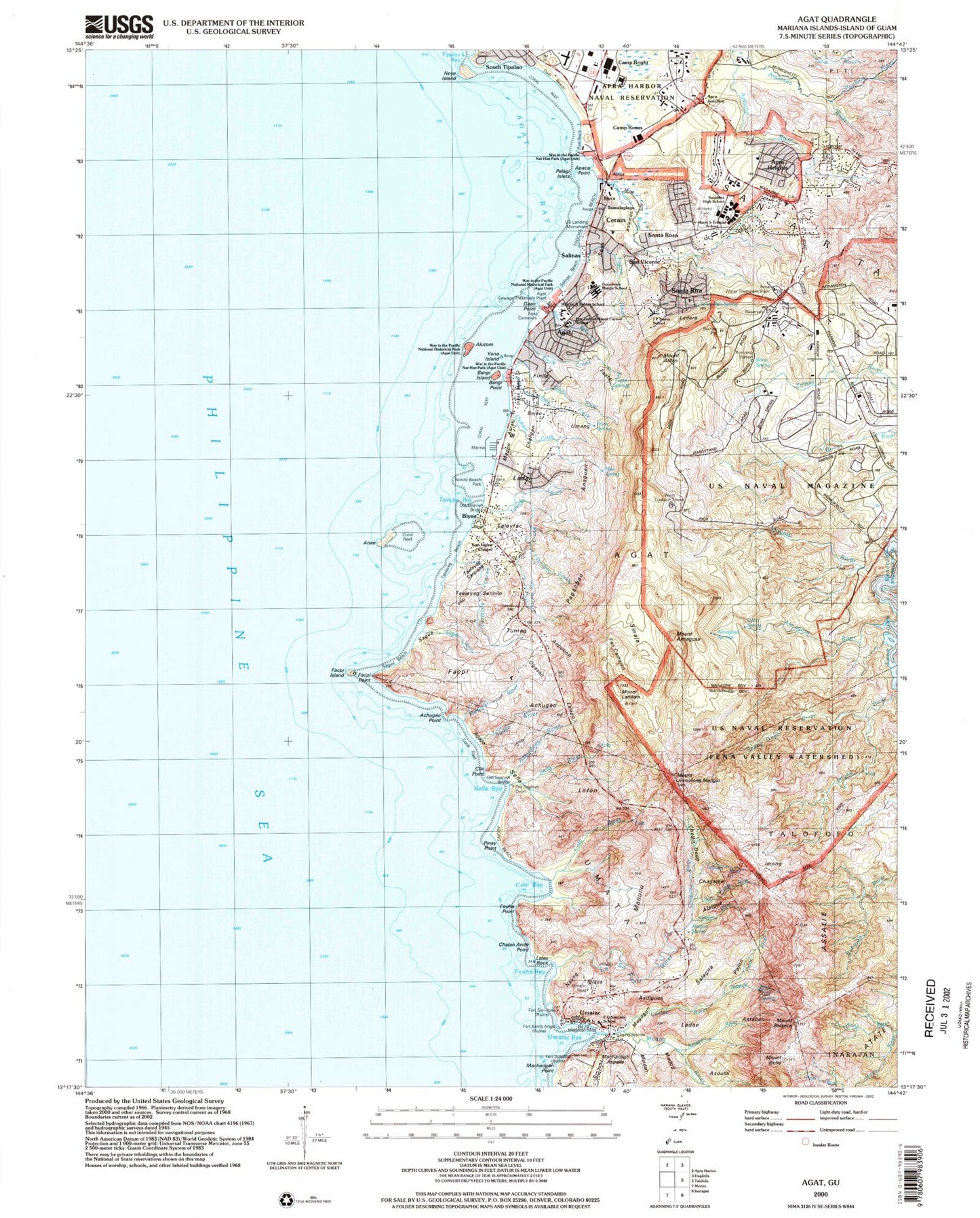
Historical USGS topographic quad map of Agat in the state of Guam. Map scale may vary for some years, but is generally around 1:24,000. Print size is approximately 24" x 27"
This quadrangle is in the following counties: Guam.
The map contains contour lines, roads, rivers, towns, and lakes. Printed on high-quality waterproof paper with UV fade-resistant inks, and shipped rolled.
Contains the following named places: Abong Beach, Achugao Point, Achugao Valley, Agaga, Agaga River, Agat, Agat Ballpark, Agat Bay, Agat Cemetery, Agat Census Designated Place, Agat Election District, Agat Elementary School, Agat Public Library, Agat Sewage Treatment Plant, Agat Small Boat Harbor, Agat Unit War In the Pacific National Historical Park, Alatgue, Alatgue River, Alatgue Spring, Alifan Spring Reservoir, Almagosa River, Almagosa Springs, Alutom, Anae, Anaguan, Apaca Point, Aplacho River, Apra Heights, Apra Heights Reservoir, Apra Junction, Ascola Sito Creek, Asdigues, Aslemon, Asmafines River, Asnaki, Aspution, Assalie, Astaban, Astaban River, Atate, Auau Creek, Auau Spring, Ayuja, Bangi Island, Bangi Point, Bejao, Biyae, Bolanos Conservation Reserve, Bolanos River, Bona, Bona Spring, Camp Bright, Camp Roxas, Cerain, Cetti Bay, Cetti Falls, Cetti River, Chagame, Chagame River, Chalan Anite Point, Chalan Aniti, Chalan Daog, Chaligan, Chaligan Creek, Chandija, Chii Point, Chioreto River, Church of San Dionisio, Dadi Beach, Dobo Spring, Faata, Faata Springs, Facpi, Facpi Bay, Facpi Island, Facpi Point, Fan Camajan, Fena Water Treatment Plant, Finile, Finile Creek, Fort San Jose, Fort Santo Angel, Fort Soledad, Fouha Bay, Fouha Point, Francisco Q Sanchez School, Gaan Point, Gaan River, Guam Ordnance Annex, Gumagao, Haps Reef, Harry S Truman Elementary School, Hill 40, Ieygo River, Ilicho River, Imong, Imong River, Inaso Maso, Iplaza, J P Torres Elementary School, Joe Guzman Ball Park, Jumullong Manglo, La Sa Fua River, Ladae, Ladai, Ladera, Laelae, Laelae River, Laguan River, Laguet, Lalapo, Lalas Rock, Lehga River, Lengga, Lofon, Maanot Pass, Machadgan Point, Machanage Aspaile, Madofan River, Madog River, Magellan Monument, Magpo, Magpo Point, Magugun, Managam, Manunu, Mao Spring, Marianas Baptist Church, Matdan, Maulap River, Mount Alifan, Mount Alifan Unit War In the Pacific National Historical Park, Mount Almagosa, Mount Bolanos, Mount Carmel School, Mount Ilicho, Mount Lamlam, Mount Taene, Namo River, Neye Island, Nimitz Beach Park, Oceanview Middle School, Ogasan, Old Agat Cemetery, Old Spanish Bridge, Old Spanish Oven, Ordnance Annex Guam, Our Lady of Guadalupe Church, Our Lady of Mount Carmel Catholic Church, Pagachao, Pagachao Creek, Pajon River, Paulana River, Pelagi Islets, Petes Reef, Philippine Sea, Piga Spring, Pinay Point, Point Manban, Rizal Beach, Sabo River, Sadog Gago River, Sagua, Sagua Beach, Sagua River, Salagna, Salinas, Salinas Beach, Salinas River, San Isidro Chapel, San Nicolas River, San Vicente, Santa Rita, Santa Rita Census Designated Place, Santa Rita Election District, Santa Rita Spring, Santa Rosa, Santa Rosa Census Designated Place, Sella, Sella Bay, Sella River, Sesa, Sinaje, South Tipalao, Southern High School, Taccalom, Taelayag Beach, Taelayag Creek, Taelayag Sanhilo, Taelayag Sanpapa, Taleyfac, Taleyfac Bay, Taleyfac River, Tantapalo Point, Tatatmon, Tijera, Tipalao Beach, Togcha Beach, Togcha River, Tumag, Tumalaglago, Umang, Umatac, Umatac Ballpark, Umatac Bay, Umatac Bay Park, Umatac Bridge, Umatac Cemetery, Umatac Census Designated Place, Umatac Election District, Umatac River, United States Landing Monument, War in the Pacific National Historical Park, West Lookout Tower, White Beach One, White Beach Two, Yellow Beach One, Yellow Beach Two, Yona Island, ZIP Code: 96928


