MyTopo
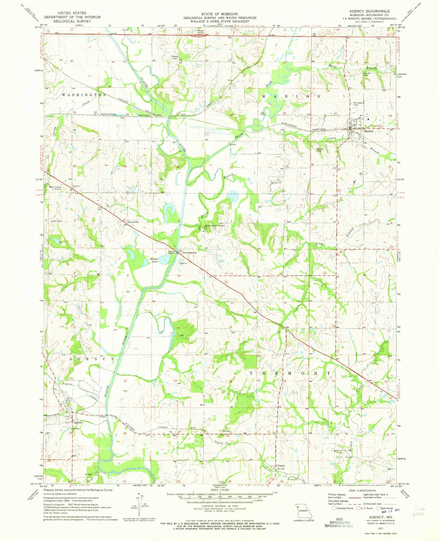
Classic USGS Agency Missouri 7.5'x7.5' Topo Map
Couldn't load pickup availability
Historical USGS topographic quad map of Agency in the state of Missouri. Map scale may vary for some years, but is generally around 1:24,000. Print size is approximately 24" x 27"
This quadrangle is in the following counties: Buchanan.
The map contains contour lines, roads, rivers, towns, and lakes. Printed on high-quality waterproof paper with UV fade-resistant inks, and shipped rolled.
Contains the following named places: Agency, Agency Post Office, Becks Branch, Blakely Cemetery, Camp Marvin Hillyard, Candy Creek, City of Easton, East Buchanan Middle School, Easton, Easton Fire Protection District, Easton Post Office, Ebenezer Church, Ebenezer School, Ehlert Lake, Ehlert Lake Dam, Evansville, Fairview School, Frazer School, Frazier, Garrettsburg, Gibson School, Greener School, Holmes School, James Branch, Karns Cemetery, KKJO-AM (St Joseph), KTAJ-TV (St Joseph), Malden School, Midway Church, Millers Lake, Moore School, Mount Moriah Cemetery, Mount Moriah Church, Moxley Cemetery, Oakland School, One Hundred and Two River, Pigeon Creek, Platte River, Possum Hollow, Riley Branch, Rock Creek, Rockhouse School, Saint Joseph Cemetery Old, Saint Josephs Cemetery, Stamper School, Third Fork, Thompson Lake, Township of Agency, Township of Tremont, Village of Agency, Woodbury Lake, Woodbury Lake Dam, ZIP Codes: 64401, 64443