MyTopo
Classic USGS Agua Adentro Mountain Texas 7.5'x7.5' Topo Map
Regular price
$16.95
Regular price
Sale price
$16.95
Unit price
per
Couldn't load pickup availability
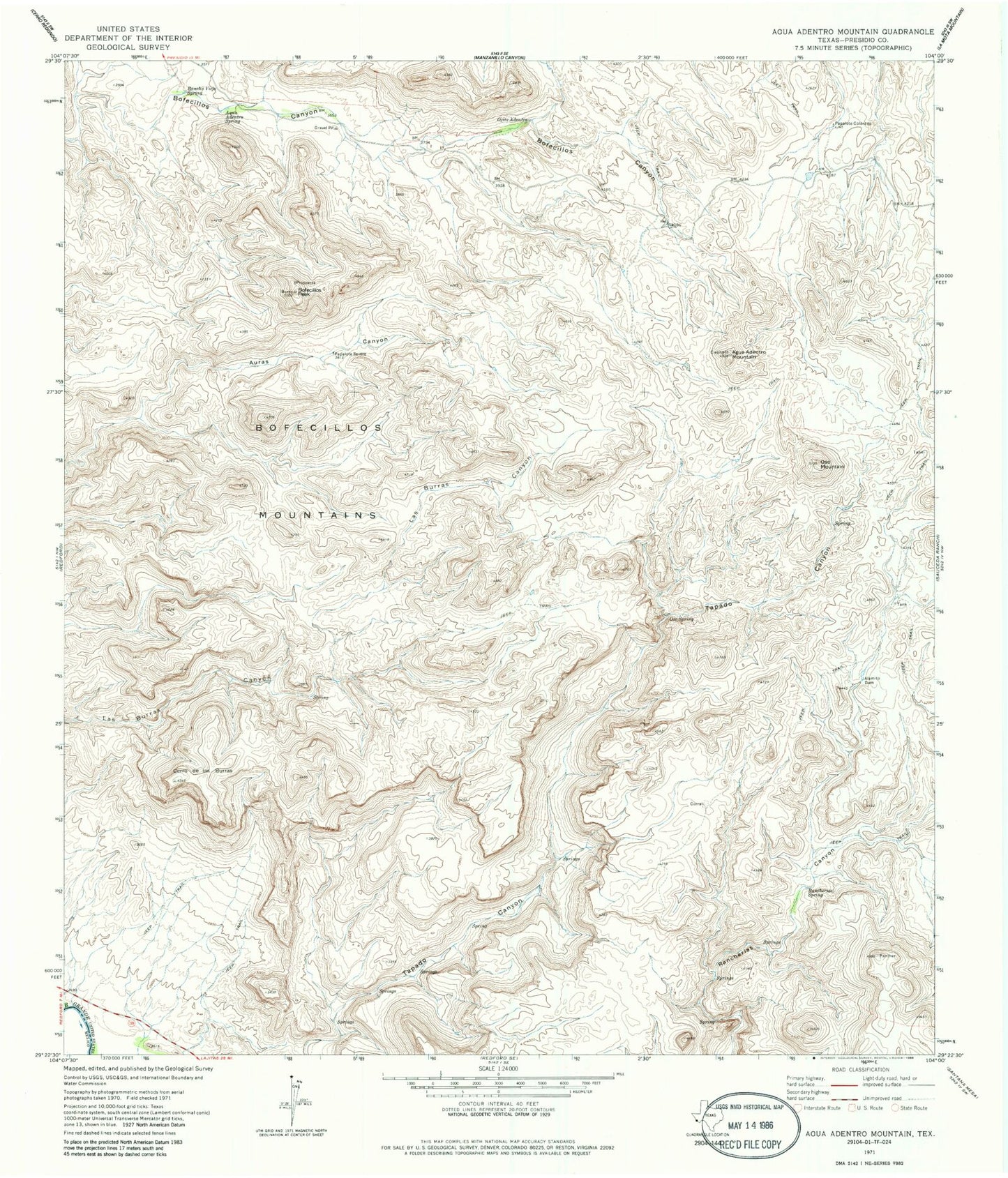
Historical USGS topographic quad map of Agua Adentro Mountain in the state of Texas. Typical map scale is 1:24,000, but may vary for certain years, if available. Print size: 24" x 27"
This quadrangle is in the following counties: Presidio.
The map contains contour lines, roads, rivers, towns, and lakes. Printed on high-quality waterproof paper with UV fade-resistant inks, and shipped rolled.
Contains the following named places: Agua Adentro Mountain, Alamito Dam, Aqua Adentro Spring, Bofecillos Mountains, Bofecillos Peak, Cerro de las Burras, Ojito Adentro, Oso Mountain, Oso Spring, Papalote Severo, Rancherias Spring, Rancho Viejo Spring, Papalote Colorado