MyTopo
Classic USGS Agua Nueva SE Texas 7.5'x7.5' Topo Map
Regular price
$16.95
Regular price
Sale price
$16.95
Unit price
per
Couldn't load pickup availability
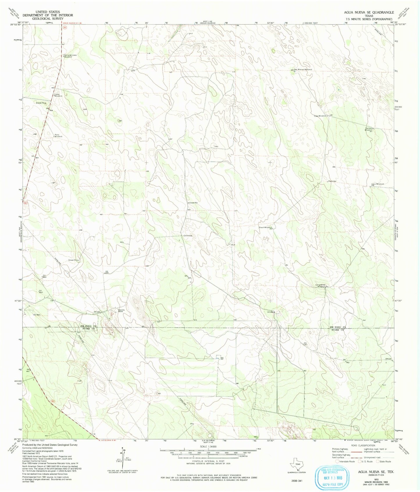
Historical USGS topographic quad map of Agua Nueva SE in the state of Texas. Map scale may vary for some years, but is generally around 1:24,000. Print size is approximately 24" x 27"
This quadrangle is in the following counties: Jim Hogg, Starr.
The map contains contour lines, roads, rivers, towns, and lakes. Printed on high-quality waterproof paper with UV fade-resistant inks, and shipped rolled.
Contains the following named places: Brazil Windmill, Cantera Windmill, Copa Windmill, La Libertad Ranch, Las Comitas Ranch, Lavor Windmill, Lenarderos Windmill, Loma Windmill, Mancia Ranch, Noria de Llano Windmill, Plato Windmill, Ramirito Ranch, San Manuel Windmill, Sanbenito Ranch