MyTopo
USGS Classic Ahern Pass Montana 7.5'x7.5' Topo Map
Couldn't load pickup availability
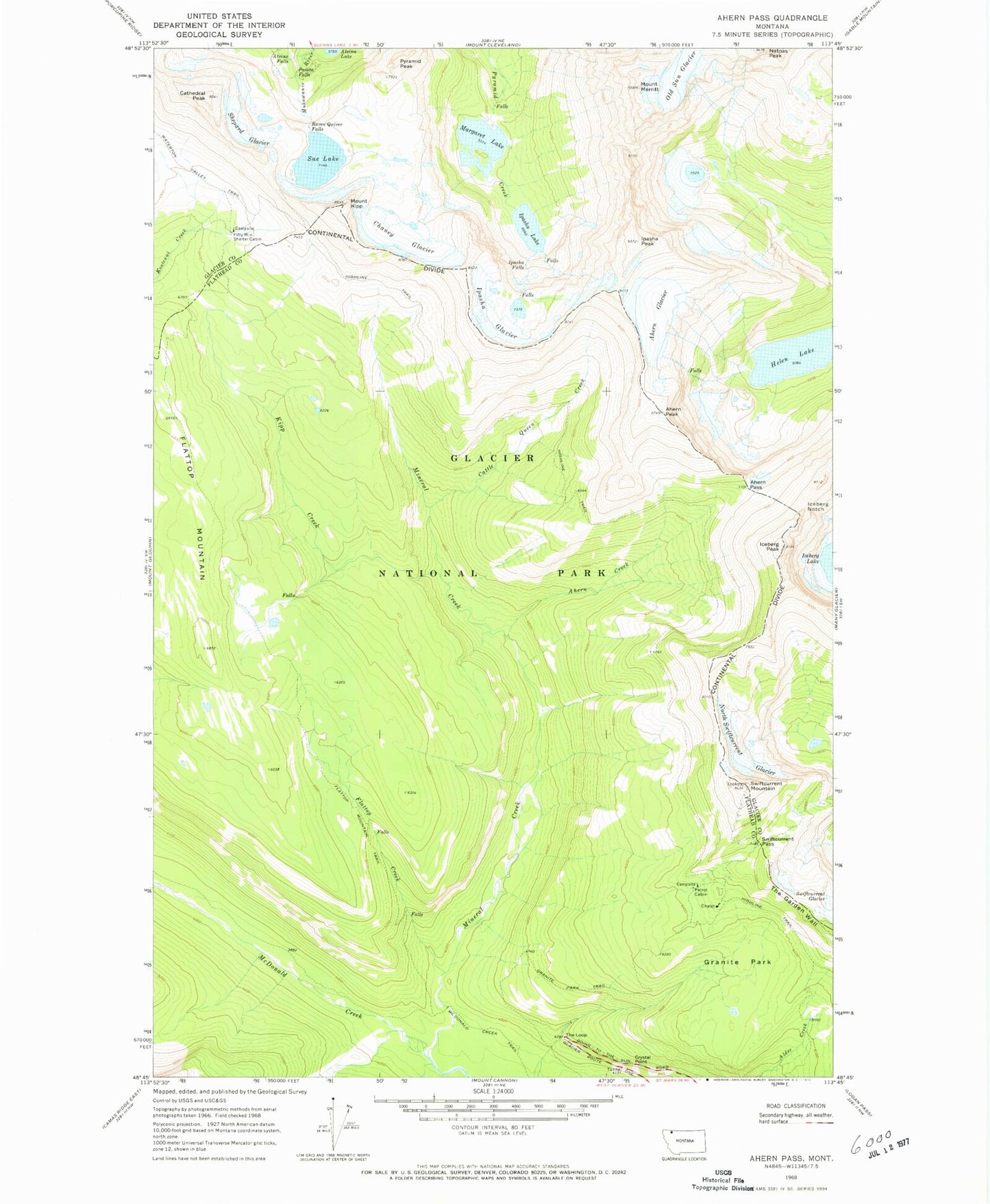
Historical USGS topographic quad map of Ahern Pass in the state of Montana. Scale: 1:24000. Print size: 24" x 27"
This quadrangle is in the following counties: Flathead, Glacier.
The map contains contour lines, roads, rivers, towns, lakes, and grids including latitude / longitude and UTM / MGRS. Printed on high-quality waterproof paper with UV fade-resistant inks.
Contains the following named places: Ahern Creek, Ahern Glacier, Ahern Pass, Ahern Peak, Atsina Falls, Cathedral Peak, Cattle Queen Creek, Chaney Glacier, Fifty Mountain Shelter Cabin, Flattop Creek, Flattop Mountain, Flattop Mountain Trail, Granite Park, Granite Park Trail, Helen Lake, Highline Trail, Iceberg Notch, Iceberg Peak, Ipasha Falls, Ipasha Glacier, Ipasha Lake, Ipasha Peak, Kipp Creek, Mount Kipp, Margaret Lake, McDonald Creek Trail, Mount Merritt, Mineral Creek, Natoas Peak, North Swiftcurrent Glacier, Old Sun Glacier, Paiota Falls, Raven Quiver Falls, Shepard Glacier, Sue Lake, Swiftcurrent Mountain, Swiftcurrent Pass, The Loop, Crystal Point, Pyramid Peak