MyTopo
Classic USGS Aimwell Louisiana 7.5'x7.5' Topo Map
Couldn't load pickup availability
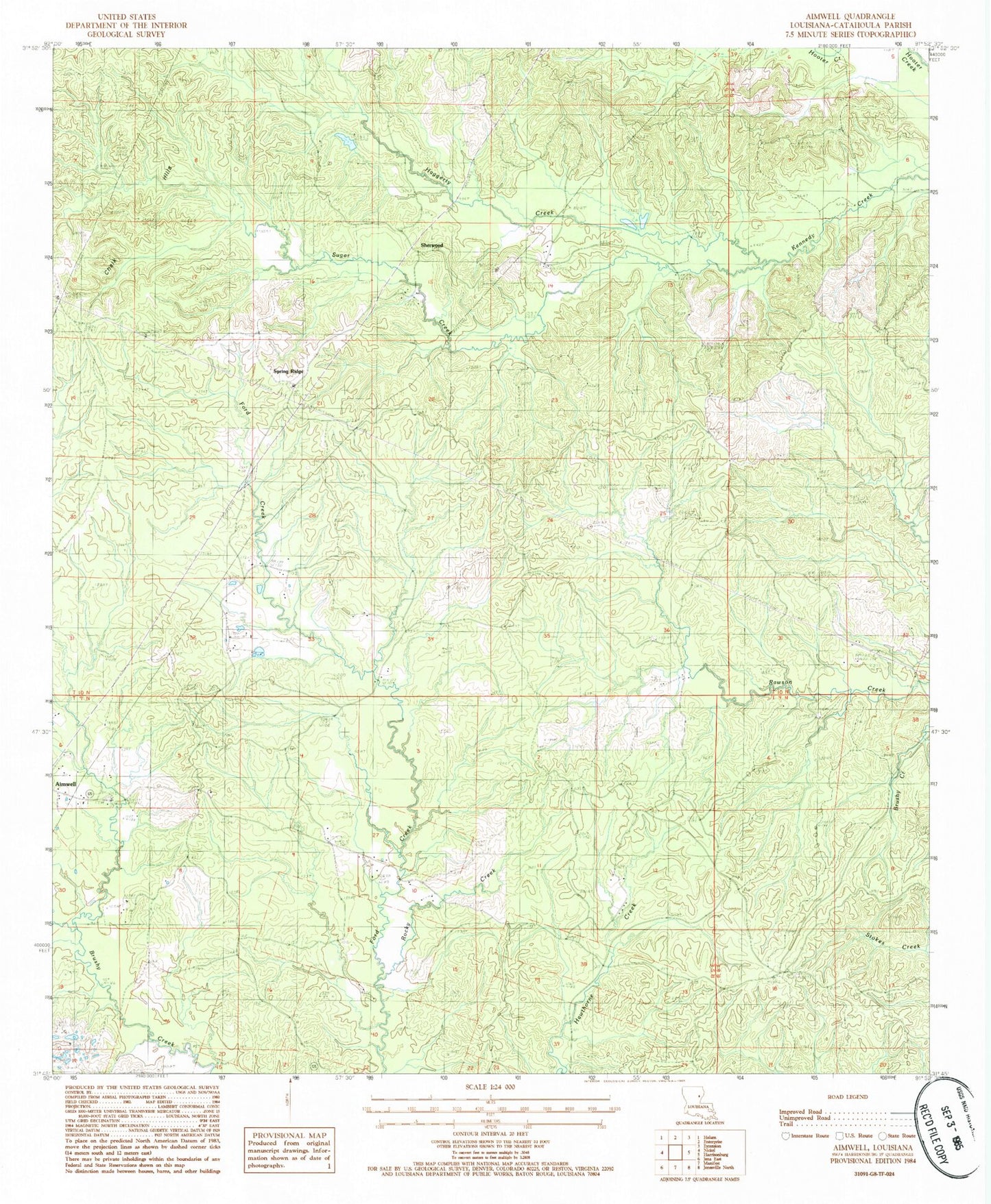
Historical USGS topographic quad map of Aimwell in the state of Louisiana. Map scale may vary for some years, but is generally around 1:24,000. Print size is approximately 24" x 27"
This quadrangle is in the following counties: Catahoula.
The map contains contour lines, roads, rivers, towns, and lakes. Printed on high-quality waterproof paper with UV fade-resistant inks, and shipped rolled.
Contains the following named places: Aimwell, Aimwell Baptist Church, Aimwell Cemetery, Aimwell Lookout Tower, Aimwell Pentecostal Church, Aimwell Post Office, Cassels Hill, Chalk Hills, Ford Cemetery, Haggerty Creek, McClendon Cemetery, Old Spring Ridge Cemetery, Parish Governing Authority District 3, Prichard, Pritchard Cemetery, Rocky Creek, Sherwood, Siloam Cemetery, Spring Ridge, Spring Ridge Cemetery, Spring Ridge Church, Sugar Creek, Ward Three, ZIP Code: 71401