MyTopo
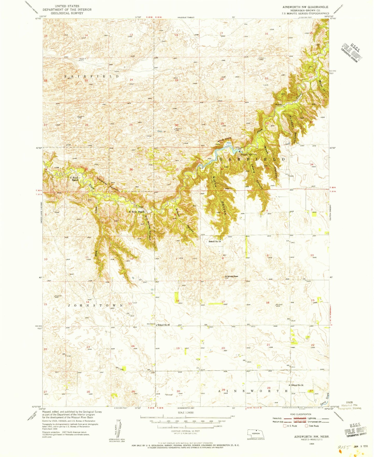
Classic USGS Ainsworth NW Nebraska 7.5'x7.5' Topo Map
Couldn't load pickup availability
Historical USGS topographic quad map of Ainsworth NW in the state of Nebraska. Map scale may vary for some years, but is generally around 1:24,000. Print size is approximately 24" x 27"
This quadrangle is in the following counties: Brown.
The map contains contour lines, roads, rivers, towns, and lakes. Printed on high-quality waterproof paper with UV fade-resistant inks, and shipped rolled.
Contains the following named places: Antelope Peak, Bill White Canyon, Bobcat State Wildlife Management Area, Broyer Canyon, C Keim Ranch, Deep Creek, Horsethief Canyons, Hurlbut Canyon, Lessig Canyon, Moore Creek, Pine Canyon Dam, Pine Canyon Reservoir, Quinn Canyon, R Keim Ranch, School Number 18, School Number 23, School Number 24, White Cliffs, Wood Canyon