MyTopo
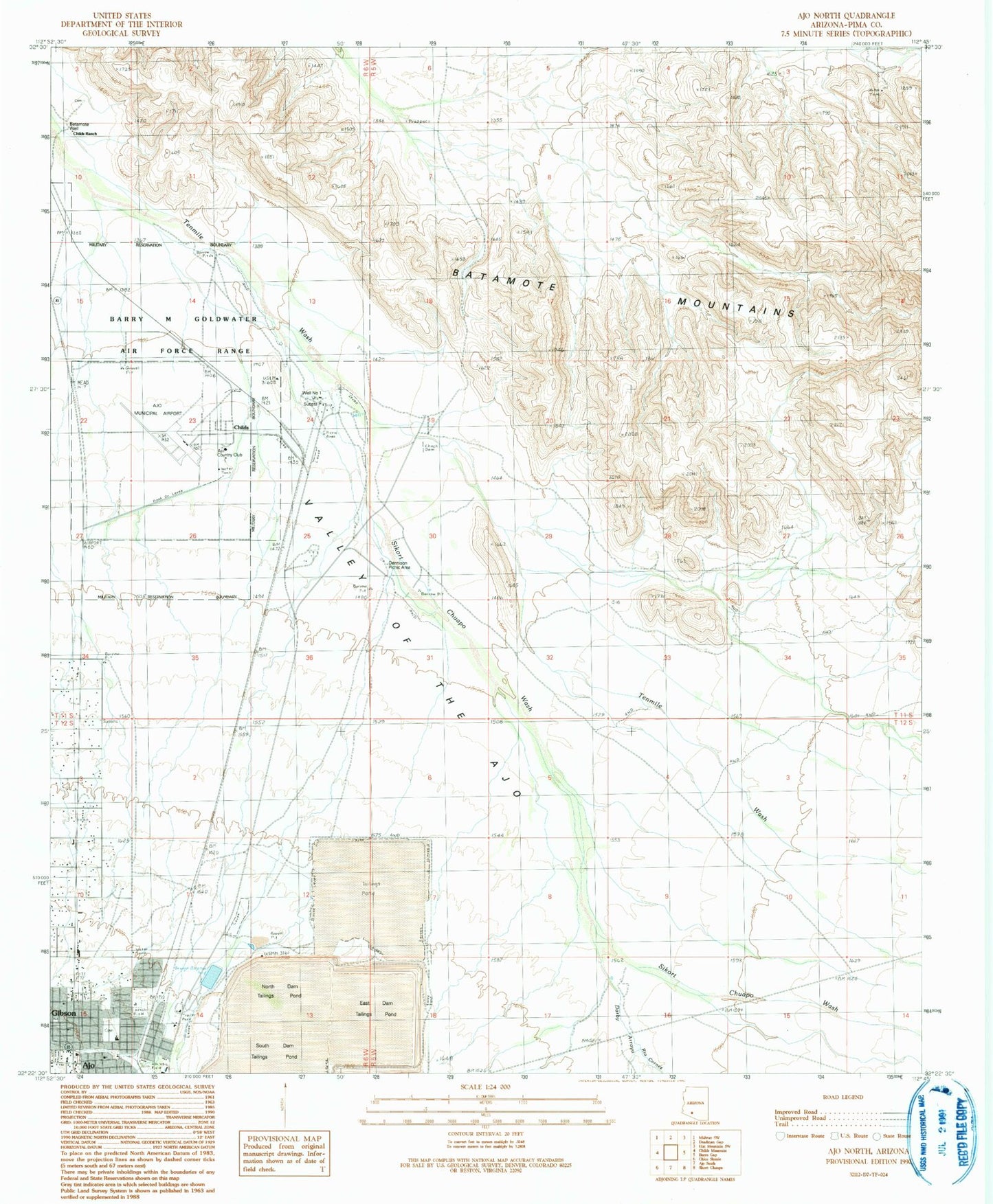
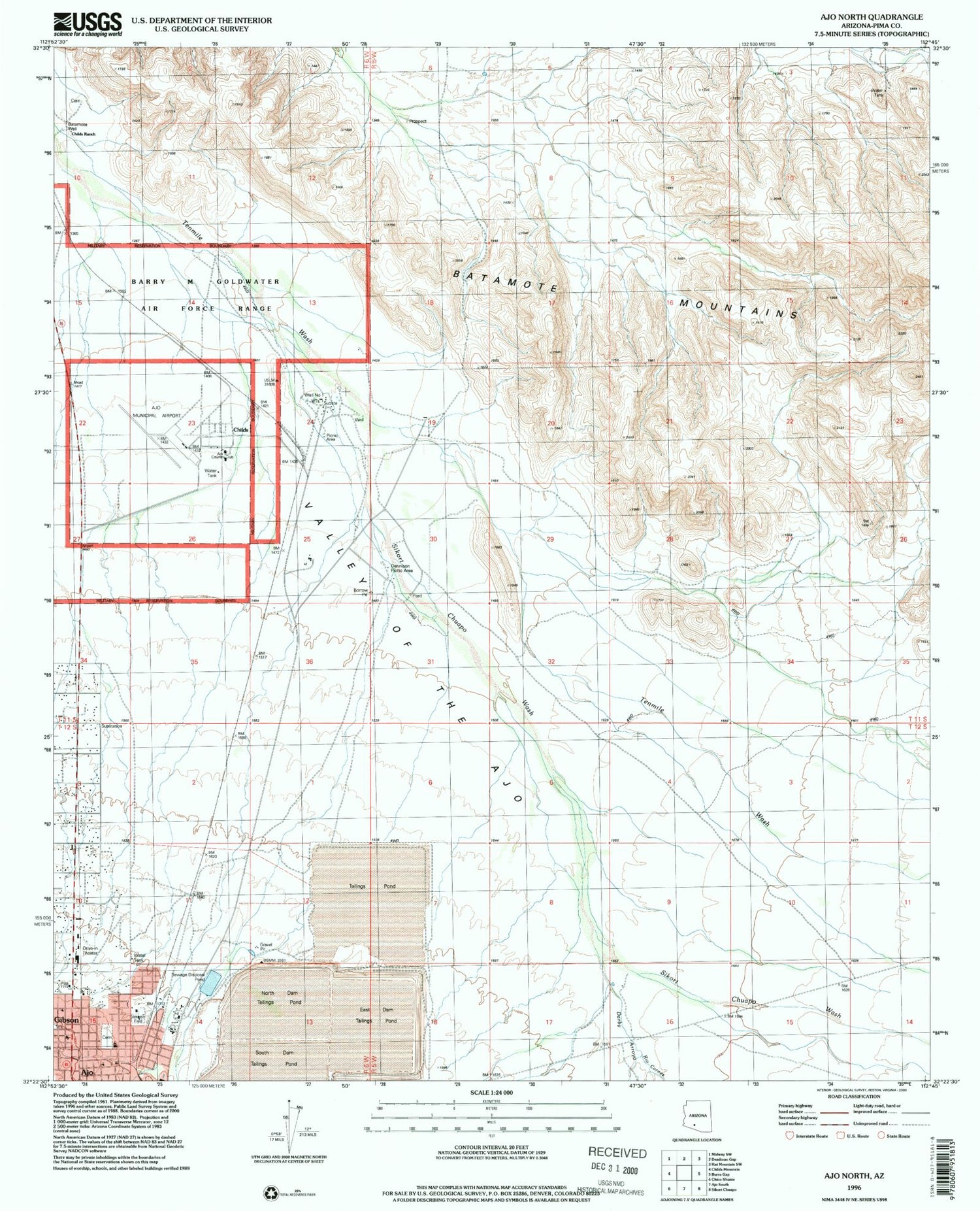
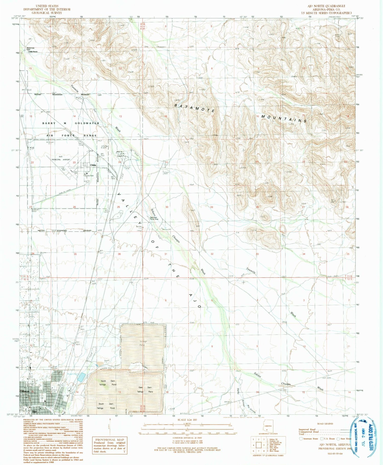
Classic USGS Ajo North Arizona 7.5'x7.5' Topo Map
Couldn't load pickup availability
Historical USGS topographic quad map of Ajo North in the state of Arizona. Map scale may vary for some years, but is generally around 1:24,000. Print size is approximately 24" x 27"
This quadrangle is in the following counties: Pima.
The map contains contour lines, roads, rivers, towns, and lakes. Printed on high-quality waterproof paper with UV fade-resistant inks, and shipped rolled.
Contains the following named places: Ajo Army Air Field, Ajo Cemetery, Ajo Country Club, Ajo First Assembly of God, Ajo Landfill, Ajo Recreation Center, Batamote Mountains, Bud Walker Park, Childs, Childs Ranch, Darby Arroyo, Dennison Picnic Ground, East Dam Tailings Pond, Eric Marcus Municipal Airport, Full Gospel Fellowship Church, Gibson, Good Shepherd Presbyterian Church, KTTZ-FM (Ajo), North Dam Tailings Pond, Pima County Sheriff's Office Ajo District, Plaza Shopping Center, Rio Cornez, Sikort Chuapo Wash, South Dam Tailings Pond, Valley of the Ajo, Well Number One