MyTopo
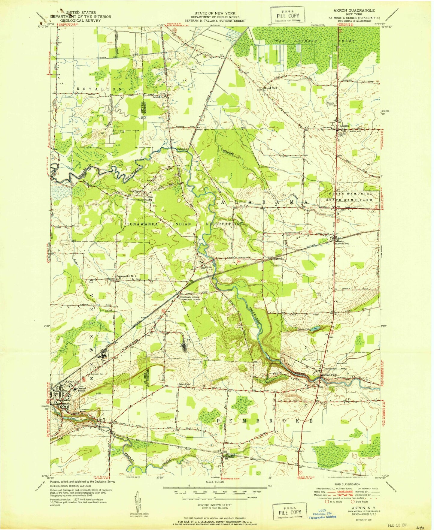
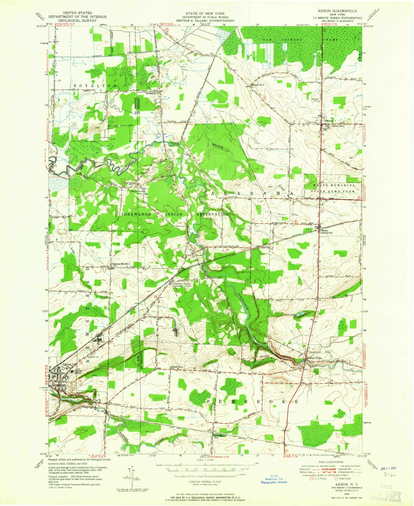
Classic USGS Akron New York 7.5'x7.5' Topo Map
Couldn't load pickup availability
Historical USGS topographic quad map of Akron in the state of New York. Map scale may vary for some years, but is generally around 1:24,000. Print size is approximately 24" x 27"
This quadrangle is in the following counties: Erie, Genesee, Niagara.
The map contains contour lines, roads, rivers, towns, and lakes. Printed on high-quality waterproof paper with UV fade-resistant inks, and shipped rolled.
Contains the following named places: Akron, Akron Airport, Akron Free Methodist Church, Akron High School, Akron Middle School, Akron Mobile Home Park, Akron Post Office, Akron Primary School, Akron Volunteer Fire Company Station 2, Alabama, Alabama Cemetery, Alabama Volunteer Fire Department Station 2, Antones's Mobile Home Park, Basom, Basom Post Office, Common School Number 1, Dande Farms Country Club, Delre's Greenhouse, Divers Lake, Evergreen Lawn Cemetery, Foot Road Bridge, Four Corners Cemetery, Gaskosada, Indian Falls, Indian Falls Cemetery, Indian Falls Fire Department, Indian Falls Methodist Church, Long House Cemetery, Maple Lawn Cemetery, Pembroke Station, Pembroke Toll Plaza, Presbyterian Church Cemetery, Saint John's Evangelical Lutheran Church, Saint Teresas Roman Catholic Cemetery, School Number 1, School Number 2, School Number 3, School Number 7, School Number 8, Tonawanda Indian Community Center, Tonawanda Reservation, Town of Alabama, Village of Akron, White Memorial State Game Farm, Whitney Creek, ZIP Code: 14013