MyTopo
Classic USGS Alabaster Michigan 7.5'x7.5' Topo Map
Couldn't load pickup availability
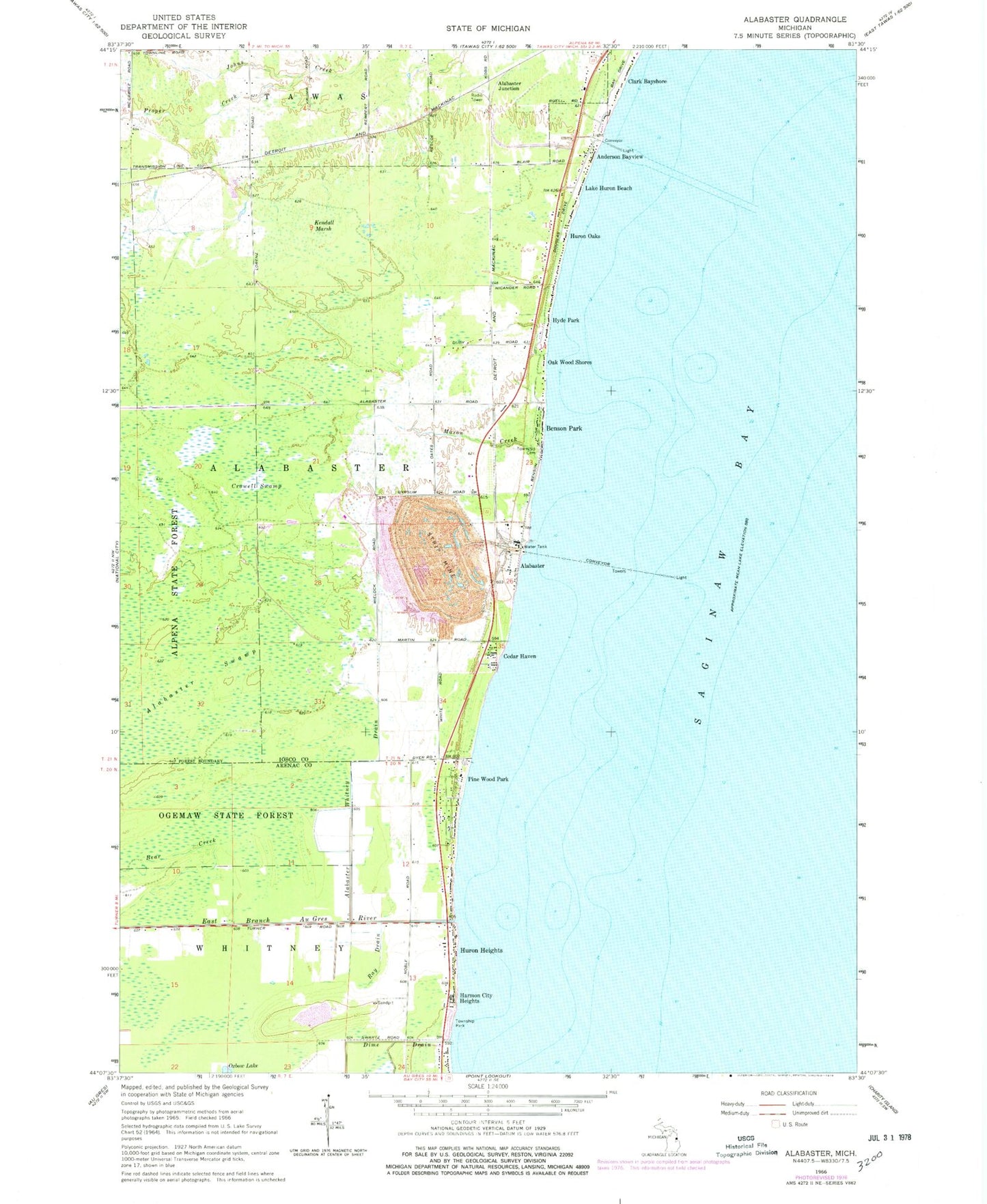
Historical USGS topographic quad map of Alabaster in the state of Michigan. Map scale may vary for some years, but is generally around 1:24,000. Print size is approximately 24" x 27"
This quadrangle is in the following counties: Arenac, Iosco.
The map contains contour lines, roads, rivers, towns, and lakes. Printed on high-quality waterproof paper with UV fade-resistant inks, and shipped rolled.
Contains the following named places: Alabaster, Alabaster Bible Church, Alabaster Historical Marker, Alabaster Junction, Alabaster Post Office, Alabaster Station, Alabaster Swamp, Alabaster Township Cemetery, Alabaster Whitney Drain, Anderson Bayview, Au Gres - Sims - Whitney Fire Department, Benson Park, Brown's Landing RV Park, Cedar Haven, Clark Bayshore, Crowell Swamp, Dime Drain, East Branch Au Gres River, Harmon City Heights, Huron Heights, Huron Oaks, Hyde Park, Ipperwash Scarp, Kendall Marsh, Lake Huron Beach, Mason Creek, Oak Wood Shores, Pine Wood Park, Proper Creek, Ray Drain, Singing Bridge Golf Course, Township of Alabaster, U S Gypsum Company, Whitney Township Park