
MyTopo
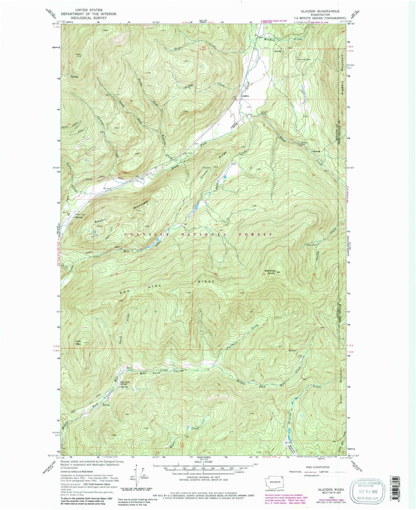
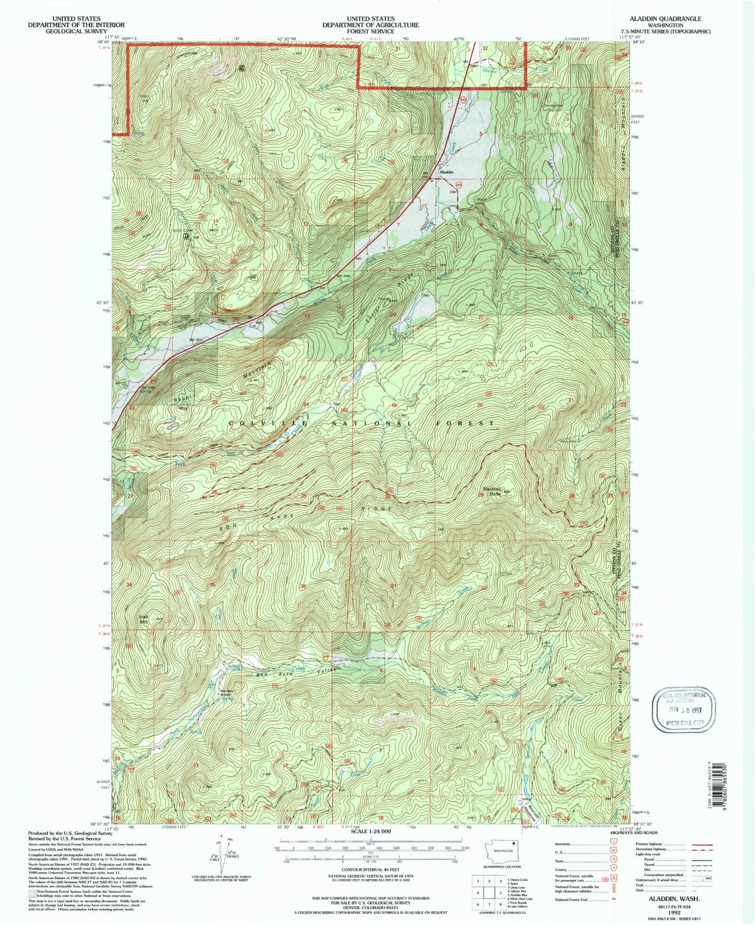
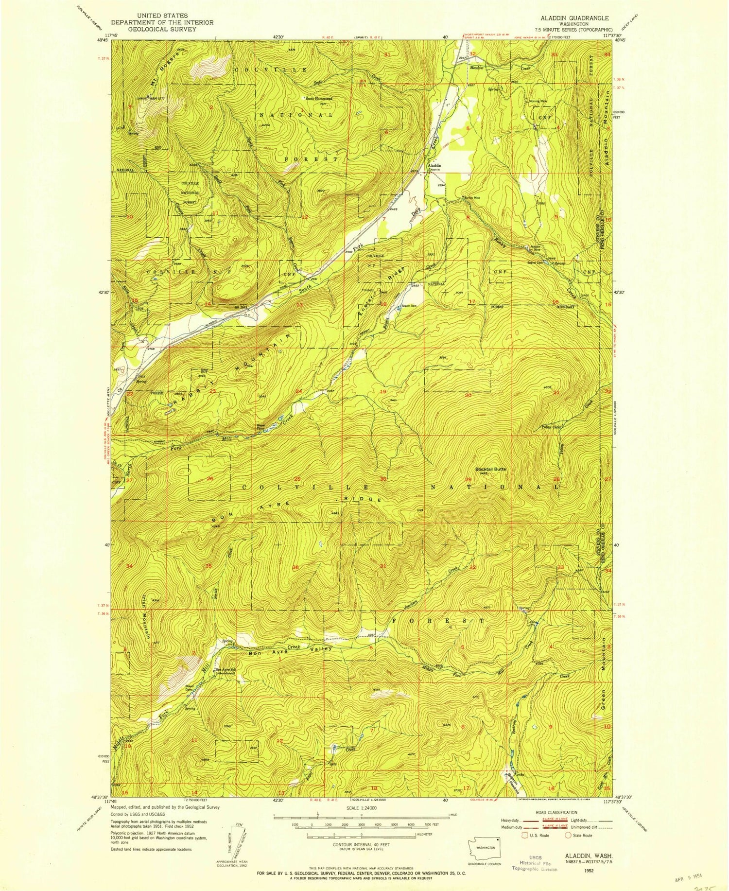
Classic USGS Aladdin Washington 7.5'x7.5' Topo Map
Couldn't load pickup availability
Historical USGS topographic quad map of Aladdin in the state of Washington. Typical map scale is 1:24,000, but may vary for certain years, if available. Print size: 24" x 27"
This quadrangle is in the following counties: Pend Oreille, Stevens.
The map contains contour lines, roads, rivers, towns, and lakes. Printed on high-quality waterproof paper with UV fade-resistant inks, and shipped rolled.
Contains the following named places: Aladdin, Aladdin Mine, Bestrom Meadows, Blacktail Butte, Bon Ayre Ridge, Bon Ayre School, Bon Ayre Valley, Burrus Mine, Clinton Creek, Cy Creek, Ensler Ridge, Irish Mountain, Jacobsen Creek, Kenny Creek, Kolle Creek, Meadow Creek, Morning Mine, North Fork Rogers Creek, Polley Cabin, Rabbit Creek, Rabbit Mountain, Rocky Creek, Rogers Creek, Scott Creek, Smith Creek, South Fork Rogers Creek, Aladdin, Aladdin Mine, Bestrom Meadows, Blacktail Butte, Bon Ayre Ridge, Bon Ayre School, Bon Ayre Valley, Burrus Mine, Clinton Creek, Cy Creek, Ensler Ridge, Irish Mountain, Jacobsen Creek, Kenny Creek, Kolle Creek, Meadow Creek, Morning Mine, North Fork Rogers Creek, Polley Cabin, Rabbit Creek, Rabbit Mountain, Rocky Creek, Rogers Creek, Scott Creek, Smith Creek, South Fork Rogers Creek